

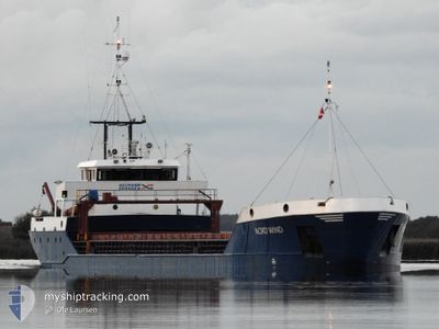
NORDWIND
General Cargo

Current Trip
| Time Travelled | 1 day |
|---|---|
| Remaining Time | 5 h, 17 mins |
| Distance Travelled | 287.58 nm |
| Remaining Distance | 49.89 nm |
| AVG Speed | 7.9 Knop |
| MAX Speed | 9.8 Knop |
| AVG Wind | 9.9 knots |
| MAX Wind | 12 knots |
| MIN Temp | 4.6°C / 40.28°F |
| MAX Temp | 13.7°C / 56.66°F |
| Djupgående | 3 m |
| Position mottagen | 3 h, 42 m sen |
Current Position
| Longitud | --- |
|---|---|
| Latitude | --- |
| Status | Under way using engine |
| Fart | 9.1 Knop |
| Kurs | 91.9° |
| Område | Baltic Sea |
| Station | T-AIS |
| Position mottagen | 3 h, 42 m sen |
Information
The current position of NORDWIND is in Baltic Sea with coordinates 54.87452° / 17.24925° as reported on 2025-03-27 19:45 by AIS to our vessel tracker app. The vessel's current speed is 9.1 Knop and is heading at the port of GDANSK. The estimated time of arrival as calculated by MyShipTracking vessel tracking app is 2025-03-28 05:44 LT
The vessel NORDWIND (IMO: 9013000, MMSI: 305286000) is a General Cargo that was built in 1991 ( 34 År gammal ). It's sailing under the flag of [AG] Antigua Barbuda.
In this page you can find informations about the vessels current position, last detected port calls, and current voyage information. If the vessels is not in coverage by AIS you will find the latest position.
The current position of NORDWIND is detected by our AIS receivers and we are not responsible for the reliability of the data. The last position was recorded while the vessel was in Coverage by the Ais receivers of our vessel tracking app.
The current draught of NORDWIND as reported by AIS is 3 meters
Weather
| Temperature | 4.8°C / 40.64°F |
|---|---|
| Wind Speed | 11 knots |
| Direction | 220° SW |
| Pressure | 1017.9 hPa |
| Humidity | 91.7 % |
| Cloud Coverage | 100 % |


Featured Company
Last Port Calls
| Port | Arrival | Departure | Time In Port |
|---|---|---|---|
| 2025-03-25 10:01 | 2025-03-26 12:21 | 1 d | |
| 2025-03-19 09:41 | 2025-03-19 18:07 | 8 h | |
| 2025-03-16 10:28 | 2025-03-18 18:16 | 2 d | |
| 2025-03-12 20:03 | 2025-03-14 13:53 | 1 d | |
| 2025-03-07 13:58 | 2025-03-11 00:33 | 3 d | |
| 2025-03-05 19:38 | 2025-03-06 21:36 | 1 d | |
| 2025-03-01 12:48 | 2025-03-04 14:53 | 3 d | |
| 2025-02-26 05:58 | 2025-02-27 17:59 | 1 d | |
| 2025-02-25 11:14 | 2025-02-25 17:12 | 5 h | |
| 2025-02-23 08:29 | 2025-02-24 08:46 | 1 d |
Last Trips
| Origin | Departure | Destination | Arrival | Distance | |
|---|---|---|---|---|---|
| 2025-03-19 18:07 | 2025-03-25 10:01 | 643.77 nm | |||
| 2025-03-18 18:16 | 2025-03-19 09:41 | 120.96 nm | |||
| 2025-03-14 13:53 | 2025-03-16 10:28 | 363.65 nm | |||
| 2025-03-11 00:33 | 2025-03-12 20:03 | 367.68 nm | |||
| 2025-03-06 21:36 | 2025-03-07 13:58 | 101.88 nm | |||
| 2025-03-04 14:53 | 2025-03-05 19:38 | 242.28 nm | |||
| 2025-02-27 17:59 | 2025-03-01 12:48 | 337.36 nm | |||
| 2025-02-25 17:12 | 2025-02-26 05:58 | 109.55 nm | |||
| 2025-02-24 08:46 | 2025-02-25 11:14 | 227.45 nm | |||
| 2025-02-22 09:07 | 2025-02-23 08:29 | 207.38 nm |
Events
| Tid | Event | Detaljer | Position / Dest | Information |
|---|---|---|---|---|
| 2025-03-27 19:49 | Status ändrad | Default Under way using engine |
54.87407 / 17.27062
GDANSK
|
Fart: 9.1 kn Kurs: 91.9° |
| 2025-03-27 19:45 | UTANFÖR täckningsområde |
54.87452 / 17.24925
Baltic Sea
GDANSK
|
Fart: 9.1 kn Kurs: 91.9° |
|
| 2025-03-27 19:41 | Status ändrad | Under way using engine Default |
54.87486 / 17.23230
GDANSK
|
Fart: 9 kn Kurs: 67° |
| 2025-03-27 19:34 | Status ändrad | Default Under way using engine |
54.87074 / 17.20358
GDANSK
|
Fart: 9 kn Kurs: 68.9° |
| 2025-03-27 17:27 | Status ändrad | Under way using engine Default |
54.78738 / 16.67314
GDANSK
|
Fart: 9 kn Kurs: 80° |
| 2025-03-27 17:21 | I täckningsområde |
54.78738 / 16.67314
Baltic Sea
GDANSK
|
Fart: 9 kn Kurs: 80.1° |
|
| 2025-03-27 16:45 | Status ändrad | Default Under way using engine |
54.77117 / 16.49013
GDANSK
|
Fart: 9.2 kn Kurs: 80.6° |
| 2025-03-27 16:02 | UTANFÖR täckningsområde |
54.75566 / 16.30389
Baltic Sea
GDANSK
|
Fart: 9.2 kn Kurs: 80.6° |
|
| 2025-03-27 10:22 | Upptäckt i hav | Polish part of the Baltic Sea |
54.61490 / 14.82186
Baltic Sea
GDANSK
|
Fart: 9.2 kn Kurs: 82.2° |
| 2025-03-27 09:16 | Byter havsområde | Danish part of the Kattegat German part of the Baltic Sea |
54.59145 / 14.53942
Kattegat
GDANSK
|
Fart: 9 kn Kurs: 82° |