
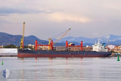
NORDORINOCO
Cargo
Current Trip
| Time Travelled | 3 days |
|---|---|
| Remaining Time | --- |
| Distance Travelled | 819.52 nm |
| Remaining Distance | --- |
| AVG Speed | 9.2 Knop |
| MAX Speed | 13.8 Knop |
| AVG Wind | 16.1 knots |
| MAX Wind | 35 knots |
| MIN Temp | 11.2°C / 52.16°F |
| MAX Temp | 19.1°C / 66.38°F |
| Djupgående | 10.3 m |
| Position mottagen | 2 d sen |
Current Position
| Longitud | --- |
|---|---|
| Latitude | --- |
| Status | Under way using engine |
| Fart | 12.3 Knop |
| Kurs | 274.7° |
| Område | North Atlantic Ocean |
| Station | T-AIS |
| Position mottagen | 2 d sen |
Info
Information
The current position of NORDORINOCO is in North Atlantic Ocean with coordinates 35.95990° / -6.21829° as reported on 2026-01-01 19:44 by AIS to our vessel tracker app. The vessel's current speed is 12.3 Knop and is heading at the port of COATZACOALCOS. The estimated time of arrival as calculated by MyShipTracking vessel tracking app is 2026-01-17 21:00 LT
The vessel NORDORINOCO (IMO: 9741712, MMSI: 255806048) is a Cargo It's sailing under the flag of [PT] Portugal.
In this page you can find informations about the vessels current position, last detected port calls, and current voyage information. If the vessels is not in coverage by AIS you will find the latest position.
The current position of NORDORINOCO is detected by our AIS receivers and we are not responsible for the reliability of the data. The last position was recorded while the vessel was in Coverage by the Ais receivers of our vessel tracking app.
The current draught of NORDORINOCO as reported by AIS is 10.3 meters
Weather
| Temperature | 16.7°C / 62.06°F |
|---|---|
| Wind Speed | 22 knots |
| Direction | 355° N |
| Pressure | 1000.5 hPa |
| Humidity | 81.8 % |
| Cloud Coverage | 17 % |
Featured Company
Last Port Calls
| Port | Arrival | Departure | Time In Port |
|---|---|---|---|
| 2025-12-27 09:15 | 2025-12-31 07:30 | 3 d | |
| 2025-12-14 17:42 | 2025-12-15 18:06 | 1 d | |
| 2025-12-06 02:26 | 2025-12-07 19:27 | 1 d |
Last Trips
| Origin | Departure | Destination | Arrival | Distance | |
|---|---|---|---|---|---|
| 2025-12-15 18:06 | 2025-12-27 09:15 | 861.91 nm | |||
| 2025-12-07 19:27 | 2025-12-14 17:42 | 1254.04 nm | |||
| 2025-10-21 14:31 | 2025-12-06 02:26 | 9678.45 nm |
Events
| Tid | Event | Detaljer | Position / Dest | Information |
|---|---|---|---|---|
| 2026-01-01 19:50 | Status ändrad | Default Under way using engine |
35.96127 / -6.24704
MX COA
|
Fart: 12.3 kn Kurs: 274.7° |
| 2026-01-01 19:44 | Status ändrad | Under way using engine Default |
35.95990 / -6.21829
MX COA
|
Fart: 12.3 kn Kurs: 273° |
| 2026-01-01 19:44 | UTANFÖR täckningsområde |
35.95990 / -6.21829
North Atlantic Ocean
MX COA
|
Fart: 12.3 kn Kurs: 274.7° |
|
| 2026-01-01 19:35 | Status ändrad | Default Under way using engine |
35.95860 / -6.18048
MX COA
|
Fart: 12.1 kn Kurs: 267.7° |
| 2026-01-01 19:25 | Status ändrad | Under way using engine Default |
35.95767 / -6.13910
MX COA
|
Fart: 12 kn Kurs: 269° |
| 2026-01-01 19:19 | Status ändrad | Default Under way using engine |
35.95811 / -6.11456
MX COA
|
Fart: 12 kn Kurs: 267.9° |
| 2026-01-01 18:46 | Byter havsområde | Spanish part of the North Atlantic Ocean Spanish part of the Strait of Gibraltar |
35.95951 / -5.98026
North Atlantic Ocean
MX COA
|
Fart: 12.9 kn Kurs: 269.9° |
| 2026-01-01 16:10 | Byter havsområde | Spanish part of the Strait of Gibraltar Gibraltarian part of the Strait of Gibraltar |
36.06580 / -5.37767
Strait of Gibraltar
MX COA
|
Fart: 11.7 kn Kurs: 208.1° |
| 2026-01-01 15:44 | STARTAR förflyttning | 1.69 nm, South of GIBRALTAR |
36.11934 / -5.36372
MX COA
|
Fart: 3.1 kn Kurs: 149° |
| 2026-01-01 15:29 | Status ändrad | Under way using engine At anchor |
36.12097 / -5.36245
MX COA
|
Fart: 0.3 kn Kurs: 103° |