

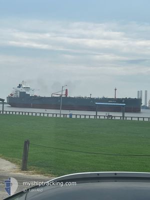
NORDLOTUS
Crude Oil Tanker

Current Trip
USTXT>XXXXX
| Time Travelled | 1 day |
|---|---|
| Remaining Time | --- |
| Distance Travelled | 39.45 nm |
| Remaining Distance | --- |
| AVG Speed | 7.3 Knop |
| MAX Speed | 12.9 Knop |
| AVG Wind | 10.9 knots |
| MAX Wind | 15 knots |
| MIN Temp | 20.1°C / 68.18°F |
| MAX Temp | 21°C / 69.8°F |
| Djupgående | 8.2 m |
| Position mottagen | 8 m sen |
Current Position
| Longitud | --- |
|---|---|
| Latitude | --- |
| Status | At anchor |
| Fart | 0.1 Knop |
| Kurs | 195° |
| Område | Gulf of Mexico |
| Station | T-AIS |
| Position mottagen | 8 m sen |
Information
The current position of NORDLOTUS is in Gulf of Mexico with coordinates 29.07492° / -94.60283° as reported on 2025-03-27 11:06 by AIS to our vessel tracker app. The vessel's current speed is 0.1 Knop
The vessel NORDLOTUS (IMO: 9624067, MMSI: 255806138) is a Crude Oil Tanker that was built in 2013 ( 12 År gammal ). It's sailing under the flag of [PT] Portugal.
In this page you can find informations about the vessels current position, last detected port calls, and current voyage information. If the vessels is not in coverage by AIS you will find the latest position.
The current position of NORDLOTUS is detected by our AIS receivers and we are not responsible for the reliability of the data. The last position was recorded while the vessel was in Coverage by the Ais receivers of our vessel tracking app.
The current draught of NORDLOTUS as reported by AIS is 8.2 meters
Weather
| Temperature | 20.1°C / 68.18°F |
|---|---|
| Wind Speed | 5 knots |
| Direction | 33° NNE |
| Pressure | 1018.9 hPa |
| Humidity | 86.9 % |
| Cloud Coverage | 100 % |


Featured Company
Last Port Calls
| Port | Arrival | Departure | Time In Port |
|---|---|---|---|
| 2025-03-24 19:12 | 2025-03-25 22:09 | 1 d | |
| 2025-03-23 05:55 | 2025-03-23 09:36 | 3 h | |
| 2025-03-21 18:24 | 2025-03-23 05:40 | 1 d | |
| 2025-03-14 21:08 | 2025-03-21 17:52 | 6 d | |
| 2025-03-07 08:49 | 2025-03-11 20:29 | 4 d | |
| 2025-02-12 17:25 | 2025-02-12 17:48 | 22 m | |
| 2025-01-02 20:04 | 2025-01-04 13:33 | 1 d |
Most Visited Ports (Last year)
| Port | Arrivals | |
|---|---|---|
| 5 | ||
| 4 | ||
| 3 | ||
| 3 | ||
| 3 | ||
| 3 |
Last Trips
| Origin | Departure | Destination | Arrival | Distance | |
|---|---|---|---|---|---|
| 2025-03-23 09:36 | 2025-03-24 19:12 | 426.53 nm | |||
| 2025-03-23 05:40 | 2025-03-23 05:55 | 2.13 nm | |||
| 2025-03-21 17:52 | 2025-03-21 18:24 | 1.71 nm | |||
| 2025-03-11 20:29 | 2025-03-14 21:08 | 808.33 nm | |||
| 2025-02-12 17:48 | 2025-03-07 08:49 | 1068.51 nm | |||
| 2025-01-04 13:33 | 2025-02-12 17:25 | 2999.14 nm | |||
| 2024-12-19 22:43 | 2025-01-02 20:04 | 1416.41 nm |
Events
| Tid | Event | Detaljer | Position / Dest | Information |
|---|---|---|---|---|
| 2025-03-27 11:12 | Status ändrad | Default At anchor |
29.07480 / -94.60269
USTXT>XXXXX
|
Fart: 0.1 kn Kurs: 195° |
| 2025-03-27 11:06 | Status ändrad | At anchor Default |
29.07492 / -94.60283
USTXT>XXXXX
|
Fart: 0.1 kn Kurs: 194° |
| 2025-03-27 10:42 | Status ändrad | Default At anchor |
29.07493 / -94.60365
USTXT>XXXXX
|
Fart: 0.1 kn Kurs: 178° |
| 2025-03-27 10:36 | Status ändrad | At anchor Default |
29.07486 / -94.60370
USTXT>XXXXX
|
Fart: Kurs: 175° |
| 2025-03-27 10:24 | I täckningsområde |
29.07486 / -94.60370
Gulf of Mexico
USTXT>XXXXX
|
Fart: 0.1 kn Kurs: 32.6° |
|
| 2025-03-27 09:27 | Status ändrad | Default At anchor |
29.07487 / -94.60422
USTXT>XXXXX
|
Fart: 0.1 kn Kurs: 166° |
| 2025-03-27 09:21 | Status ändrad | At anchor Default |
29.07487 / -94.60416
USTXT>XXXXX
|
Fart: 0.1 kn Kurs: 169° |
| 2025-03-27 09:21 | UTANFÖR täckningsområde |
29.07487 / -94.60416
Gulf of Mexico
USTXT>XXXXX
|
Fart: 0.1 kn Kurs: 292.4° |
|
| 2025-03-27 09:06 | Status ändrad | Default At anchor |
29.07495 / -94.60405
USTXT>XXXXX
|
Fart: Kurs: 167° |
| 2025-03-27 09:00 | Status ändrad | At anchor Default |
29.07493 / -94.60405
USTXT>XXXXX
|
Fart: Kurs: 170° |