
NO DESTINATION
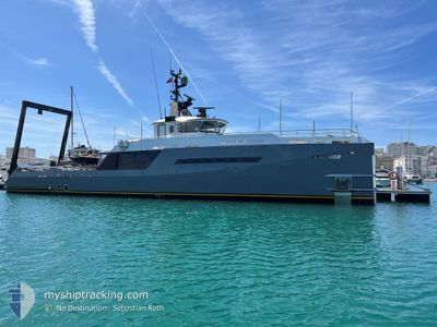
Crew Boat
Current Trip
| Time Travelled | 2 days |
|---|---|
| Remaining Time | --- |
| Distance Travelled | 43.11 nm |
| Remaining Distance | --- |
| AVG Speed | 8.9 Knop |
| MAX Speed | 10.3 Knop |
| AVG Wind | 8.2 knots |
| MAX Wind | 16.9 knots |
| MIN Temp | 23°C / 73.4°F |
| MAX Temp | 28.3°C / 82.94°F |
| Djupgående | 2.6 m |
| Position mottagen | Nu |
Current Position
| Longitud | 20.64047° |
|---|---|
| Latitude | 38.25315° |
| Status | Under way using engine |
| Fart | 0.1 Knop |
| Kurs | 357° |
| Område | Ionian Sea |
| Station | T-AIS |
| Position mottagen | Nu |
Info
Information
The current position of NO DESTINATION is in Ionian Sea with coordinates 38.25315° / 20.64047° as reported on 2024-06-11 18:13 by AIS to our vessel tracker app. The vessel's current speed is 0.1 Knop
The vessel NO DESTINATION (IMO: 9535670, MMSI: 538071386) is a Crew Boat that was built in 2009 ( 15 År gammal ). It's sailing under the flag of [MH] Marshall Is.
In this page you can find informations about the vessels current position, last detected port calls, and current voyage information. If the vessels is not in coverage by AIS you will find the latest position.
The current position of NO DESTINATION is detected by our AIS receivers and we are not responsible for the reliability of the data. The last position was recorded while the vessel was in Coverage by the Ais receivers of our vessel tracking app.
The current draught of NO DESTINATION as reported by AIS is 2.6 meters
Weather
| Temperature | 24.4°C / 75.92°F |
|---|---|
| Wind Speed | 2 knots |
| Direction | 317° NW |
| Pressure | 1012.5 hPa |
| Humidity | 66 % |
| Cloud Coverage | 28 % |
Featured Company
Last Port Calls
| Port | Arrival | Departure | Time In Port |
|---|---|---|---|
| 2024-06-08 17:31 | 2024-06-09 12:41 | 19 h | |
| 2024-06-03 15:31 | 2024-06-05 10:26 | 1 d | |
| 2024-06-01 11:24 | 2024-06-03 11:09 | 1 d | |
| 2024-05-31 07:38 | 2024-05-31 11:13 | 3 h | |
| 2024-05-30 07:04 | 2024-05-30 08:25 | 1 h | |
| 2024-05-29 09:57 |
Last Trips
| Origin | Departure | Destination | Arrival | Distance | |
|---|---|---|---|---|---|
| 2024-06-05 13:26 | 2024-06-08 20:31 | 100.36 nm | |||
| 2024-06-03 14:09 | 2024-06-03 18:31 | 27.09 nm | |||
| 2024-05-31 13:13 | 2024-06-01 14:24 | 118.18 nm | |||
| 2024-05-30 10:25 | 2024-05-31 09:38 | 203.80 nm | |||
| 2024-05-29 11:57 | 2024-05-30 09:04 | 182.69 nm |
Events
| Tid | Event | Detaljer | Position / Dest | Information |
|---|---|---|---|---|
| 2024-06-11 15:59 | Status ändrad | Under way using engine Default |
38.25305 / 20.64033
KEFALONIA
|
Fart: 0.1 kn Kurs: 359° |
| 2024-06-11 15:51 | Status ändrad | Default Under way using engine |
38.25303 / 20.64032
KEFALONIA
|
Fart: Kurs: 356° |
| 2024-06-11 11:06 | Status ändrad | Under way using engine Default |
38.25305 / 20.64072
KEFALONIA
|
Fart: 0.1 kn Kurs: 297° |
| 2024-06-11 11:02 | Status ändrad | Default Under way using engine |
38.25313 / 20.64085
KEFALONIA
|
Fart: 0.2 kn Kurs: 300° |
| 2024-06-11 10:11 | Status ändrad | Under way using engine Default |
38.25315 / 20.64092
KEFALONIA
|
Fart: Kurs: 320° |
| 2024-06-11 09:59 | Status ändrad | Default Under way using engine |
38.25307 / 20.64077
KEFALONIA
|
Fart: Kurs: 303° |
| 2024-06-10 16:47 | Status ändrad | Under way using engine Default |
38.25327 / 20.63997
KEFALONIA
|
Fart: 0.1 kn Kurs: 45° |
| 2024-06-10 16:31 | Status ändrad | Default Under way using engine |
38.25326 / 20.63995
KEFALONIA
|
Fart: 0.1 kn Kurs: 40° |
| 2024-06-10 16:18 | Status ändrad | Under way using engine Default |
38.25323 / 20.63998
KEFALONIA
|
Fart: 0.1 kn Kurs: 10° |
| 2024-06-10 16:01 | Status ändrad | Default Under way using engine |
38.25317 / 20.64008
KEFALONIA
|
Fart: Kurs: 8° |