
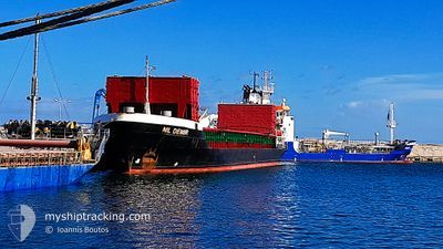
NIL DEMIR
General Cargo
Current Trip
TRTEK
| Time Travelled | 2 days |
|---|---|
| Remaining Time | --- |
| Distance Travelled | 83.87 nm |
| Remaining Distance | --- |
| AVG Speed | 8.9 Knop |
| MAX Speed | 9.8 Knop |
| AVG Wind | 4.4 knots |
| MAX Wind | 10 knots |
| MIN Temp | 1.1°C / 33.98°F |
| MAX Temp | 11.6°C / 52.88°F |
| Djupgående | 4.3 m |
| Position mottagen | 4 m sen |
Current Position
| Longitud | --- |
|---|---|
| Latitude | --- |
| Status | At anchor |
| Fart | |
| Kurs | 301° |
| Område | Sea of Marmara |
| Station | T-AIS |
| Position mottagen | 4 m sen |
Info
Information
The current position of NIL DEMIR is in Sea of Marmara with coordinates 40.86393° / 29.19796° as reported on 2025-02-27 11:51 by AIS to our vessel tracker app. The vessel's current speed is 0 Knop
The vessel NIL DEMIR (IMO: 8003814, MMSI: 354692000) is a General Cargo that was built in 1980 ( 45 År gammal ). It's sailing under the flag of [PA] Panama.
In this page you can find informations about the vessels current position, last detected port calls, and current voyage information. If the vessels is not in coverage by AIS you will find the latest position.
The current position of NIL DEMIR is detected by our AIS receivers and we are not responsible for the reliability of the data. The last position was recorded while the vessel was in Coverage by the Ais receivers of our vessel tracking app.
The current draught of NIL DEMIR as reported by AIS is 4.3 meters
Weather
| Temperature | 11.4°C / 52.52°F |
|---|---|
| Wind Speed | 6 knots |
| Direction | 113° ESE |
| Pressure | 1021.7 hPa |
| Humidity | 66.1 % |
| Cloud Coverage | 88 % |
Featured Company
Last Port Calls
| Port | Arrival | Departure | Time In Port |
|---|---|---|---|
| 2025-02-24 05:07 | 2025-02-24 23:28 | 18 h | |
| 2025-02-12 16:09 | 2025-02-13 15:53 | 23 h | |
| 2025-02-08 19:39 | 2025-02-10 11:17 | 1 d | |
| 2025-02-04 07:01 | 2025-02-04 09:17 | 2 h | |
| 2025-01-31 18:37 | 2025-02-01 01:13 | 6 h | |
| 2025-01-31 17:29 | 2025-01-31 17:33 | 4 m | |
| 2025-01-30 11:34 | 2025-01-31 16:48 | 1 d | |
| 2025-01-29 12:55 | 2025-01-30 10:21 | 21 h | |
| 2025-01-28 01:39 | 2025-01-29 11:44 | 1 d | |
| 2025-01-27 09:44 | 2025-01-27 10:20 | 35 m |
Most Visited Ports (Last year)
| Port | Arrivals | |
|---|---|---|
| 18 | ||
| 8 | ||
| 3 | ||
| 3 | ||
| 3 | ||
| 2 |
Last Trips
| Origin | Departure | Destination | Arrival | Distance | |
|---|---|---|---|---|---|
| 2025-02-13 17:53 | 2025-02-24 08:07 | 445.32 nm | |||
| 2025-02-10 13:17 | 2025-02-12 18:09 | 3.82 nm | |||
| 2025-02-04 11:17 | 2025-02-08 21:39 | 59.05 nm | |||
| 2025-02-01 04:13 | 2025-02-04 09:01 | 390.61 nm | |||
| 2025-01-31 20:33 | 2025-01-31 21:37 | 4.31 nm | |||
| 2025-01-31 19:48 | 2025-01-31 20:29 | 5.16 nm | |||
| 2025-01-30 13:21 | 2025-01-30 14:34 | 4.27 nm | |||
| 2025-01-29 14:44 | 2025-01-29 15:55 | 4.28 nm | |||
| 2025-01-27 13:20 | 2025-01-28 04:39 | 12.92 nm | |||
| 2025-01-26 18:37 | 2025-01-27 12:44 | 12.98 nm |
Events
| Tid | Event | Detaljer | Position / Dest | Information |
|---|---|---|---|---|
| 2025-02-27 11:51 | Status ändrad | At anchor Default |
40.86393 / 29.19796
TRTEK
|
Fart: Kurs: 304° |
| 2025-02-27 11:45 | Status ändrad | Default At anchor |
40.86390 / 29.19786
TRTEK
|
Fart: Kurs: 304° |
| 2025-02-27 10:51 | Status ändrad | At anchor Default |
40.86398 / 29.19792
TRTEK
|
Fart: Kurs: 308° |
| 2025-02-27 10:42 | Status ändrad | Default At anchor |
40.86395 / 29.19782
TRTEK
|
Fart: Kurs: 308° |
| 2025-02-27 10:24 | Status ändrad | At anchor Default |
40.86378 / 29.19769
TRTEK
|
Fart: Kurs: 327° |
| 2025-02-27 10:15 | Status ändrad | Default At anchor |
40.86380 / 29.19776
TRTEK
|
Fart: Kurs: 307° |
| 2025-02-27 08:17 | Status ändrad | At anchor Default |
40.86448 / 29.19799
TRTEK
|
Fart: Kurs: 261° |
| 2025-02-27 08:11 | Status ändrad | Default At anchor |
40.86446 / 29.19802
TRTEK
|
Fart: Kurs: 264° |
| 2025-02-27 04:53 | Status ändrad | At anchor Default |
40.86472 / 29.19784
TRTEK
|
Fart: Kurs: 240° |
| 2025-02-27 04:47 | Status ändrad | Default At anchor |
40.86461 / 29.19792
TRTEK
|
Fart: Kurs: 238° |