
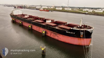
NIKOLAS D
Cargo
Current Trip
| Time Travelled | 13 days |
|---|---|
| Remaining Time | --- |
| Distance Travelled | 3888.45 nm |
| Remaining Distance | --- |
| AVG Speed | 11.7 Knop |
| MAX Speed | 13 Knop |
| AVG Wind | 12 knots |
| MAX Wind | 22.6 knots |
| MIN Temp | 17.1°C / 62.78°F |
| MAX Temp | 29.4°C / 84.92°F |
| Djupgående | 12.6 m |
| Position mottagen | 1 m sen |
Current Position
| Longitud | -18.96488° |
|---|---|
| Latitude | 30.18791° |
| Status | Under way using engine |
| Fart | 12.2 Knop |
| Kurs | 26.3° |
| Område | North Atlantic Ocean |
| Station | T-AIS |
| Position mottagen | 1 m sen |
Info
Information
The current position of NIKOLAS D is in North Atlantic Ocean with coordinates 30.18791° / -18.96488° as reported on 2024-05-05 11:36 by AIS to our vessel tracker app. The vessel's current speed is 12.2 Knop and is heading at the port of AMSTERDAM. The estimated time of arrival as calculated by MyShipTracking vessel tracking app is 2024-05-11 08:00 LT
The vessel NIKOLAS D (IMO: 9474723, MMSI: 352993000) is a Cargo It's sailing under the flag of [PA] Panama.
In this page you can find informations about the vessels current position, last detected port calls, and current voyage information. If the vessels is not in coverage by AIS you will find the latest position.
The current position of NIKOLAS D is detected by our AIS receivers and we are not responsible for the reliability of the data. The last position was recorded while the vessel was in Coverage by the Ais receivers of our vessel tracking app.
The current draught of NIKOLAS D as reported by AIS is 12.6 meters
Weather
| Temperature | 19.6°C / 67.28°F |
|---|---|
| Wind Speed | 10 knots |
| Direction | 51° NE |
| Pressure | 1021.3 hPa |
| Humidity | 76.4 % |
| Cloud Coverage | 98 % |
Featured Company
Last Port Calls
| Port | Arrival | Departure | Time In Port |
|---|---|---|---|
| 2024-04-19 22:11 | 2024-04-22 00:19 | 2 d | |
| 2024-03-02 11:28 |
Most Visited Ports (Last year)
| Port | Arrivals | |
|---|---|---|
| 3 | ||
| 1 | ||
| 1 | ||
| 1 | ||
| 1 | ||
| 1 |
Last Trips
| Origin | Departure | Destination | Arrival | Distance | |
|---|---|---|---|---|---|
| 2024-03-02 16:58 | 2024-04-19 19:11 | 9442.40 nm |
Events
| Tid | Event | Detaljer | Position / Dest | Information |
|---|---|---|---|---|
| 2024-05-05 10:48 | Status ändrad | Under way using engine Default |
30.04119 / -19.04570
NL AMS
|
Fart: 12 kn Kurs: 25° |
| 2024-05-05 10:29 | Status ändrad | Default Under way using engine |
29.98167 / -19.07833
NL AMS
|
Fart: 12.3 kn Kurs: 26.5° |
| 2024-05-05 06:47 | Status ändrad | Under way using engine Default |
29.30678 / -19.43836
NL AMS
|
Fart: 11.8 kn Kurs: 26° |
| 2024-05-05 06:45 | Status ändrad | Default Under way using engine |
29.30032 / -19.44209
NL AMS
|
Fart: 11.7 kn Kurs: 24.8° |
| 2024-05-05 06:39 | Status ändrad | Under way using engine Default |
29.28073 / -19.45328
NL AMS
|
Fart: 11.8 kn Kurs: 27° |
| 2024-05-05 06:39 | I täckningsområde |
29.28508 / -19.45079
North Atlantic Ocean
NL AMS
|
Fart: 11.7 kn Kurs: 24.8° |
|
| 2024-05-05 04:06 | Status ändrad | Default Under way using engine |
28.82257 / -19.69498
NL AMS
|
Fart: 12 kn Kurs: 24.3° |
| 2024-05-05 03:59 | UTANFÖR täckningsområde |
28.79924 / -19.70781
North Atlantic Ocean
NL AMS
|
Fart: 12 kn Kurs: 24.3° |
|
| 2024-05-05 03:50 | Status ändrad | Under way using engine Default |
28.77406 / -19.72127
NL AMS
|
Fart: 11.9 kn Kurs: 26° |
| 2024-05-05 03:46 | Status ändrad | Default Under way using engine |
28.76193 / -19.72768
NL AMS
|
Fart: 11.9 kn Kurs: 24.1° |