
NAVIOS UNISON
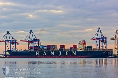
Container Ship
Current Trip
| Time Travelled | 13 days |
|---|---|
| Remaining Time | --- |
| Distance Travelled | 2437.05 nm |
| Remaining Distance | --- |
| AVG Speed | 11.2 Knop |
| MAX Speed | 20.4 Knop |
| AVG Wind | 15.7 knots |
| MAX Wind | 34 knots |
| MIN Temp | 4.4°C / 39.92°F |
| MAX Temp | 29.3°C / 84.74°F |
| Djupgående | 9.4 m |
| Position mottagen | 13 d sen |
Current Position
| Longitud | --- |
|---|---|
| Latitude | --- |
| Status | Under way using engine |
| Fart | 12.9 Knop |
| Kurs | 24.3° |
| Område | South China Sea |
| Station | T-AIS |
| Position mottagen | 13 d sen |
Info
Information
The current position of NAVIOS UNISON is in South China Sea with coordinates 1.61934° / 104.69582° as reported on 2025-02-13 09:36 by AIS to our vessel tracker app. The vessel's current speed is 12.9 Knop and is heading at the port of VUNG TAU.
The vessel NAVIOS UNISON (IMO: 9408853, MMSI: 636018069) is a Container Ship that was built in 2010 ( 15 År gammal ). It's sailing under the flag of [LR] Liberia.
In this page you can find informations about the vessels current position, last detected port calls, and current voyage information. If the vessels is not in coverage by AIS you will find the latest position.
The current position of NAVIOS UNISON is detected by our AIS receivers and we are not responsible for the reliability of the data. The last position was recorded while the vessel was in Coverage by the Ais receivers of our vessel tracking app.
The current draught of NAVIOS UNISON as reported by AIS is 9.4 meters
Weather
| Temperature | 9.5°C / 49.1°F |
|---|---|
| Wind Speed | 14 knots |
| Direction | 153° SSE |
| Pressure | 1020.5 hPa |
| Humidity | 96.1 % |
| Cloud Coverage | 100 % |
Featured Company
Last Port Calls
| Port | Arrival | Departure | Time In Port |
|---|---|---|---|
| 2025-02-11 17:34 | 2025-02-13 12:18 | 1 d | |
| 2025-02-05 06:55 | 2025-02-05 17:32 | 10 h | |
| 2025-02-03 06:51 | 2025-02-04 04:37 | 21 h | |
| 2025-01-17 21:25 | 2025-01-20 14:04 | 2 d | |
| 2025-01-12 23:48 | 2025-01-15 20:45 | 2 d | |
| 2024-12-09 18:56 | 2024-12-10 21:08 | 1 d | |
| 2024-12-05 18:32 | 2024-12-07 03:22 | 1 d | |
| 2024-12-02 06:20 | 2024-12-04 03:32 | 1 d |
Most Visited Ports (Last year)
| Port | Arrivals | |
|---|---|---|
| 5 | ||
| 5 | ||
| 5 | ||
| 5 | ||
| 5 | ||
| 4 |
Last Trips
| Origin | Departure | Destination | Arrival | Distance | |
|---|---|---|---|---|---|
| 2025-02-05 17:32 | 2025-02-11 17:34 | 2801.41 nm | |||
| 2025-02-04 04:37 | 2025-02-05 06:55 | 376.13 nm | |||
| 2025-01-20 14:04 | 2025-02-03 06:51 | 4326.85 nm | |||
| 2025-01-15 20:45 | 2025-01-17 21:25 | 237.37 nm | |||
| 2024-12-10 21:08 | 2025-01-12 23:48 | 5929.90 nm | |||
| 2024-12-07 03:22 | 2024-12-09 18:56 | 915.96 nm | |||
| 2024-12-04 03:32 | 2024-12-05 18:32 | 658.70 nm | |||
| 2024-11-29 11:28 | 2024-12-02 06:20 | 811.41 nm |
Events
| Tid | Event | Detaljer | Position / Dest | Information |
|---|---|---|---|---|
| 2025-02-26 10:16 | STOPPAR förflyttning | 16.68 nm, South of SHENGSI |
30.47048 / 122.50246
VNVUT
|
Fart: 0.3 kn Kurs: 340° |
| 2025-02-26 08:19 | STARTAR förflyttning |
30.44869 / 122.75894
VNVUT
|
Fart: 10 kn Kurs: 355° |
|
| 2025-02-25 07:31 | STOPPAR förflyttning |
30.43926 / 122.76252
VNVUT
|
Fart: 0.1 kn Kurs: 277° |
|
| 2025-02-24 22:45 | STARTAR förflyttning | 13.69 nm, South East of NINGBO |
29.77122 / 122.01829
VNVUT
|
Fart: 3.9 kn Kurs: 70° |
| 2025-02-24 08:05 | STOPPAR förflyttning | 13.3 nm, South East of NINGBO |
29.77542 / 122.01224
VNVUT
|
Fart: 0.3 kn Kurs: 229° |