
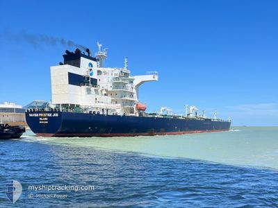
NAVIG8 PRESTIGE JKB
Tanker
Current Trip
| Time Travelled | 10 days |
|---|---|
| Remaining Time | --- |
| Distance Travelled | 2970.38 nm |
| Remaining Distance | --- |
| AVG Speed | 12.1 Knop |
| MAX Speed | 15.1 Knop |
| AVG Wind | 16 knots |
| MAX Wind | 36 knots |
| MIN Temp | 6.3°C / 43.34°F |
| MAX Temp | 18.1°C / 64.58°F |
| Djupgående | 9.7 m |
| Position mottagen | 2 m sen |
Current Position
| Longitud | -73.62296° |
|---|---|
| Latitude | 40.49694° |
| Status | At anchor |
| Fart | |
| Kurs | 229° |
| Område | North Atlantic Ocean |
| Station | T-AIS |
| Position mottagen | 2 m sen |
Info
Information
The current position of NAVIG8 PRESTIGE JKB is in North Atlantic Ocean with coordinates 40.49694° / -73.62296° as reported on 2024-05-13 06:30 by AIS to our vessel tracker app. The vessel's current speed is 0 Knop
The vessel NAVIG8 PRESTIGE JKB (IMO: 9831309, MMSI: 538007785) is a Tanker It's sailing under the flag of [MH] Marshall Is.
In this page you can find informations about the vessels current position, last detected port calls, and current voyage information. If the vessels is not in coverage by AIS you will find the latest position.
The current position of NAVIG8 PRESTIGE JKB is detected by our AIS receivers and we are not responsible for the reliability of the data. The last position was recorded while the vessel was in Coverage by the Ais receivers of our vessel tracking app.
The current draught of NAVIG8 PRESTIGE JKB as reported by AIS is 9.7 meters
Weather
| Temperature | 10.9°C / 51.62°F |
|---|---|
| Wind Speed | 10 knots |
| Direction | 242° WSW |
| Pressure | 1016.6 hPa |
| Humidity | 77.5 % |
| Cloud Coverage | 18 % |
Featured Company
Last Port Calls
| Port | Arrival | Departure | Time In Port |
|---|---|---|---|
| 2024-05-01 04:11 | 2024-05-03 04:51 | 2 d | |
| 2024-04-22 09:45 | 2024-04-23 19:06 | 1 d | |
| 2024-04-14 11:23 | 2024-04-15 18:54 | 1 d | |
| 2024-04-07 19:08 | 2024-04-09 19:09 | 2 d | |
| 2024-04-02 15:00 | 2024-04-03 17:34 | 1 d | |
| 2024-03-23 03:45 | 2024-03-24 13:25 | 1 d |
Last Trips
| Origin | Departure | Destination | Arrival | Distance | |
|---|---|---|---|---|---|
| 2024-04-23 20:06 | 2024-05-01 05:11 | 951.20 nm | |||
| 2024-04-15 19:54 | 2024-04-22 10:45 | 970.74 nm | |||
| 2024-04-09 21:09 | 2024-04-14 12:23 | 642.41 nm | |||
| 2024-04-03 18:34 | 2024-04-07 21:08 | 536.18 nm | |||
| 2024-03-24 14:25 | 2024-04-02 16:00 | 1834.34 nm | |||
| 2024-02-19 06:09 | 2024-03-23 04:45 | 9060.74 nm |
Events
| Tid | Event | Detaljer | Position / Dest | Information |
|---|---|---|---|---|
| 2024-05-13 04:12 | Status ändrad | At anchor Under way using engine |
40.49595 / -73.62293
USNYC
|
Fart: 0.1 kn Kurs: 253° |
| 2024-05-13 04:09 | STOPPAR förflyttning | 17.41 nm, East of TWIN LIGHTS |
40.49600 / -73.62304
USNYC
|
Fart: 0.3 kn Kurs: 248° |
| 2024-05-13 02:06 | ETA ändrat | 2024/05/13 01:00 2024/05/12 17:00 |
40.49986 / -73.25401
USNYC
|
Fart: 10 kn Kurs: 271.1° |
| 2024-05-13 01:56 | Byter havsområde | United States part of the North Atlantic Ocean Portuguese part of the North Atlantic Ocean |
40.49933 / -73.21868
North Atlantic Ocean
|
Fart: 9.9 kn Kurs: 270.9° |
| 2024-05-13 01:55 | Status ändrad | Under way using engine Default |
40.49925 / -73.21574
USNYC
|
Fart: 9 kn Kurs: 271° |
| 2024-05-13 01:50 | I täckningsområde |
40.49933 / -73.21868
North Atlantic Ocean
|
Fart: 9.9 kn Kurs: 270.9° |
|
| 2024-05-03 14:58 | Status ändrad | Default Under way using engine |
38.64820 / -11.46156
USNYC
|
Fart: 12.8 kn Kurs: 290.6° |
| 2024-05-03 14:54 | UTANFÖR täckningsområde |
38.64257 / -11.44234
North Atlantic Ocean
USNYC
|
Fart: 12.8 kn Kurs: 290.6° |
|
| 2024-05-03 14:53 | Status ändrad | Under way using engine Default |
38.64194 / -11.44019
USNYC
|
Fart: 13 kn Kurs: 291° |
| 2024-05-03 14:46 | Status ändrad | Default Under way using engine |
38.63298 / -11.41111
USNYC
|
Fart: 13 kn Kurs: 291.8° |