

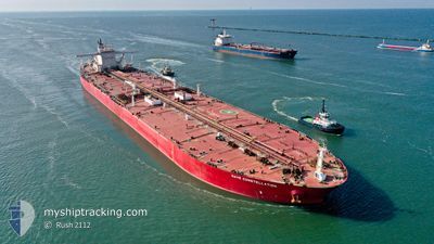
NAVE CONSTELLATION
Tanker

Current Trip
| Time Travelled | --- |
|---|---|
| Remaining Time | 23 h, 48 mins |
| Distance Travelled | 11945.27 nm |
| Remaining Distance | 262.35 nm |
| AVG Speed | 10.5 Knop |
| MAX Speed | 15.1 Knop |
| AVG Wind | 12.9 knots |
| MAX Wind | 31.9 knots |
| MIN Temp | 6.2°C / 43.16°F |
| MAX Temp | 28.8°C / 83.84°F |
| Djupgående | 10.8 m |
| Position mottagen | 15 h, 52 m sen |
Current Position
| Longitud | --- |
|---|---|
| Latitude | --- |
| Status | Under way using engine |
| Fart | 5.6 Knop |
| Kurs | 237.7° |
| Område | Persian Gulf |
| Station | T-AIS |
| Position mottagen | 15 h, 52 m sen |
Information
The current position of NAVE CONSTELLATION is in Persian Gulf with coordinates 25.92280° / 55.53466° as reported on 2025-02-25 04:46 by AIS to our vessel tracker app. The vessel's current speed is 5.6 Knop and is heading at the port of RAS TANURA. The estimated time of arrival as calculated by MyShipTracking vessel tracking app is 2025-02-26 20:27 LT
The vessel NAVE CONSTELLATION (IMO: 9515929, MMSI: 636020982) is a Tanker It's sailing under the flag of [LR] Liberia.
In this page you can find informations about the vessels current position, last detected port calls, and current voyage information. If the vessels is not in coverage by AIS you will find the latest position.
The current position of NAVE CONSTELLATION is detected by our AIS receivers and we are not responsible for the reliability of the data. The last position was recorded while the vessel was in Coverage by the Ais receivers of our vessel tracking app.
The current draught of NAVE CONSTELLATION as reported by AIS is 10.8 meters
Weather
| Temperature | 16.4°C / 61.52°F |
|---|---|
| Wind Speed | 26 knots |
| Direction | 310° NW |
| Pressure | 1020.1 hPa |
| Humidity | 54.7 % |
| Cloud Coverage | 10 % |


Featured Company
Last Port Calls
Most Visited Ports (Last year)
| Port | Arrivals | |
|---|---|---|
| 1 | ||
| 1 | ||
| 1 | ||
| 1 |
Last Trips
| Origin | Departure | Destination | Arrival | Distance |
|---|
Events
| Tid | Event | Detaljer | Position / Dest | Information |
|---|---|---|---|---|
| 2025-02-25 04:51 | Status ändrad | Default Under way using engine |
25.91856 / 55.52712
SG SIN >> SA RTA
|
Fart: 5.6 kn Kurs: 237.7° |
| 2025-02-25 04:46 | UTANFÖR täckningsområde |
25.92280 / 55.53466
Persian Gulf
SG SIN >> SA RTA
|
Fart: 5.6 kn Kurs: 237.7° |
|
| 2025-02-25 04:33 | Status ändrad | Under way using engine Default |
25.93429 / 55.55535
SG SIN >> SA RTA
|
Fart: 5.9 kn Kurs: 238° |
| 2025-02-25 04:25 | Status ändrad | Default Under way using engine |
25.94074 / 55.56694
SG SIN >> SA RTA
|
Fart: 5.8 kn Kurs: 238.6° |
| 2025-02-25 04:07 | Status ändrad | Under way using engine Default |
25.95668 / 55.59557
SG SIN >> SA RTA
|
Fart: 5.8 kn Kurs: 236° |
| 2025-02-25 03:59 | Status ändrad | Default Under way using engine |
25.96317 / 55.60678
SG SIN >> SA RTA
|
Fart: 5.9 kn Kurs: 229.8° |
| 2025-02-25 03:31 | Status ändrad | Under way using engine Default |
25.99432 / 55.64557
SG SIN >> SA RTA
|
Fart: 5.5 kn Kurs: 233° |
| 2025-02-25 02:54 | Status ändrad | Default Under way using engine |
26.02840 / 55.69561
SG SIN >> SA RTA
|
Fart: 5.5 kn Kurs: 235.9° |
| 2025-02-25 02:33 | Status ändrad | Under way using engine Default |
26.04520 / 55.72533
SG SIN >> SA RTA
|
Fart: 5.9 kn Kurs: 247° |
| 2025-02-25 02:04 | Status ändrad | Default Under way using engine |
26.06460 / 55.77463
SG SIN >> SA RTA
|
Fart: 6.3 kn Kurs: 245.1° |