
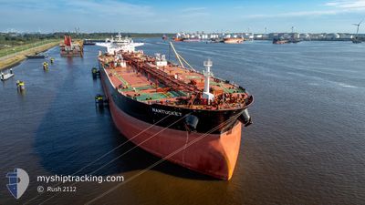
NANTUCKET
Tanker
Current Trip
| Time Travelled | 4 days |
|---|---|
| Remaining Time | --- |
| Distance Travelled | 57.24 nm |
| Remaining Distance | --- |
| AVG Speed | 8.5 Knop |
| MAX Speed | 12.4 Knop |
| AVG Wind | 4.2 knots |
| MAX Wind | 12 knots |
| MIN Temp | 9.4°C / 48.92°F |
| MAX Temp | 20.4°C / 68.72°F |
| Djupgående | 15.2 m |
| Position mottagen | 4 m sen |
Current Position
| Longitud | --- |
|---|---|
| Latitude | --- |
| Status | At anchor |
| Fart | |
| Kurs | 104° |
| Område | Sea of Marmara |
| Station | T-AIS |
| Position mottagen | 4 m sen |
Information
The current position of NANTUCKET is in Sea of Marmara with coordinates 40.75465° / 29.69074° as reported on 2025-03-28 04:29 by AIS to our vessel tracker app. The vessel's current speed is 0 Knop
The vessel NANTUCKET (IMO: 9600865, MMSI: 636021793) is a Tanker It's sailing under the flag of [LR] Liberia.
In this page you can find informations about the vessels current position, last detected port calls, and current voyage information. If the vessels is not in coverage by AIS you will find the latest position.
The current position of NANTUCKET is detected by our AIS receivers and we are not responsible for the reliability of the data. The last position was recorded while the vessel was in Coverage by the Ais receivers of our vessel tracking app.
The current draught of NANTUCKET as reported by AIS is 15.2 meters
Weather
| Temperature | 16.5°C / 61.7°F |
|---|---|
| Wind Speed | 5 knots |
| Direction | 91° E |
| Pressure | 1003 hPa |
| Humidity | 51.8 % |
| Cloud Coverage | 100 % |
Featured Company
Events
| Tid | Event | Detaljer | Position / Dest | Information |
|---|---|---|---|---|
| 2025-03-26 19:38 | Status ändrad | At anchor Default |
40.75359 / 29.69609
TR TUT
|
Fart: Kurs: 292° |
| 2025-03-26 19:29 | Status ändrad | Default At anchor |
40.75366 / 29.69650
TR TUT
|
Fart: Kurs: 292° |
| 2025-03-26 19:20 | Status ändrad | At anchor Default |
40.75368 / 29.69664
TR TUT
|
Fart: Kurs: 292° |
| 2025-03-26 19:01 | Status ändrad | Default At anchor |
40.75364 / 29.69647
TR TUT
|
Fart: Kurs: 294° |
| 2025-03-26 18:23 | Status ändrad | At anchor Default |
40.75325 / 29.69647
TR TUT
|
Fart: Kurs: 302° |
| 2025-03-26 18:02 | Status ändrad | Default At anchor |
40.75312 / 29.69638
TR TUT
|
Fart: Kurs: 309° |
| 2025-03-24 16:04 | Status ändrad | At anchor Default |
40.75359 / 29.69647
TR TUT
|
Fart: Kurs: 273° |
| 2025-03-24 15:59 | Status ändrad | Default At anchor |
40.75355 / 29.69649
TR TUT
|
Fart: Kurs: 273° |
| 2025-03-23 12:10 | Status ändrad | At anchor Under way using engine |
40.75343 / 29.69083
TR TUT
|
Fart: 0.5 kn Kurs: 86° |
| 2025-03-23 12:08 | STOPPAR förflyttning | 1.48 nm, South West of EVYAP |
40.75322 / 29.69113
TR TUT
|
Fart: 0.3 kn Kurs: 79° |