
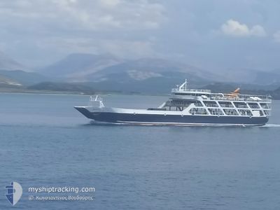
NANTI
Ro-Ro/Passenger Ship
Current Trip
KERKYRA-IGOUMENITSA
| Time Travelled | 21 h, 30 mins |
|---|---|
| Remaining Time | --- |
| Distance Travelled | --- |
| Remaining Distance | --- |
| AVG Speed | --- |
| MAX Speed | --- |
| AVG Wind | --- |
| MAX Wind | --- |
| MIN Temp | --- |
| MAX Temp | --- |
| Djupgående | 2.4 m |
| Position mottagen | 1 d sen |
Current Position
| Longitud | 20.18878° |
|---|---|
| Latitude | 39.50478° |
| Status | Under way using engine |
| Fart | 11 Knop |
| Kurs | 107.5° |
| Område | Ionian Sea |
| Station | T-AIS |
| Position mottagen | 1 d sen |
Info
Information
The current position of NANTI is in Ionian Sea with coordinates 39.50478° / 20.18878° as reported on 2024-05-01 08:28 by AIS to our vessel tracker app. The vessel's current speed is 11 Knop
The vessel NANTI (IMO: 7350557, MMSI: 237033400) is a Ro-Ro/Passenger Ship that was built in 1973 ( 51 År gammal ). It's sailing under the flag of [GR] Greece.
In this page you can find informations about the vessels current position, last detected port calls, and current voyage information. If the vessels is not in coverage by AIS you will find the latest position.
The current position of NANTI is detected by our AIS receivers and we are not responsible for the reliability of the data. The last position was recorded while the vessel was in Coverage by the Ais receivers of our vessel tracking app.
The current draught of NANTI as reported by AIS is 2.4 meters
Weather
| Temperature | 20°C / 68°F |
|---|---|
| Wind Speed | 9 knots |
| Direction | 170° S |
| Pressure | 1014.8 hPa |
| Humidity | 69.4 % |
| Cloud Coverage | 80 % |
Featured Company
Last Port Calls
| Port | Arrival | Departure | Time In Port |
|---|---|---|---|
| 2024-05-01 08:38 | 2024-05-01 11:18 | 2 h | |
| 2024-04-30 10:38 | 2024-05-01 04:43 | 18 h | |
| 2024-04-30 08:22 | 2024-04-30 09:10 | 48 m | |
| 2024-04-30 04:46 | 2024-04-30 06:49 | 2 h | |
| 2024-04-30 02:27 | 2024-04-30 03:09 | 41 m | |
| 2024-04-29 10:33 | 2024-04-30 00:40 | 14 h | |
| 2024-04-29 04:39 | 2024-04-29 06:37 | 1 h | |
| 2024-04-29 02:37 | 2024-04-29 03:05 | 27 m | |
| 2024-04-29 00:34 | |||
| 2024-04-28 04:43 | 2024-04-28 06:35 | 1 h |
Most Visited Ports (Last year)
| Port | Arrivals | |
|---|---|---|
| 381 | ||
| 348 |
Last Trips
| Origin | Departure | Destination | Arrival | Distance | |
|---|---|---|---|---|---|
| 2024-05-01 07:43 | 2024-05-01 11:38 | 21.81 nm | |||
| 2024-04-30 12:10 | 2024-04-30 13:38 | 16.96 nm | |||
| 2024-04-30 09:49 | 2024-04-30 11:22 | 16.66 nm | |||
| 2024-04-30 06:09 | 2024-04-30 07:46 | 17.34 nm | |||
| 2024-04-30 03:40 | 2024-04-30 05:27 | 15.35 nm | |||
| 2024-04-29 09:37 | 2024-04-29 13:33 | 22.16 nm | |||
| 2024-04-29 06:05 | 2024-04-29 07:39 | 15.96 nm | |||
| 2024-04-29 03:34 | 2024-04-29 05:37 | 14.99 nm | |||
| 2024-04-28 03:36 | 2024-04-28 07:43 | 32.28 nm | |||
| 2024-04-27 03:35 | 2024-04-27 08:03 | 23.47 nm |
Events
| Tid | Event | Detaljer | Position / Dest | Information |
|---|---|---|---|---|
| 2024-05-01 11:18 | AVGÅTT HAMN |
|
39.53822 / 20.10805
KERKYRA-IGOUMENITSA
|
Fart: Kurs: -1° |
| 2024-05-01 08:38 | Status ändrad | Default Under way using engine |
39.49940 / 20.23017
[GR] IGOUMENITSA
|
Fart: 11 kn Kurs: 107.5° |
| 2024-05-01 08:38 | ANLÄNDER HAMN |
|
39.49940 / 20.23017
[GR] IGOUMENITSA
|
Fart: 11 kn Kurs: 107.5° |
| 2024-05-01 08:28 | Status ändrad | Under way using engine Default |
39.50478 / 20.18878
KERKYRA-IGOUMENITSA
|
Fart: 11.3 kn Kurs: 125° |
| 2024-05-01 08:28 | I täckningsområde |
39.50478 / 20.18878
Ionian Sea
|
Fart: 11 kn Kurs: 107.5° |
|
| 2024-05-01 08:28 | UTANFÖR täckningsområde |
39.50478 / 20.18878
Ionian Sea
[GR] IGOUMENITSA
|
Fart: 11 kn Kurs: 107.5° |
|
| 2024-05-01 04:43 | AVGÅTT HAMN |
|
39.58155 / 20.03233
KERKYRA-IGOUMENITSA
|
Fart: Kurs: -1° |
| 2024-04-30 10:50 | UTANFÖR täckningsområde |
39.49837 / 20.26287
Ionian Sea
[GR] IGOUMENITSA
|
Fart: 0.2 kn Kurs: 343.3° |
|
| 2024-04-30 10:48 | STOPPAR förflyttning |
39.49832 / 20.26287
[GR] IGOUMENITSA
|
Fart: 0.3 kn Kurs: 511° |
|
| 2024-04-30 10:38 | ANLÄNDER HAMN |
|
39.49917 / 20.22655
[GR] IGOUMENITSA
|
Fart: 11 kn Kurs: 89.7° |