
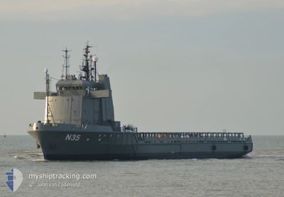
N35
Offshore Supply Ship
Current Trip
PIRCKYPINE BANK
| Time Travelled | 7 days |
|---|---|
| Remaining Time | --- |
| Distance Travelled | 602.30 nm |
| Remaining Distance | --- |
| AVG Speed | 6.7 Knop |
| MAX Speed | 11.5 Knop |
| AVG Wind | 6.1 knots |
| MAX Wind | 13.9 knots |
| MIN Temp | 8.7°C / 47.66°F |
| MAX Temp | 14.1°C / 57.38°F |
| Djupgående | 4 m |
| Position mottagen | 4 d sen |
Current Position
| Longitud | -10.07626° |
|---|---|
| Latitude | 51.16283° |
| Status | Under way using engine |
| Fart | 6.8 Knop |
| Kurs | 335.5° |
| Område | Celtic Sea |
| Station | T-AIS |
| Position mottagen | 4 d sen |
Info
Information
The current position of N35 is in Celtic Sea with coordinates 51.16283° / -10.07626° as reported on 2024-05-11 22:17 by AIS to our vessel tracker app. The vessel's current speed is 6.8 Knop
The vessel N35 (IMO: 8119637, MMSI: 351556000) is a Offshore Supply Ship that was built in 1983 ( 41 År gammal ). It's sailing under the flag of [PA] Panama.
In this page you can find informations about the vessels current position, last detected port calls, and current voyage information. If the vessels is not in coverage by AIS you will find the latest position.
The current position of N35 is detected by our AIS receivers and we are not responsible for the reliability of the data. The last position was recorded while the vessel was in Coverage by the Ais receivers of our vessel tracking app.
The current draught of N35 as reported by AIS is 4 meters
Weather
| Temperature | 13.5°C / 56.3°F |
|---|---|
| Wind Speed | 7 knots |
| Direction | 222° SW |
| Pressure | 1014.3 hPa |
| Humidity | 90 % |
| Cloud Coverage | 100 % |
Featured Company
Most Visited Ports (Last year)
| Port | Arrivals | |
|---|---|---|
| 1 |
Last Trips
| Origin | Departure | Destination | Arrival | Distance |
|---|
Events
| Tid | Event | Detaljer | Position / Dest | Information |
|---|---|---|---|---|
| 2024-05-11 22:17 | UTANFÖR täckningsområde |
51.16283 / -10.07626
Celtic Sea
PIRCKYPINE BANK
|
Fart: 6.8 kn Kurs: 335.5° |
|
| 2024-05-11 13:10 | I täckningsområde |
50.44959 / -9.12090
Celtic Sea
PIRCKYPINE BANK
|
Fart: 5.3 kn Kurs: 298.2° |
|
| 2024-05-11 11:54 | UTANFÖR täckningsområde |
50.39095 / -8.95017
Celtic Sea
PIRCKYPINE BANK
|
Fart: 5.9 kn Kurs: 300.4° |
|
| 2024-05-11 09:55 | I täckningsområde |
50.29808 / -8.66276
Celtic Sea
PIRCKYPINE BANK
|
Fart: 7 kn Kurs: 292.7° |
|
| 2024-05-11 08:47 | UTANFÖR täckningsområde |
50.24498 / -8.47736
Celtic Sea
PIRCKYPINE BANK
|
Fart: 6.6 kn Kurs: 294.3° |
|
| 2024-05-11 08:47 | Upptäckt i hav | Irish part of the Celtic Sea |
50.24461 / -8.47602
Celtic Sea
PIRCKYPINE BANK
|
Fart: 6.8 kn Kurs: 292.8° |
| 2024-05-10 20:48 | I täckningsområde |
49.72385 / -6.30237
Celtic Sea
PIRCKYPINE BANK
|
Fart: 7 kn Kurs: 263.9° |
|
| 2024-05-10 17:39 | UTANFÖR täckningsområde |
49.75709 / -5.75173
Celtic Sea
PIRCKYPINE BANK
|
Fart: 6.7 kn Kurs: 264.9° |
|
| 2024-05-10 17:39 | I täckningsområde |
49.75709 / -5.75173
Celtic Sea
PIRCKYPINE BANK
|
Fart: 6.7 kn Kurs: 264.9° |
|
| 2024-05-10 16:35 | UTANFÖR täckningsområde |
49.77509 / -5.56614
Celtic Sea
PIRCKYPINE BANK
|
Fart: 7 kn Kurs: 260.2° |