
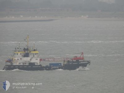
MULTRASALVOR 4
Salvage/Rescue Vessel
Current Trip
SALVAGE OPS HUMBERUK
| Time Travelled | 7 days |
|---|---|
| Remaining Time | --- |
| Distance Travelled | 431.84 nm |
| Remaining Distance | --- |
| AVG Speed | 5.9 Knop |
| MAX Speed | 10.6 Knop |
| AVG Wind | 12.4 knots |
| MAX Wind | 22.5 knots |
| MIN Temp | 3.8°C / 38.84°F |
| MAX Temp | 14.6°C / 58.28°F |
| Djupgående | 2.9 m |
| Position mottagen | 19 h, 57 m sen |
Current Position
| Longitud | --- |
|---|---|
| Latitude | --- |
| Status | Under way using engine |
| Fart | 1.2 Knop |
| Kurs | 41° |
| Område | North Sea |
| Station | T-AIS |
| Position mottagen | 19 h, 57 m sen |
Info
Information
The current position of MULTRASALVOR 4 is in North Sea with coordinates 53.41483° / 0.52962° as reported on 2025-03-17 06:12 by AIS to our vessel tracker app. The vessel's current speed is 1.2 Knop
The vessel MULTRASALVOR 4 (IMO: 8224286, MMSI: 246490000) is a Salvage/Rescue Vessel that was built in 1983 ( 42 År gammal ). It's sailing under the flag of [NL] Netherlands.
In this page you can find informations about the vessels current position, last detected port calls, and current voyage information. If the vessels is not in coverage by AIS you will find the latest position.
The current position of MULTRASALVOR 4 is detected by our AIS receivers and we are not responsible for the reliability of the data. The last position was recorded while the vessel was in Coverage by the Ais receivers of our vessel tracking app.
The current draught of MULTRASALVOR 4 as reported by AIS is 2.9 meters
Weather
| Temperature | 5.7°C / 42.26°F |
|---|---|
| Wind Speed | 15 knots |
| Direction | 106° ESE |
| Pressure | 1029.5 hPa |
| Humidity | 73.8 % |
| Cloud Coverage | 1 % |
Featured Company
Last Port Calls
| Port | Arrival | Departure | Time In Port |
|---|---|---|---|
| 2025-03-10 15:43 | 2025-03-10 16:57 | 1 h | |
| 2025-02-21 15:10 | 2025-03-10 15:25 | 17 d | |
| 2025-02-20 23:45 | 2025-02-21 14:58 | 15 h | |
| 2025-02-20 21:00 | 2025-02-20 23:37 | 2 h | |
| 2025-02-20 08:24 | 2025-02-20 20:39 | 12 h | |
| 2025-02-13 15:23 | 2025-02-20 08:16 | 6 d | |
| 2025-02-12 17:45 | 2025-02-13 14:08 | 20 h | |
| 2025-02-12 15:34 |
Last Trips
| Origin | Departure | Destination | Arrival | Distance | |
|---|---|---|---|---|---|
| 2025-03-10 15:25 | 2025-03-10 15:43 | 1.62 nm | |||
| 2025-02-21 14:58 | 2025-02-21 15:10 | 0.95 nm | |||
| 2025-02-20 23:37 | 2025-02-20 23:45 | 1.09 nm | |||
| 2025-02-20 20:39 | 2025-02-20 21:00 | 1.19 nm | |||
| 2025-02-20 08:16 | 2025-02-20 08:24 | 0.73 nm | |||
| 2025-02-13 14:08 | 2025-02-13 15:23 | 11.25 nm | |||
| 2025-02-12 15:34 | 2025-02-12 17:45 | 11.66 nm |
Events
| Tid | Event | Detaljer | Position / Dest | Information |
|---|---|---|---|---|
| 2025-03-17 21:54 | STARTAR förflyttning |
53.50735 / .56625
SALVAGE OPS HUMBERUK
|
Fart: 3.3 kn Kurs: 247° |
|
| 2025-03-17 17:42 | STOPPAR förflyttning | 21.47 nm, South East of GRIMSBY |
53.42734 / .47457
SALVAGE OPS HUMBERUK
|
Fart: 0.2 kn Kurs: 25° |
| 2025-03-17 15:17 | STARTAR förflyttning | 21.03 nm, East of GRIMSBY |
53.49165 / .50080
SALVAGE OPS HUMBERUK
|
Fart: 3.9 kn Kurs: 158° |
| 2025-03-17 11:33 | STOPPAR förflyttning |
53.48982 / .54895
SALVAGE OPS HUMBERUK
|
Fart: 0.1 kn Kurs: 191° |
|
| 2025-03-17 10:40 | STARTAR förflyttning |
53.48261 / .54024
SALVAGE OPS HUMBERUK
|
Fart: 3.7 kn Kurs: 35° |
|
| 2025-03-17 06:14 | Status ändrad | Default Under way using engine |
53.41419 / .53001
SALVAGE OPS HUMBERUK
|
Fart: 1.2 kn Kurs: 41° |
| 2025-03-17 06:12 | Status ändrad | Under way using engine Default |
53.41483 / .52962
SALVAGE OPS HUMBERUK
|
Fart: 1.2 kn Kurs: 349° |
| 2025-03-17 06:12 | I täckningsområde |
53.41483 / .52962
North Sea
|
Fart: 1.2 kn Kurs: 188.7° |
|
| 2025-03-17 06:12 | UTANFÖR täckningsområde |
53.41483 / .52962
North Sea
|
Fart: 1.2 kn Kurs: 188.7° |
|
| 2025-03-16 21:56 | STOPPAR förflyttning |
53.44632 / .54241
SALVAGE OPS HUMBERUK
|
Fart: 0.3 kn Kurs: 65° |