
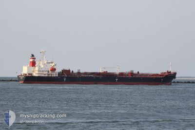
MTM NEW ORLEANS
Tanker B
Current Trip
| Time Travelled | 6 days |
|---|---|
| Remaining Time | 2 days |
| Distance Travelled | 1910.80 nm |
| Remaining Distance | 772.17 nm |
| AVG Speed | 12.2 Knop |
| MAX Speed | 16.1 Knop |
| AVG Wind | 9.2 knots |
| MAX Wind | 16.9 knots |
| MIN Temp | 22.5°C / 72.5°F |
| MAX Temp | 29.2°C / 84.56°F |
| Djupgående | 7.2 m |
| Position mottagen | 2 d sen |
Current Position
| Longitud | --- |
|---|---|
| Latitude | --- |
| Status | Under way using engine |
| Fart | 12.7 Knop |
| Kurs | 121.8° |
| Område | Laccadive Sea |
| Station | T-AIS |
| Position mottagen | 2 d sen |
Info
Information
The current position of MTM NEW ORLEANS is in Laccadive Sea with coordinates 6.53531° / 78.84605° as reported on 2025-02-16 08:36 by AIS to our vessel tracker app. The vessel's current speed is 12.7 Knop and is heading at the port of PORT KLANG. The estimated time of arrival as calculated by MyShipTracking vessel tracking app is 2025-02-21 20:47 LT
The vessel MTM NEW ORLEANS (IMO: 9749398, MMSI: 565884000) is a Tanker B It's sailing under the flag of [SG] Singapore.
In this page you can find informations about the vessels current position, last detected port calls, and current voyage information. If the vessels is not in coverage by AIS you will find the latest position.
The current position of MTM NEW ORLEANS is detected by our AIS receivers and we are not responsible for the reliability of the data. The last position was recorded while the vessel was in Coverage by the Ais receivers of our vessel tracking app.
The current draught of MTM NEW ORLEANS as reported by AIS is 7.2 meters
Weather
| Temperature | 26.9°C / 80.42°F |
|---|---|
| Wind Speed | 9 knots |
| Direction | 30° NNE |
| Pressure | 1009.9 hPa |
| Humidity | 70.6 % |
| Cloud Coverage | 100 % |
Featured Company
Last Port Calls
| Port | Arrival | Departure | Time In Port |
|---|---|---|---|
| 2025-02-08 17:13 | 2025-02-12 06:19 | 3 d | |
| 2024-12-10 07:19 | 2024-12-16 21:36 | 6 d | |
| 2024-11-30 23:59 |
Most Visited Ports (Last year)
| Port | Arrivals | |
|---|---|---|
| 3 | ||
| 2 | ||
| 2 | ||
| 1 | ||
| 1 | ||
| 1 |
Last Trips
| Origin | Departure | Destination | Arrival | Distance | |
|---|---|---|---|---|---|
| 2024-12-16 15:36 | 2025-02-08 22:43 | 9805.98 nm | |||
| 2024-11-30 17:59 | 2024-12-10 01:19 | 452.89 nm |
Events
| Tid | Event | Detaljer | Position / Dest | Information |
|---|---|---|---|---|
| 2025-02-16 08:38 | Status ändrad | Default Under way using engine |
6.53230 / 78.85068
MYPKG
|
Fart: 12.7 kn Kurs: 121.8° |
| 2025-02-16 08:36 | UTANFÖR täckningsområde |
6.53531 / 78.84605
Laccadive Sea
MYPKG
|
Fart: 12.7 kn Kurs: 121.8° |
|
| 2025-02-16 05:58 | Byter havsområde | Sri Lankan part of the Laccadive Sea Indian part of the Laccadive Sea |
6.86034 / 78.38777
Laccadive Sea
MYPKG
|
Fart: 12.5 kn Kurs: 127.7° |
| 2025-02-16 04:13 | Status ändrad | Under way using engine Default |
7.08509 / 78.07814
MYPKG
|
Fart: 12.9 kn Kurs: 126° |
| 2025-02-16 04:09 | Status ändrad | Default Under way using engine |
7.09398 / 78.06619
MYPKG
|
Fart: 12.7 kn Kurs: 123.9° |
| 2025-02-16 03:40 | Status ändrad | Under way using engine Default |
7.15448 / 77.98270
MYPKG
|
Fart: 12.6 kn Kurs: 126° |
| 2025-02-16 03:24 | Status ändrad | Default Under way using engine |
7.18610 / 77.93860
MYPKG
|
Fart: 13.1 kn Kurs: 125.8° |
| 2025-02-16 02:57 | Status ändrad | Under way using engine Default |
7.24264 / 77.86054
MYPKG
|
Fart: 12.6 kn Kurs: 125° |
| 2025-02-16 02:46 | Status ändrad | Default Under way using engine |
7.26516 / 77.82609
MYPKG
|
Fart: 12.4 kn Kurs: 124° |
| 2025-02-16 02:40 | Status ändrad | Under way using engine Default |
7.27559 / 77.81024
MYPKG
|
Fart: 12.6 kn Kurs: 128° |