
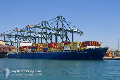
MSC VANCOUVER
Container Ship
Current Trip
BRSZZ
| Time Travelled | 1 day |
|---|---|
| Remaining Time | --- |
| Distance Travelled | 164.24 nm |
| Remaining Distance | --- |
| AVG Speed | 7.3 Knop |
| MAX Speed | 14.7 Knop |
| AVG Wind | 10.7 knots |
| MAX Wind | 14.9 knots |
| MIN Temp | 23.5°C / 74.3°F |
| MAX Temp | 30.5°C / 86.9°F |
| Djupgående | 12.2 m |
| Position mottagen | 4 h, 30 m sen |
Current Position
| Longitud | --- |
|---|---|
| Latitude | --- |
| Status | Under way using engine |
| Fart | 0.4 Knop |
| Kurs | 68° |
| Område | South Atlantic Ocean |
| Station | T-AIS |
| Position mottagen | 4 h, 30 m sen |
Info
Information
The current position of MSC VANCOUVER is in South Atlantic Ocean with coordinates -24.47091° / -46.59848° as reported on 2025-02-17 12:36 by AIS to our vessel tracker app. The vessel's current speed is 0.4 Knop
The vessel MSC VANCOUVER (IMO: 9285691, MMSI: 636020499) is a Container Ship that was built in 2004 ( 21 År gammal ). It's sailing under the flag of [LR] Liberia.
In this page you can find informations about the vessels current position, last detected port calls, and current voyage information. If the vessels is not in coverage by AIS you will find the latest position.
The current position of MSC VANCOUVER is detected by our AIS receivers and we are not responsible for the reliability of the data. The last position was recorded while the vessel was in Coverage by the Ais receivers of our vessel tracking app.
The current draught of MSC VANCOUVER as reported by AIS is 12.2 meters
Weather
| Temperature | 30.1°C / 86.18°F |
|---|---|
| Wind Speed | 6 knots |
| Direction | 118° ESE |
| Pressure | 1009 hPa |
| Humidity | 67.3 % |
| Cloud Coverage | 10 % |
Featured Company
Last Port Calls
| Port | Arrival | Departure | Time In Port |
|---|---|---|---|
| 2025-02-15 10:04 | 2025-02-16 01:56 | 15 h | |
| 2025-02-14 01:14 | 2025-02-14 07:19 | 6 h | |
| 2025-02-10 18:58 | 2025-02-12 04:47 | 1 d | |
| 2025-01-25 17:23 | 2025-01-26 01:20 | 7 h | |
| 2025-01-24 23:24 | 2025-01-25 17:05 | 17 h | |
| 2025-01-15 20:48 | 2025-01-18 13:54 | 2 d | |
| 2025-01-11 20:25 | 2025-01-12 12:44 | 16 h | |
| 2025-01-03 18:21 | 2025-01-04 11:17 | 16 h | |
| 2024-12-23 13:30 | 2024-12-23 13:38 | 7 m | |
| 2024-12-15 11:04 | 2024-12-15 12:00 | 56 m |
Last Trips
| Origin | Departure | Destination | Arrival | Distance | |
|---|---|---|---|---|---|
| 2025-02-14 04:19 | 2025-02-15 07:04 | 135.11 nm | |||
| 2025-02-12 01:47 | 2025-02-13 22:14 | 133.84 nm | |||
| 2025-01-25 20:20 | 2025-02-10 15:58 | 4566.53 nm | |||
| 2025-01-25 12:05 | 2025-01-25 12:23 | 1.71 nm | |||
| 2025-01-18 07:54 | 2025-01-24 18:24 | 1735.43 nm | |||
| 2025-01-12 06:44 | 2025-01-15 14:48 | 556.36 nm | |||
| 2025-01-04 06:17 | 2025-01-11 14:25 | 1984.91 nm | |||
| 2024-12-23 10:38 | 2025-01-03 13:21 | 4119.74 nm | |||
| 2024-12-15 09:00 | 2024-12-23 10:30 | 565.23 nm | |||
| 2024-12-13 14:46 | 2024-12-15 08:04 | 228.56 nm |
Events
| Tid | Event | Detaljer | Position / Dest | Information |
|---|---|---|---|---|
| 2025-02-17 12:42 | Status ändrad | Default Under way using engine |
-24.47169 / -46.59826
BRSZZ
|
Fart: 0.4 kn Kurs: 68° |
| 2025-02-17 12:36 | UTANFÖR täckningsområde |
-24.47091 / -46.59848
South Atlantic Ocean
BRSZZ
|
Fart: 0.4 kn Kurs: 170.9° |
|
| 2025-02-17 12:31 | Status ändrad | Under way using engine Default |
-24.47028 / -46.59864
BRSZZ
|
Fart: 0.4 kn Kurs: 75° |
| 2025-02-17 12:04 | Status ändrad | Default Under way using engine |
-24.46740 / -46.59809
BRSZZ
|
Fart: 0.4 kn Kurs: 75° |
| 2025-02-17 11:52 | Status ändrad | Under way using engine Default |
-24.46581 / -46.59755
BRSZZ
|
Fart: 0.6 kn Kurs: 65° |
| 2025-02-17 11:37 | I täckningsområde |
-24.46591 / -46.59758
South Atlantic Ocean
BRSZZ
|
Fart: 0.5 kn Kurs: 190.9° |
|
| 2025-02-17 10:17 | Status ändrad | Default Under way using engine |
-24.44918 / -46.59900
BRSZZ
|
Fart: 0.6 kn Kurs: 33° |
| 2025-02-17 10:12 | UTANFÖR täckningsområde |
-24.44832 / -46.59904
South Atlantic Ocean
BRSZZ
|
Fart: 0.6 kn Kurs: 175.4° |
|
| 2025-02-17 10:09 | Status ändrad | Under way using engine Default |
-24.44773 / -46.59904
BRSZZ
|
Fart: 0.5 kn Kurs: 33° |
| 2025-02-17 10:06 | I täckningsområde |
-24.44773 / -46.59904
South Atlantic Ocean
BRSZZ
|
Fart: 0.5 kn Kurs: 187.3° |