
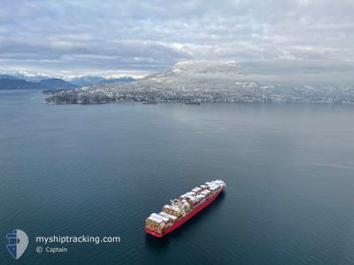
MSC UTMOST VIII
Container Ship
Current Trip
| Time Travelled | 9 h, 24 mins |
|---|---|
| Remaining Time | --- |
| Distance Travelled | 53.31 nm |
| Remaining Distance | 107.48 nm |
| AVG Speed | 11.4 Knop |
| MAX Speed | 19.1 Knop |
| AVG Wind | 10.3 knots |
| MAX Wind | 12 knots |
| MIN Temp | 7.2°C / 44.96°F |
| MAX Temp | 9.1°C / 48.38°F |
| Djupgående | 11.1 m |
| Position mottagen | 3 d sen |
Current Position
| Longitud | --- |
|---|---|
| Latitude | --- |
| Status | Under way using engine |
| Fart | 14.7 Knop |
| Kurs | 235.1° |
| Område | North Pacific Ocean |
| Station | T-AIS |
| Position mottagen | 3 d sen |
Info
Information
The current position of MSC UTMOST VIII is in North Pacific Ocean with coordinates 35.02831° / 139.61570° as reported on 2025-02-22 09:36 by AIS to our vessel tracker app. The vessel's current speed is 14.7 Knop and is heading at the port of SHANGHAI. The estimated time of arrival as calculated by MyShipTracking vessel tracking app is 2025-02-25 04:00 LT
The vessel MSC UTMOST VIII (IMO: 9302621, MMSI: 636012808) is a Container Ship that was built in 2006 ( 19 År gammal ). It's sailing under the flag of [LR] Liberia.
In this page you can find informations about the vessels current position, last detected port calls, and current voyage information. If the vessels is not in coverage by AIS you will find the latest position.
The current position of MSC UTMOST VIII is detected by our AIS receivers and we are not responsible for the reliability of the data. The last position was recorded while the vessel was in Coverage by the Ais receivers of our vessel tracking app.
The current draught of MSC UTMOST VIII as reported by AIS is 11.1 meters
Weather
| Temperature | 9.6°C / 49.28°F |
|---|---|
| Wind Speed | 3 knots |
| Direction | 14° NNE |
| Pressure | 1029 hPa |
| Humidity | 61.1 % |
| Cloud Coverage | 100 % |
Featured Company
Last Port Calls
| Port | Arrival | Departure | Time In Port |
|---|---|---|---|
| 2025-02-25 10:08 | 2025-02-25 18:45 | 8 h | |
| 2025-02-25 02:56 | 2025-02-25 10:05 | 7 h | |
| 2025-02-21 22:54 | 2025-02-22 07:44 | 8 h | |
| 2025-02-07 06:17 | 2025-02-11 08:35 | 4 d | |
| 2025-01-22 12:46 | 2025-01-26 01:04 | 3 d | |
| 2025-01-02 09:52 | 2025-01-03 22:04 | 1 d | |
| 2024-12-30 18:03 | 2024-12-31 17:40 | 23 h | |
| 2024-12-28 12:05 | 2024-12-29 02:25 | 14 h | |
| 2024-12-04 14:03 | 2024-12-08 15:05 | 4 d |
Most Visited Ports (Last year)
| Port | Arrivals | |
|---|---|---|
| 9 | ||
| 9 | ||
| 9 | ||
| 8 | ||
| 6 | ||
| 5 |
Last Trips
| Origin | Departure | Destination | Arrival | Distance | |
|---|---|---|---|---|---|
| 2025-02-25 18:05 | 2025-02-25 18:08 | 0.11 nm | |||
| 2025-02-22 16:44 | 2025-02-25 10:56 | 1007.29 nm | |||
| 2025-02-11 00:35 | 2025-02-22 07:54 | 4386.19 nm | |||
| 2025-01-25 17:04 | 2025-02-06 22:17 | 664.61 nm | |||
| 2025-01-04 07:04 | 2025-01-22 04:46 | 4379.52 nm | |||
| 2025-01-01 01:40 | 2025-01-02 18:52 | 493.99 nm | |||
| 2024-12-29 10:25 | 2024-12-31 02:03 | 208.95 nm | |||
| 2024-12-08 07:05 | 2024-12-28 20:05 | 7177.37 nm | |||
| 2024-11-24 03:28 | 2024-12-04 06:03 | 657.09 nm |
Events
| Tid | Event | Detaljer | Position / Dest | Information |
|---|---|---|---|---|
| 2025-02-25 18:45 | STARTAR förflyttning | 2.2 nm, West of YANGSHAN |
30.59974 / 122.09288
CNSHA
|
Fart: 9.5 kn Kurs: 123° |
| 2025-02-25 18:45 | AVGÅTT HAMN |
|
30.59974 / 122.09288
CNSHA
|
Fart: 0.5 kn Kurs: 307° |
| 2025-02-25 10:08 | ANLÄNDER HAMN |
|
30.60716 / 122.08395
[CN] YANGSHAN
|
Fart: Kurs: 306° |
| 2025-02-25 10:05 | AVGÅTT HAMN |
|
30.60533 / 122.08351
CNSHA
|
Fart: Kurs: 306° |
| 2025-02-25 02:56 | ANLÄNDER HAMN |
|
30.60695 / 122.08445
[CN] YANGSHAN
|
Fart: 0.2 kn Kurs: 306° |
| 2025-02-25 02:33 | STOPPAR förflyttning | 2.6 nm, West of YANGSHAN |
30.60674 / 122.08423
CNSHA
|
Fart: Kurs: 306° |
| 2025-02-22 09:42 | Status ändrad | Default Under way using engine |
35.01614 / 139.59418
CNSHA
|
Fart: 14.7 kn Kurs: 235.1° |
| 2025-02-22 09:36 | UTANFÖR täckningsområde |
35.02831 / 139.61570
North Pacific Ocean
CNSHA
|
Fart: 14.7 kn Kurs: 235.1° |
|
| 2025-02-22 09:36 | Status ändrad | Under way using engine Default |
35.02876 / 139.61652
CNSHA
|
Fart: 14.7 kn Kurs: 234° |
| 2025-02-22 09:30 | Status ändrad | Default Under way using engine |
35.04418 / 139.64290
CNSHA
|
Fart: 14.8 kn Kurs: 234.5° |