
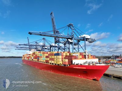
MSC UNITED VIII
Container Ship
Current Trip
| Time Travelled | 13 days |
|---|---|
| Remaining Time | --- |
| Distance Travelled | 824.75 nm |
| Remaining Distance | --- |
| AVG Speed | 9.6 Knop |
| MAX Speed | 14.8 Knop |
| AVG Wind | 14.1 knots |
| MAX Wind | 28.7 knots |
| MIN Temp | 8.5°C / 47.3°F |
| MAX Temp | 22.2°C / 71.96°F |
| Djupgående | 9.6 m |
| Position mottagen | 15 d sen |
Current Position
| Longitud | --- |
|---|---|
| Latitude | --- |
| Status | Under way using engine |
| Fart | 6.2 Knop |
| Kurs | 257° |
| Område | South China Sea |
| Station | T-AIS |
| Position mottagen | 15 d sen |
Info
Information
The current position of MSC UNITED VIII is in South China Sea with coordinates 20.63371° / 106.90556° as reported on 2024-11-29 23:41 by AIS to our vessel tracker app. The vessel's current speed is 6.2 Knop and is heading at the port of HAI PHONG.
The vessel MSC UNITED VIII (IMO: 9302619, MMSI: 636012807) is a Container Ship that was built in 2006 ( 18 År gammal ). It's sailing under the flag of [LR] Liberia.
In this page you can find informations about the vessels current position, last detected port calls, and current voyage information. If the vessels is not in coverage by AIS you will find the latest position.
The current position of MSC UNITED VIII is detected by our AIS receivers and we are not responsible for the reliability of the data. The last position was recorded while the vessel was in Coverage by the Ais receivers of our vessel tracking app.
The current draught of MSC UNITED VIII as reported by AIS is 9.6 meters
Weather
| Temperature | 8.6°C / 47.48°F |
|---|---|
| Wind Speed | 12 knots |
| Direction | 312° NW |
| Pressure | 1027.9 hPa |
| Humidity | 44.8 % |
| Cloud Coverage | --- |
Featured Company
Last Port Calls
| Port | Arrival | Departure | Time In Port |
|---|---|---|---|
| 2024-12-02 09:24 | 2024-12-02 18:36 | 9 h | |
| 2024-11-11 00:17 | 2024-11-12 03:45 | 1 d | |
| 2024-11-05 01:22 | 2024-11-06 00:26 | 23 h | |
| 2024-11-03 00:02 | 2024-11-03 20:50 | 20 h | |
| 2024-10-27 10:06 | 2024-10-28 02:36 | 16 h | |
| 2024-10-18 00:16 | 2024-10-18 16:26 | 16 h | |
| 2024-10-15 15:53 | 2024-10-16 06:45 | 14 h | |
| 2024-10-12 11:05 | 2024-10-13 22:08 | 1 d |
Most Visited Ports (Last year)
| Port | Arrivals | |
|---|---|---|
| 6 | ||
| 5 | ||
| 5 | ||
| 4 | ||
| 2 | ||
| 2 |
Last Trips
| Origin | Departure | Destination | Arrival | Distance | |
|---|---|---|---|---|---|
| 2024-11-12 03:45 | 2024-12-02 09:24 | 5763.24 nm | |||
| 2024-11-06 00:26 | 2024-11-11 00:17 | 1130.62 nm | |||
| 2024-11-03 20:50 | 2024-11-05 01:22 | 429.01 nm | |||
| 2024-10-28 02:36 | 2024-11-03 00:02 | 2489.15 nm | |||
| 2024-10-18 16:26 | 2024-10-27 10:06 | 2573.64 nm | |||
| 2024-10-16 06:45 | 2024-10-18 00:16 | 440.10 nm | |||
| 2024-10-13 22:08 | 2024-10-15 15:53 | 496.00 nm | |||
| 2024-09-23 23:07 | 2024-10-12 11:05 | 4589.67 nm |
Events
| Tid | Event | Detaljer | Position / Dest | Information |
|---|---|---|---|---|
| 2024-12-09 17:21 | STARTAR förflyttning | 11.44 nm, South West of JINHAI HEAVY INDUSTR |
30.16163 / 122.05806
HAI PHONG
|
Fart: 4.8 kn Kurs: 247° |
| 2024-12-06 07:47 | STOPPAR förflyttning | 10.99 nm, South West of JINHAI HEAVY INDUSTR |
30.16549 / 122.06552
HAI PHONG
|
Fart: 0.2 kn Kurs: 299° |
| 2024-12-05 18:39 | STARTAR förflyttning |
29.76183 / 123.19906
HAI PHONG
|
Fart: 4 kn Kurs: 338° |