
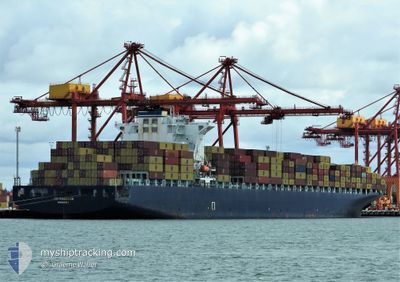
MSC TIANSHAN
Container Ship
Current Trip
| Time Travelled | 9 days |
|---|---|
| Remaining Time | --- |
| Distance Travelled | 4246.73 nm |
| Remaining Distance | --- |
| AVG Speed | 18.4 Knop |
| MAX Speed | 21.7 Knop |
| AVG Wind | 12.4 knots |
| MAX Wind | 20.3 knots |
| MIN Temp | -0.1°C / 31.82°F |
| MAX Temp | 27°C / 80.6°F |
| Djupgående | 10.2 m |
| Position mottagen | 9 d sen |
Current Position
| Longitud | --- |
|---|---|
| Latitude | --- |
| Status | Under way using engine |
| Fart | 19.2 Knop |
| Kurs | 183.2° |
| Område | North Atlantic Ocean |
| Station | T-AIS |
| Position mottagen | 9 d sen |
Info
Information
The current position of MSC TIANSHAN is in North Atlantic Ocean with coordinates 39.83773° / -73.85592° as reported on 2025-01-12 12:27 by AIS to our vessel tracker app. The vessel's current speed is 19.2 Knop and is heading at the port of SINGAPORE. The estimated time of arrival as calculated by MyShipTracking vessel tracking app is 2025-02-08 14:00 LT
The vessel MSC TIANSHAN (IMO: 9305477, MMSI: 636020501) is a Container Ship that was built in 2006 ( 19 År gammal ). It's sailing under the flag of [LR] Liberia.
In this page you can find informations about the vessels current position, last detected port calls, and current voyage information. If the vessels is not in coverage by AIS you will find the latest position.
The current position of MSC TIANSHAN is detected by our AIS receivers and we are not responsible for the reliability of the data. The last position was recorded while the vessel was in Coverage by the Ais receivers of our vessel tracking app.
The current draught of MSC TIANSHAN as reported by AIS is 10.2 meters
Weather
| Temperature | 26.9°C / 80.42°F |
|---|---|
| Wind Speed | 8 knots |
| Direction | 138° SE |
| Pressure | 1012 hPa |
| Humidity | 77 % |
| Cloud Coverage | 15 % |
Featured Company
Last Port Calls
| Port | Arrival | Departure | Time In Port |
|---|---|---|---|
| 2025-01-08 07:24 | 2025-01-12 08:29 | 4 d | |
| 2024-12-31 15:38 | 2025-01-03 11:48 | 2 d | |
| 2024-12-28 20:40 | 2024-12-30 16:13 | 1 d | |
| 2024-11-24 23:03 | 2024-11-26 10:57 | 1 d | |
| 2024-11-21 15:27 | 2024-11-22 09:55 | 18 h | |
| 2024-11-16 05:16 | 2024-11-17 04:44 | 23 h |
Last Trips
| Origin | Departure | Destination | Arrival | Distance | |
|---|---|---|---|---|---|
| 2025-01-03 06:48 | 2025-01-08 02:24 | 793.24 nm | |||
| 2024-12-30 11:13 | 2024-12-31 10:38 | 245.58 nm | |||
| 2024-11-26 19:57 | 2024-12-28 15:40 | 10845.92 nm | |||
| 2024-11-22 17:55 | 2024-11-25 08:03 | 524.51 nm | |||
| 2024-11-17 12:44 | 2024-11-21 23:27 | 821.60 nm | |||
| 2024-10-27 01:22 | 2024-11-16 13:16 | 8221.71 nm |
Events
| Tid | Event | Detaljer | Position / Dest | Information |
|---|---|---|---|---|
| 2025-01-12 12:34 | Status ändrad | Default Under way using engine |
39.80237 / -73.85834
SGSIN
|
Fart: 19.2 kn Kurs: 183.2° |
| 2025-01-12 12:27 | UTANFÖR täckningsområde |
39.83773 / -73.85592
North Atlantic Ocean
SGSIN
|
Fart: 19.2 kn Kurs: 183.2° |
|
| 2025-01-12 08:29 | AVGÅTT HAMN |
|
40.57748 / -74.03533
SGSIN
|
Fart: 17.1 kn Kurs: 168° |
| 2025-01-12 08:16 | Status ändrad | Under way using engine At anchor |
40.61768 / -74.05609
[US] NEW YORK
|
Fart: 4 kn Kurs: 144° |
| 2025-01-12 08:15 | STARTAR förflyttning |
40.61872 / -74.05686
[US] NEW YORK
|
Fart: 3.2 kn Kurs: 150° |
|
| 2025-01-12 06:55 | Djupgående ändrat | 10.2 10 |
40.61879 / -74.05305
[US] NEW YORK
|
Fart: 0.1 kn Kurs: 292° |
| 2025-01-12 06:55 | Destination ändrad | SGSIN USNYC |
40.61879 / -74.05305
[US] NEW YORK
|
Fart: 0.1 kn Kurs: 292° |
| 2025-01-12 06:55 | ETA ändrat | 2025/02/08 14:00 2025/02/07 23:00 |
40.61879 / -74.05305
[US] NEW YORK
|
Fart: 0.1 kn Kurs: 292° |