

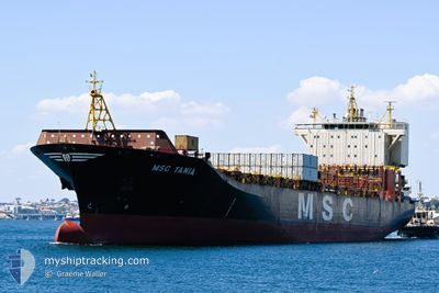
MSC TANIA
Container Ship

Current Trip
| Time Travelled | 4 days |
|---|---|
| Remaining Time | --- |
| Distance Travelled | 228.49 nm |
| Remaining Distance | --- |
| AVG Speed | 15.3 Knop |
| MAX Speed | 16.9 Knop |
| AVG Wind | 7 knots |
| MAX Wind | 16 knots |
| MIN Temp | 21.7°C / 71.06°F |
| MAX Temp | 23.5°C / 74.3°F |
| Djupgående | 9.2 m |
| Position mottagen | 3 d sen |
Current Position
| Longitud | --- |
|---|---|
| Latitude | --- |
| Status | Under way using engine |
| Fart | 16.6 Knop |
| Kurs | 172.5° |
| Område | Gulf of Oman |
| Station | T-AIS |
| Position mottagen | 3 d sen |
Information
The current position of MSC TANIA is in Gulf of Oman with coordinates 25.26964° / 56.68010° as reported on 2025-02-24 20:45 by AIS to our vessel tracker app. The vessel's current speed is 16.6 Knop and is heading at the port of COEGA. The estimated time of arrival as calculated by MyShipTracking vessel tracking app is 2025-03-12 12:00 LT
The vessel MSC TANIA (IMO: 9316373, MMSI: 636018603) is a Container Ship that was built in 2006 ( 19 År gammal ). It's sailing under the flag of [LR] Liberia.
In this page you can find informations about the vessels current position, last detected port calls, and current voyage information. If the vessels is not in coverage by AIS you will find the latest position.
The current position of MSC TANIA is detected by our AIS receivers and we are not responsible for the reliability of the data. The last position was recorded while the vessel was in Coverage by the Ais receivers of our vessel tracking app.
The current draught of MSC TANIA as reported by AIS is 9.2 meters
Weather
| Temperature | 24.4°C / 75.92°F |
|---|---|
| Wind Speed | 12 knots |
| Direction | 312° NW |
| Pressure | 1013.9 hPa |
| Humidity | 82.5 % |
| Cloud Coverage | 96 % |


Featured Company
Last Port Calls
| Port | Arrival | Departure | Time In Port |
|---|---|---|---|
| 2025-02-23 19:17 | 2025-02-24 05:59 | 10 h | |
| 2025-02-21 17:56 | 2025-02-22 11:42 | 17 h | |
| 2025-02-17 13:21 | 2025-02-19 10:05 | 1 d | |
| 2025-01-12 09:26 | 2025-01-14 13:46 | 2 d | |
| 2024-12-31 09:23 | 2025-01-01 19:20 | 1 d | |
| 2024-12-30 07:10 | 2024-12-31 08:27 | 1 d | |
| 2024-12-14 04:11 | 2024-12-15 02:37 | 22 h | |
| 2024-12-05 12:56 | 2024-12-05 22:21 | 9 h | |
| 2024-12-04 15:30 | 2024-12-05 07:31 | 16 h |
Last Trips
| Origin | Departure | Destination | Arrival | Distance | |
|---|---|---|---|---|---|
| 2025-02-22 15:42 | 2025-02-23 23:17 | 46.02 nm | |||
| 2025-02-19 13:05 | 2025-02-21 21:56 | 339.60 nm | |||
| 2025-01-15 00:46 | 2025-02-17 16:21 | 10710.78 nm | |||
| 2025-01-02 06:20 | 2025-01-12 20:26 | 1198.81 nm | |||
| 2024-12-31 19:27 | 2024-12-31 20:23 | 9.15 nm | |||
| 2024-12-15 10:37 | 2024-12-30 18:10 | 5193.39 nm | |||
| 2024-12-06 06:21 | 2024-12-14 12:11 | 958.52 nm | |||
| 2024-12-05 15:31 | 2024-12-05 20:56 | 57.70 nm | |||
| 2024-11-24 14:34 | 2024-12-04 23:30 | 4082.13 nm |
Events
| Tid | Event | Detaljer | Position / Dest | Information |
|---|---|---|---|---|
| 2025-02-24 20:46 | Status ändrad | Default Under way using engine |
25.26918 / 56.68017
COEGA
|
Fart: 16.6 kn Kurs: 172.5° |
| 2025-02-24 20:45 | UTANFÖR täckningsområde |
25.26964 / 56.68010
Gulf of Oman
COEGA
|
Fart: 16.6 kn Kurs: 172.5° |
|
| 2025-02-24 19:14 | Byter havsområde | United Arab Emirates part of the Gulf of Oman Omani part of the Gulf of Oman |
25.67790 / 56.65569
Gulf of Oman
COEGA
|
Fart: 16.2 kn Kurs: 187.8° |
| 2025-02-24 18:20 | Byter havsområde | Omani part of the Gulf of Oman Omani part of the Persian Gulf |
25.92350 / 56.66964
Gulf of Oman
COEGA
|
Fart: 16.8 kn Kurs: 171.8° |
| 2025-02-24 18:18 | Status ändrad | Under way using engine Default |
25.93087 / 56.66835
COEGA
|
Fart: 16.8 kn Kurs: 172° |
| 2025-02-24 18:09 | I täckningsområde |
25.92350 / 56.66964
Gulf of Oman
COEGA
|
Fart: 16.8 kn Kurs: 171.8° |
|
| 2025-02-24 13:22 | Status ändrad | Default Under way using engine |
26.18734 / 56.00294
COEGA
|
Fart: 16.3 kn Kurs: 63.9° |
| 2025-02-24 13:17 | UTANFÖR täckningsområde |
26.17749 / 55.98004
Persian Gulf
COEGA
|
Fart: 16.3 kn Kurs: 63.9° |
|
| 2025-02-24 13:09 | Byter havsområde | Omani part of the Persian Gulf United Arab Emirates part of the Persian Gulf |
26.16263 / 55.94620
Persian Gulf
COEGA
|
Fart: 16.6 kn Kurs: 63.7° |
| 2025-02-24 13:09 | Status ändrad | Under way using engine Default |
26.16136 / 55.94337
COEGA
|
Fart: 16.6 kn Kurs: 63° |