
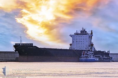
MSC RENAISSANCE III
Container Ship
Current Trip
| Time Travelled | 4 days |
|---|---|
| Remaining Time | 14 h, 28 mins |
| Distance Travelled | 1198.13 nm |
| Remaining Distance | 151.87 nm |
| AVG Speed | 12.2 Knop |
| MAX Speed | 15.4 Knop |
| AVG Wind | 11.4 knots |
| MAX Wind | 21.8 knots |
| MIN Temp | 15.4°C / 59.72°F |
| MAX Temp | 20.4°C / 68.72°F |
| Djupgående | 11.6 m |
| Position mottagen | 11 m sen |
Current Position
| Longitud | 6.08385° |
|---|---|
| Latitude | 41.02978° |
| Status | Under way using engine |
| Fart | 10.5 Knop |
| Kurs | 343° |
| Område | Mediterranean Sea - Western Basin |
| Station | T-AIS |
| Position mottagen | 11 m sen |
Info
Information
The current position of MSC RENAISSANCE III is in Mediterranean Sea - Western Basin with coordinates 41.02978° / 6.08385° as reported on 2024-05-06 10:06 by AIS to our vessel tracker app. The vessel's current speed is 10.5 Knop and is heading at the port of FOS. The estimated time of arrival as calculated by MyShipTracking vessel tracking app is 2024-05-07 00:46 LT
The vessel MSC RENAISSANCE III (IMO: 9358436, MMSI: 636017608) is a Container Ship that was built in 2006 ( 18 År gammal ). It's sailing under the flag of [LR] Liberia.
In this page you can find informations about the vessels current position, last detected port calls, and current voyage information. If the vessels is not in coverage by AIS you will find the latest position.
The current position of MSC RENAISSANCE III is detected by our AIS receivers and we are not responsible for the reliability of the data. The last position was recorded while the vessel was in Coverage by the Ais receivers of our vessel tracking app.
The current draught of MSC RENAISSANCE III as reported by AIS is 11.6 meters
Weather
| Temperature | 16.8°C / 62.24°F |
|---|---|
| Wind Speed | 11 knots |
| Direction | 201° SSW |
| Pressure | 1012 hPa |
| Humidity | 84.1 % |
| Cloud Coverage | 97 % |
Featured Company
Last Port Calls
| Port | Arrival | Departure | Time In Port |
|---|---|---|---|
| 2024-05-01 15:22 | 2024-05-02 10:05 | 18 h | |
| 2024-04-29 19:56 | 2024-04-30 07:09 | 11 h | |
| 2024-04-29 05:26 | 2024-04-29 13:34 | 8 h | |
| 2024-04-28 04:21 | 2024-04-28 20:15 | 15 h | |
| 2024-04-24 22:43 | 2024-04-26 03:45 | 1 d | |
| 2024-04-22 19:14 | 2024-04-23 07:00 | 11 h | |
| 2024-04-19 02:04 | 2024-04-20 04:24 | 1 d | |
| 2024-04-12 18:54 | 2024-04-17 12:30 | 4 d | |
| 2024-04-09 03:04 | 2024-04-10 02:44 | 23 h | |
| 2024-04-05 12:29 | 2024-04-07 03:15 | 1 d |
Most Visited Ports (Last year)
| Port | Arrivals | |
|---|---|---|
| 24 | ||
| 7 | ||
| 7 | ||
| 7 | ||
| 7 | ||
| 7 |
Last Trips
| Origin | Departure | Destination | Arrival | Distance | |
|---|---|---|---|---|---|
| 2024-04-30 10:09 | 2024-05-01 18:22 | 308.37 nm | |||
| 2024-04-29 16:34 | 2024-04-29 22:56 | 65.31 nm | |||
| 2024-04-28 23:15 | 2024-04-29 08:26 | 84.28 nm | |||
| 2024-04-26 06:45 | 2024-04-28 07:21 | 363.33 nm | |||
| 2024-04-23 09:00 | 2024-04-25 01:43 | 538.70 nm | |||
| 2024-04-20 06:24 | 2024-04-22 21:14 | 780.59 nm | |||
| 2024-04-17 14:30 | 2024-04-19 04:04 | 564.73 nm | |||
| 2024-04-10 04:44 | 2024-04-12 20:54 | 266.82 nm | |||
| 2024-04-07 05:15 | 2024-04-09 05:04 | 417.41 nm | |||
| 2024-03-31 18:23 | 2024-04-05 14:29 | 18.22 nm |
Events
| Tid | Event | Detaljer | Position / Dest | Information |
|---|---|---|---|---|
| 2024-05-06 10:11 | Status ändrad | Default Under way using engine |
41.04235 / 6.07888
FRFOS
|
Fart: 10.5 kn Kurs: 343° |
| 2024-05-06 07:10 | Status ändrad | Under way using engine Default |
40.55950 / 6.31567
FRFOS
|
Fart: 10.1 kn Kurs: 342° |
| 2024-05-06 07:10 | I täckningsområde |
40.56206 / 6.31435
Mediterranean Sea - Western Basin
FRFOS
|
Fart: 9.8 kn Kurs: 337.9° |
|
| 2024-05-05 16:24 | Status ändrad | Default Under way using engine |
38.24370 / 8.53687
FRFOS
|
Fart: 12.8 kn Kurs: 298° |
| 2024-05-05 16:19 | Status ändrad | Under way using engine Default |
38.23500 / 8.55705
FRFOS
|
Fart: 12.8 kn Kurs: 298° |
| 2024-05-05 16:19 | UTANFÖR täckningsområde |
38.23500 / 8.55705
Mediterranean Sea - Western Basin
FRFOS
|
Fart: 12.8 kn Kurs: 298° |
|
| 2024-05-05 16:04 | Status ändrad | Default Under way using engine |
38.20982 / 8.61535
FRFOS
|
Fart: 12.8 kn Kurs: 298° |
| 2024-05-05 15:59 | Byter havsområde | Italian part of the Mediterranean Sea - Western Basin Tunisian part of the Mediterranean Sea - Western Basin |
38.20067 / 8.63635
Mediterranean Sea - Western Basin
FRFOS
|
Fart: 12.8 kn Kurs: 298° |
| 2024-05-05 15:59 | Status ändrad | Under way using engine Default |
38.20067 / 8.63635
FRFOS
|
Fart: 12.8 kn Kurs: 299° |
| 2024-05-05 15:37 | Status ändrad | Default Under way using engine |
38.16089 / 8.72398
FRFOS
|
Fart: 12.9 kn Kurs: 300° |