
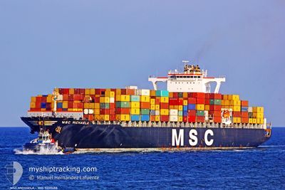
MSC MICHAELA
Container Ship
Current Trip
| Time Travelled | 4 days |
|---|---|
| Remaining Time | --- |
| Distance Travelled | 883.31 nm |
| Remaining Distance | --- |
| AVG Speed | 15.6 Knop |
| MAX Speed | 18.4 Knop |
| AVG Wind | 10.5 knots |
| MAX Wind | 21 knots |
| MIN Temp | 28°C / 82.4°F |
| MAX Temp | 33.8°C / 92.84°F |
| Djupgående | 14.4 m |
| Position mottagen | 3 d sen |
Current Position
| Longitud | 56.75303° |
|---|---|
| Latitude | 24.69363° |
| Status | Under way using engine |
| Fart | 17.5 Knop |
| Kurs | 171.5° |
| Område | Gulf of Oman |
| Station | T-AIS |
| Position mottagen | 3 d sen |
Info
Information
The current position of MSC MICHAELA is in Gulf of Oman with coordinates 24.69363° / 56.75303° as reported on 2024-06-03 00:47 by AIS to our vessel tracker app. The vessel's current speed is 17.5 Knop
The vessel MSC MICHAELA (IMO: 9230488, MMSI: 353666000) is a Container Ship that was built in 2002 ( 22 År gammal ). It's sailing under the flag of [PA] Panama.
In this page you can find informations about the vessels current position, last detected port calls, and current voyage information. If the vessels is not in coverage by AIS you will find the latest position.
The current position of MSC MICHAELA is detected by our AIS receivers and we are not responsible for the reliability of the data. The last position was recorded while the vessel was in Coverage by the Ais receivers of our vessel tracking app.
The current draught of MSC MICHAELA as reported by AIS is 14.4 meters
Weather
| Temperature | 28.9°C / 84.02°F |
|---|---|
| Wind Speed | 15 knots |
| Direction | 238° WSW |
| Pressure | 1004.9 hPa |
| Humidity | 86.6 % |
| Cloud Coverage | --- |
Featured Company
Last Trips
| Origin | Departure | Destination | Arrival | Distance | |
|---|---|---|---|---|---|
| 2024-05-20 04:47 | 2024-06-01 03:35 | 4225.48 nm | |||
| 2024-05-08 09:47 | 2024-05-14 10:07 | 894.53 nm | |||
| 2024-04-23 05:35 | 2024-05-04 15:19 | 1924.07 nm | |||
| 2024-04-09 19:09 | 2024-04-20 17:15 | 3359.94 nm | |||
| 2024-03-29 02:39 | 2024-04-08 14:49 | 2498.03 nm |
Events
| Tid | Event | Detaljer | Position / Dest | Information |
|---|---|---|---|---|
| 2024-06-04 16:55 | STOPPAR förflyttning |
22.91500 / 67.21333
INMUN
|
Fart: Kurs: -1° |
|
| 2024-06-03 00:49 | Status ändrad | Default Under way using engine |
24.68197 / 56.75497
INMUN
|
Fart: 17.5 kn Kurs: 171.5° |
| 2024-06-03 00:47 | UTANFÖR täckningsområde |
24.69363 / 56.75303
Gulf of Oman
INMUN
|
Fart: 17.5 kn Kurs: 171.5° |
|
| 2024-06-02 23:38 | Byter havsområde | Omani part of the Gulf of Oman United Arab Emirates part of the Gulf of Oman |
25.02668 / 56.69881
Gulf of Oman
INMUN
|
Fart: 17.1 kn Kurs: 170.8° |
| 2024-06-02 21:22 | Byter havsområde | United Arab Emirates part of the Gulf of Oman Omani part of the Gulf of Oman |
25.67085 / 56.60292
Gulf of Oman
INMUN
|
Fart: 17.4 kn Kurs: 179.9° |
| 2024-06-02 20:28 | Byter havsområde | Omani part of the Gulf of Oman Omani part of the Persian Gulf |
25.93380 / 56.60114
Gulf of Oman
INMUN
|
Fart: 17.4 kn Kurs: 179° |
| 2024-06-02 20:26 | Status ändrad | Under way using engine Default |
25.94408 / 56.60102
INMUN
|
Fart: 17.4 kn Kurs: 180° |
| 2024-06-02 20:14 | I täckningsområde |
25.93380 / 56.60114
Gulf of Oman
INMUN
|
Fart: 17.4 kn Kurs: 179° |
|
| 2024-06-02 18:13 | Status ändrad | Default Under way using engine |
26.53982 / 56.48072
INMUN
|
Fart: 17.2 kn Kurs: 65.8° |
| 2024-06-02 18:08 | UTANFÖR täckningsområde |
26.53023 / 56.45424
Persian Gulf
INMUN
|
Fart: 17.2 kn Kurs: 65.8° |