
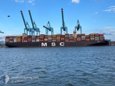
MSC LORENZA
Cargo A
Current Trip
SANTOS
| Time Travelled | 9 days |
|---|---|
| Remaining Time | --- |
| Distance Travelled | 3069.53 nm |
| Remaining Distance | --- |
| AVG Speed | 17.5 Knop |
| MAX Speed | 19.5 Knop |
| AVG Wind | 9.6 knots |
| MAX Wind | 18 knots |
| MIN Temp | 21°C / 69.8°F |
| MAX Temp | 27.4°C / 81.32°F |
| Djupgående | 11.8 m |
| Position mottagen | 10 d sen |
Current Position
| Longitud | --- |
|---|---|
| Latitude | --- |
| Status | Under way using engine |
| Fart | 17.6 Knop |
| Kurs | 260° |
| Område | South Atlantic Ocean |
| Station | T-AIS |
| Position mottagen | 10 d sen |
Info
Information
The current position of MSC LORENZA is in South Atlantic Ocean with coordinates -24.29226° / -44.69871° as reported on 2025-12-26 19:03 by AIS to our vessel tracker app. The vessel's current speed is 17.6 Knop
The vessel MSC LORENZA (IMO: 9962598, MMSI: 636023379) is a Cargo A It's sailing under the flag of [LR] Liberia.
In this page you can find informations about the vessels current position, last detected port calls, and current voyage information. If the vessels is not in coverage by AIS you will find the latest position.
The current position of MSC LORENZA is detected by our AIS receivers and we are not responsible for the reliability of the data. The last position was recorded while the vessel was in Coverage by the Ais receivers of our vessel tracking app.
The current draught of MSC LORENZA as reported by AIS is 11.8 meters
Weather
| Temperature | 21°C / 69.8°F |
|---|---|
| Wind Speed | 13 knots |
| Direction | 216° SW |
| Pressure | 1014 hPa |
| Humidity | 89.5 % |
| Cloud Coverage | 100 % |
Featured Company
Last Port Calls
| Port | Arrival | Departure | Time In Port |
|---|---|---|---|
| 2025-12-27 16:33 | 2025-12-27 17:53 | 1 h | |
| 2025-12-23 12:47 | 2025-12-24 14:43 | 1 d | |
| 2025-12-18 08:43 | 2025-12-21 13:26 | 3 d | |
| 2025-12-14 16:57 | 2025-12-16 05:19 | 1 d | |
| 2025-11-29 16:01 | 2025-12-02 05:56 | 2 d | |
| 2025-11-25 18:02 | 2025-11-26 21:59 | 1 d | |
| 2025-11-18 09:15 | 2025-11-19 05:55 | 20 h | |
| 2025-11-16 06:22 | 2025-11-17 09:10 | 1 d |
Most Visited Ports (Last year)
| Port | Arrivals | |
|---|---|---|
| 6 | ||
| 5 | ||
| 3 | ||
| 1 | ||
| 1 | ||
| 1 |
Last Trips
| Origin | Departure | Destination | Arrival | Distance | |
|---|---|---|---|---|---|
| 2025-12-24 14:43 | 2025-12-27 16:33 | 1038.51 nm | |||
| 2025-12-21 13:26 | 2025-12-23 12:47 | 408.20 nm | |||
| 2025-12-16 05:19 | 2025-12-18 08:43 | 476.51 nm | |||
| 2025-12-02 05:56 | 2025-12-14 16:57 | 2297.22 nm | |||
| 2025-11-26 21:59 | 2025-11-29 16:01 | 821.23 nm | |||
| 2025-11-19 05:55 | 2025-11-25 18:02 | 1829.04 nm | |||
| 2025-11-17 09:10 | 2025-11-18 09:15 | 180.39 nm | |||
| 2025-10-30 23:00 | 2025-11-16 06:22 | 7194.49 nm |
Events
| Tid | Event | Detaljer | Position / Dest | Information |
|---|---|---|---|---|
| 2025-12-29 19:13 | STARTAR förflyttning | 3.11 nm, North of SANTOS |
-23.91925 / -46.34510
SANTOS
|
Fart: 5.3 kn Kurs: 105° |
| 2025-12-27 21:17 | STOPPAR förflyttning | 3.25 nm, North West of SANTOS |
-23.92044 / -46.35355
SANTOS
|
Fart: Kurs: 99° |
| 2025-12-27 20:53 | AVGÅTT HAMN |
|
-23.91925 / -46.34392
SANTOS
|
Fart: 5.9 kn Kurs: 283° |
| 2025-12-27 19:33 | ANLÄNDER HAMN |
|
-23.99497 / -46.32856
[BR] SANTOS
|
Fart: 8.8 kn Kurs: 27° |
| 2025-12-27 17:37 | STARTAR förflyttning | 17.99 nm, South of SANTOS |
-24.25104 / -46.43261
SANTOS
|
Fart: 4 kn Kurs: 214° |
| 2025-12-27 13:17 | STOPPAR förflyttning | 19.51 nm, South of SANTOS |
-24.27945 / -46.42693
SANTOS
|
Fart: 0.3 kn Kurs: 28° |
| 2025-12-27 11:09 | STARTAR förflyttning |
-24.35975 / -46.42843
SANTOS
|
Fart: 4.1 kn Kurs: 174° |
|
| 2025-12-27 01:34 | STOPPAR förflyttning |
-24.36967 / -46.44379
SANTOS
|
Fart: 0.3 kn Kurs: 307° |