

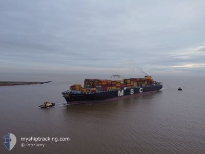
MSC LIVORNO
Container Ship

Current Trip
| Time Travelled | 14 days |
|---|---|
| Remaining Time | --- |
| Distance Travelled | 6574.83 nm |
| Remaining Distance | 307.71 nm |
| AVG Speed | 18.4 Knop |
| MAX Speed | 22.5 Knop |
| AVG Wind | 11.3 knots |
| MAX Wind | 33 knots |
| MIN Temp | 1.9°C / 35.42°F |
| MAX Temp | 22.8°C / 73.04°F |
| Djupgående | 10.4 m |
| Position mottagen | 1 d sen |
Current Position
| Longitud | --- |
|---|---|
| Latitude | --- |
| Status | Under way using engine |
| Fart | 16.6 Knop |
| Kurs | 278.6° |
| Område | Philippine Sea |
| Station | T-AIS |
| Position mottagen | 1 d sen |
Information
The current position of MSC LIVORNO is in Philippine Sea with coordinates 30.89409° / 131.38333° as reported on 2025-03-27 14:34 by AIS to our vessel tracker app. The vessel's current speed is 16.6 Knop and is heading at the port of SHANGHAI. The estimated time of arrival as calculated by MyShipTracking vessel tracking app is 2025-03-27 18:00 LT
The vessel MSC LIVORNO (IMO: 9461427, MMSI: 218441000) is a Container Ship that was built in 2010 ( 15 År gammal ). It's sailing under the flag of [DE] Germany.
In this page you can find informations about the vessels current position, last detected port calls, and current voyage information. If the vessels is not in coverage by AIS you will find the latest position.
The current position of MSC LIVORNO is detected by our AIS receivers and we are not responsible for the reliability of the data. The last position was recorded while the vessel was in Coverage by the Ais receivers of our vessel tracking app.
The current draught of MSC LIVORNO as reported by AIS is 10.4 meters
Weather
| Temperature | 3.2°C / 37.76°F |
|---|---|
| Wind Speed | 16 knots |
| Direction | 287° WNW |
| Pressure | 1025.6 hPa |
| Humidity | 44.3 % |
| Cloud Coverage | --- |


Featured Company
Last Port Calls
| Port | Arrival | Departure | Time In Port |
|---|---|---|---|
| 2025-03-12 20:44 | 2025-03-14 20:29 | 1 d | |
| 2025-03-04 06:54 | 2025-03-10 19:38 | 6 d | |
| 2025-02-16 14:02 | 2025-02-17 17:22 | 1 d | |
| 2025-02-03 08:09 | 2025-02-05 03:53 | 1 d | |
| 2025-01-30 03:14 | 2025-02-01 04:51 | 2 d | |
| 2025-01-25 09:35 | 2025-01-26 08:47 | 23 h | |
| 2025-01-22 17:16 | 2025-01-23 22:55 | 1 d | |
| 2025-01-17 04:59 | 2025-01-19 02:45 | 1 d |
Last Trips
| Origin | Departure | Destination | Arrival | Distance | |
|---|---|---|---|---|---|
| 2025-03-10 19:38 | 2025-03-12 20:44 | 449.09 nm | |||
| 2025-02-17 17:22 | 2025-03-04 06:54 | 6298.61 nm | |||
| 2025-02-05 03:53 | 2025-02-16 14:02 | 2793.72 nm | |||
| 2025-02-01 04:51 | 2025-02-03 08:09 | 829.29 nm | |||
| 2025-01-26 08:47 | 2025-01-30 03:14 | 1616.06 nm | |||
| 2025-01-23 22:55 | 2025-01-25 09:35 | 16.64 nm | |||
| 2025-01-19 02:45 | 2025-01-22 17:16 | 1254.54 nm | |||
| 2024-12-22 02:34 | 2025-01-17 04:59 | 11041.54 nm |
Events
| Tid | Event | Detaljer | Position / Dest | Information |
|---|---|---|---|---|
| 2025-03-27 14:42 | Status ändrad | Default Under way using engine |
30.89908 / 131.34251
USOAK>CNSHA
|
Fart: 16.6 kn Kurs: 278.6° |
| 2025-03-27 14:34 | UTANFÖR täckningsområde |
30.89409 / 131.38333
Philippine Sea
|
Fart: 16.6 kn Kurs: 278.6° |
|
| 2025-03-27 14:30 | Status ändrad | Under way using engine Default |
30.89130 / 131.40407
USOAK>CNSHA
|
Fart: 16.9 kn Kurs: 276° |
| 2025-03-27 14:26 | Status ändrad | Default Under way using engine |
30.88870 / 131.42664
USOAK>CNSHA
|
Fart: 16.5 kn Kurs: 275.5° |
| 2025-03-27 14:20 | Byter havsområde | Japanese part of the Philippine Sea United States part of the North Pacific Ocean |
30.88579 / 131.45878
Philippine Sea
USOAK>CNSHA
|
Fart: 16.5 kn Kurs: 275.5° |
| 2025-03-27 14:20 | Status ändrad | Under way using engine Default |
30.88579 / 131.45878
USOAK>CNSHA
|
Fart: 16.4 kn Kurs: 275° |
| 2025-03-27 14:06 | I täckningsområde |
30.88579 / 131.45878
Philippine Sea
USOAK>CNSHA
|
Fart: 16.5 kn Kurs: 275.5° |