
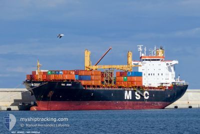
MSC JENNY II
Container Ship
Current Trip
| Time Travelled | 6 h, 55 mins |
|---|---|
| Remaining Time | 2 days |
| Distance Travelled | 83.33 nm |
| Remaining Distance | 646.36 nm |
| AVG Speed | 14.1 Knop |
| MAX Speed | 17.6 Knop |
| AVG Wind | 6.2 knots |
| MAX Wind | 10.9 knots |
| MIN Temp | 18.7°C / 65.66°F |
| MAX Temp | 22.8°C / 73.04°F |
| Djupgående | 10.9 m |
| Position mottagen | 1 h, 1 m sen |
Current Position
| Longitud | 16.20345° |
|---|---|
| Latitude | 37.65450° |
| Status | Moored |
| Fart | 2.3 Knop |
| Kurs | 143° |
| Område | Ionian Sea |
| Station | T-AIS |
| Position mottagen | 1 h, 1 m sen |
Info
Information
The current position of MSC JENNY II is in Ionian Sea with coordinates 37.65450° / 16.20345° as reported on 2024-06-04 13:25 by AIS to our vessel tracker app. The vessel's current speed is 2.3 Knop and is heading at the port of THESSALONIKI. The estimated time of arrival as calculated by MyShipTracking vessel tracking app is 2024-06-06 19:49 LT
The vessel MSC JENNY II (IMO: 9000742, MMSI: 255805777) is a Container Ship that was built in 1995 ( 29 År gammal ). It's sailing under the flag of [PT] Portugal.
In this page you can find informations about the vessels current position, last detected port calls, and current voyage information. If the vessels is not in coverage by AIS you will find the latest position.
The current position of MSC JENNY II is detected by our AIS receivers and we are not responsible for the reliability of the data. The last position was recorded while the vessel was in Coverage by the Ais receivers of our vessel tracking app.
The current draught of MSC JENNY II as reported by AIS is 10.9 meters
Weather
| Temperature | 22.1°C / 71.78°F |
|---|---|
| Wind Speed | 7 knots |
| Direction | 44° NE |
| Pressure | 1013.4 hPa |
| Humidity | 77.5 % |
| Cloud Coverage | 100 % |
Featured Company
Last Port Calls
| Port | Arrival | Departure | Time In Port |
|---|---|---|---|
| 2024-06-02 17:22 | 2024-06-04 09:32 | 1 d | |
| 2024-05-27 07:21 | 2024-05-29 20:15 | 2 d | |
| 2024-05-25 18:09 | 2024-05-26 03:56 | 9 h | |
| 2024-05-23 20:48 | 2024-05-24 17:25 | 20 h | |
| 2024-05-23 09:14 | 2024-05-23 19:41 | 10 h | |
| 2024-05-18 09:36 | 2024-05-19 01:06 | 15 h | |
| 2024-05-16 08:38 | 2024-05-17 20:32 | 1 d | |
| 2024-05-08 20:45 | 2024-05-12 04:15 | 3 d | |
| 2024-05-04 15:36 | 2024-05-04 23:19 | 7 h | |
| 2024-05-03 11:36 | 2024-05-03 23:36 | 12 h |
Most Visited Ports (Last year)
| Port | Arrivals | |
|---|---|---|
| 16 | ||
| 14 | ||
| 10 | ||
| 7 | ||
| 6 | ||
| 6 |
Last Trips
| Origin | Departure | Destination | Arrival | Distance | |
|---|---|---|---|---|---|
| 2024-05-29 20:15 | 2024-06-02 17:22 | 697.12 nm | |||
| 2024-05-26 03:56 | 2024-05-27 07:21 | 96.87 nm | |||
| 2024-05-24 17:25 | 2024-05-25 18:09 | 116.05 nm | |||
| 2024-05-23 19:41 | 2024-05-23 20:48 | 10.96 nm | |||
| 2024-05-19 01:06 | 2024-05-23 09:14 | 1128.89 nm | |||
| 2024-05-17 20:32 | 2024-05-18 09:36 | 15.12 nm | |||
| 2024-05-12 04:15 | 2024-05-16 08:38 | 569.56 nm | |||
| 2024-05-04 23:19 | 2024-05-08 20:45 | 568.52 nm | |||
| 2024-05-03 23:36 | 2024-05-04 15:36 | 82.21 nm | |||
| 2024-05-03 01:24 | 2024-05-03 11:36 | 111.79 nm |
Events
| Tid | Event | Detaljer | Position / Dest | Information |
|---|---|---|---|---|
| 2024-06-04 13:28 | Status ändrad | Default Moored |
37.65287 / 16.20449
THESSALONIKI
|
Fart: 2.3 kn Kurs: 143° |
| 2024-06-04 13:28 | STARTAR förflyttning |
37.65287 / 16.20449
THESSALONIKI
|
Fart: 3.8 kn Kurs: 128° |
|
| 2024-06-04 13:25 | Status ändrad | Moored Default |
37.65450 / 16.20345
THESSALONIKI
|
Fart: 0.3 kn Kurs: 165° |
| 2024-06-04 13:07 | STOPPAR förflyttning |
37.65667 / 16.20500
THESSALONIKI
|
Fart: Kurs: -1° |
|
| 2024-06-04 12:51 | Status ändrad | Default Moored |
37.65986 / 16.20019
THESSALONIKI
|
Fart: 4.4 kn Kurs: 148.8° |
| 2024-06-04 12:38 | Status ändrad | Moored Default |
37.67304 / 16.18476
THESSALONIKI
|
Fart: 13.1 kn Kurs: 106° |
| 2024-06-04 12:16 | Status ändrad | Default Moored |
37.69586 / 16.08369
THESSALONIKI
|
Fart: 13.5 kn Kurs: 106.1° |
| 2024-06-04 12:13 | Status ändrad | Moored Default |
37.69902 / 16.07002
THESSALONIKI
|
Fart: 13.4 kn Kurs: 106° |
| 2024-06-04 11:57 | Status ändrad | Default Moored |
37.71648 / 15.99868
THESSALONIKI
|
Fart: 13.2 kn Kurs: 109.8° |
| 2024-06-04 08:37 | Byter havsområde | Italian part of the Ionian Sea Italian part of the Tyrrhenian Sea |
38.25251 / 15.64434
Ionian Sea
THESSALONIKI
|
Fart: 16.2 kn Kurs: 240.8° |