
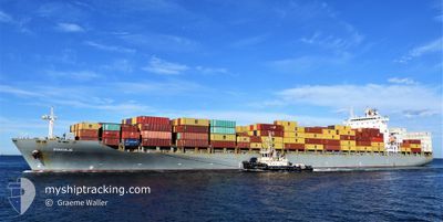
MSC DURBAN IV
Container Ship
Current Trip
| Time Travelled | 3 days |
|---|---|
| Remaining Time | --- |
| Distance Travelled | 1270.87 nm |
| Remaining Distance | --- |
| AVG Speed | 13.2 Knop |
| MAX Speed | 16.9 Knop |
| AVG Wind | 7 knots |
| MAX Wind | 15 knots |
| MIN Temp | 27.5°C / 81.5°F |
| MAX Temp | 30.9°C / 87.62°F |
| Djupgående | 11.3 m |
| Position mottagen | 3 d sen |
Current Position
| Longitud | 104.42897° |
|---|---|
| Latitude | 1.36747° |
| Status | Under way using engine |
| Fart | 14.4 Knop |
| Kurs | 51.6° |
| Område | South China Sea |
| Station | T-AIS |
| Position mottagen | 3 d sen |
Info
Information
The current position of MSC DURBAN IV is in South China Sea with coordinates 1.36747° / 104.42897° as reported on 2024-05-07 22:35 by AIS to our vessel tracker app. The vessel's current speed is 14.4 Knop and is heading at the port of MANILA. The estimated time of arrival as calculated by MyShipTracking vessel tracking app is 2024-05-12 16:00 LT
The vessel MSC DURBAN IV (IMO: 9294824, MMSI: 636015181) is a Container Ship that was built in 2006 ( 18 År gammal ). It's sailing under the flag of [LR] Liberia.
In this page you can find informations about the vessels current position, last detected port calls, and current voyage information. If the vessels is not in coverage by AIS you will find the latest position.
The current position of MSC DURBAN IV is detected by our AIS receivers and we are not responsible for the reliability of the data. The last position was recorded while the vessel was in Coverage by the Ais receivers of our vessel tracking app.
The current draught of MSC DURBAN IV as reported by AIS is 11.3 meters
Weather
| Temperature | 30°C / 86°F |
|---|---|
| Wind Speed | 9 knots |
| Direction | 60° ENE |
| Pressure | 1011.5 hPa |
| Humidity | 71.5 % |
| Cloud Coverage | 37 % |
Featured Company
Last Port Calls
| Port | Arrival | Departure | Time In Port |
|---|---|---|---|
| 2024-05-06 02:23 | 2024-05-07 19:08 | 1 d | |
| 2024-05-04 15:54 | 2024-05-05 12:57 | 21 h | |
| 2024-04-30 00:04 | 2024-04-30 15:34 | 15 h | |
| 2024-04-20 12:39 | 2024-04-21 01:35 | 12 h | |
| 2024-04-17 12:54 | 2024-04-18 06:34 | 17 h | |
| 2024-04-17 03:27 | 2024-04-17 12:11 | 8 h | |
| 2024-04-15 22:15 | 2024-04-16 10:37 | 12 h | |
| 2024-04-15 09:06 | 2024-04-15 20:39 | 11 h | |
| 2024-04-11 19:16 | 2024-04-12 14:21 | 19 h | |
| 2024-04-09 06:08 | 2024-04-09 09:56 | 3 h |
Most Visited Ports (Last year)
| Port | Arrivals | |
|---|---|---|
| 13 | ||
| 12 | ||
| 6 | ||
| 6 | ||
| 6 | ||
| 6 |
Last Trips
| Origin | Departure | Destination | Arrival | Distance | |
|---|---|---|---|---|---|
| 2024-05-05 20:57 | 2024-05-06 10:23 | 12.40 nm | |||
| 2024-04-30 23:34 | 2024-05-04 23:54 | 177.58 nm | |||
| 2024-04-21 10:35 | 2024-04-30 08:04 | 2643.91 nm | |||
| 2024-04-18 15:34 | 2024-04-20 21:39 | 506.44 nm | |||
| 2024-04-17 21:11 | 2024-04-17 21:54 | 7.78 nm | |||
| 2024-04-16 19:37 | 2024-04-17 12:27 | 205.81 nm | |||
| 2024-04-16 05:39 | 2024-04-16 07:15 | 14.54 nm | |||
| 2024-04-12 23:21 | 2024-04-15 18:06 | 695.87 nm | |||
| 2024-04-09 17:56 | 2024-04-12 04:16 | 493.58 nm | |||
| 2024-04-05 05:54 | 2024-04-09 14:08 | 671.74 nm |
Events
| Tid | Event | Detaljer | Position / Dest | Information |
|---|---|---|---|---|
| 2024-05-07 22:40 | Status ändrad | Default Under way using engine |
1.37803 / 104.44701
PHMNL
|
Fart: 14.4 kn Kurs: 51.6° |
| 2024-05-07 22:35 | UTANFÖR täckningsområde |
1.36747 / 104.42897
South China Sea
PHMNL
|
Fart: 14.4 kn Kurs: 51.6° |
|
| 2024-05-07 22:19 | Byter havsområde | Malaysian part of the South China Sea Malaysian part of the Singapore Strait |
1.32908 / 104.38074
South China Sea
PHMNL
|
Fart: 13.5 kn Kurs: 51.7° |
| 2024-05-07 22:17 | Status ändrad | Under way using engine Default |
1.32365 / 104.37383
PHMNL
|
Fart: 13.3 kn Kurs: 39° |
| 2024-05-07 22:12 | Status ändrad | Default Under way using engine |
1.31178 / 104.36266
PHMNL
|
Fart: 13.6 kn Kurs: 48.5° |
| 2024-05-07 21:58 | Status ändrad | Under way using engine Default |
1.27990 / 104.31780
PHMNL
|
Fart: 13.9 kn Kurs: 81° |
| 2024-05-07 21:40 | Status ändrad | Default Under way using engine |
1.27112 / 104.24997
PHMNL
|
Fart: 14.3 kn Kurs: 86.6° |
| 2024-05-07 21:10 | Byter havsområde | Malaysian part of the Singapore Strait Indonesian part of the Singapore Strait |
1.26375 / 104.13199
Singapore Strait
PHMNL
|
Fart: 13.9 kn Kurs: 84.6° |
| 2024-05-07 19:53 | Byter havsområde | Indonesian part of the Singapore Strait Singaporean part of the Singapore Strait |
1.18331 / 103.83851
Singapore Strait
PHMNL
|
Fart: 12.9 kn Kurs: 98.2° |
| 2024-05-07 19:08 | AVGÅTT HAMN |
|
1.26623 / 103.76450
PHMNL
|
Fart: 8.7 kn Kurs: 150° |