
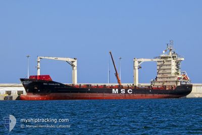
MSC CHARLOTTE
General Cargo
Current Trip
| Time Travelled | 1 day |
|---|---|
| Remaining Time | 16 h, 53 mins |
| Distance Travelled | 455.97 nm |
| Remaining Distance | 217.89 nm |
| AVG Speed | 12.8 Knop |
| MAX Speed | 13.5 Knop |
| AVG Wind | 10.8 knots |
| MAX Wind | 21 knots |
| MIN Temp | 13.7°C / 56.66°F |
| MAX Temp | 17.1°C / 62.78°F |
| Djupgående | 7.4 m |
| Position mottagen | 1 m sen |
Current Position
| Longitud | --- |
|---|---|
| Latitude | --- |
| Status | Under way using engine |
| Fart | 13.2 Knop |
| Kurs | 313.1° |
| Område | Aegean Sea |
| Station | T-AIS |
| Position mottagen | 1 m sen |
Info
Information
The current position of MSC CHARLOTTE is in Aegean Sea with coordinates 37.77148° / 25.48823° as reported on 2024-11-27 21:12 by AIS to our vessel tracker app. The vessel's current speed is 13.2 Knop and is heading at the port of THESSALONIKI. The estimated time of arrival as calculated by MyShipTracking vessel tracking app is 2024-11-28 14:07 LT
The vessel MSC CHARLOTTE (IMO: 9330238, MMSI: 636020574) is a General Cargo that was built in 2007 ( 17 År gammal ). It's sailing under the flag of [LR] Liberia.
In this page you can find informations about the vessels current position, last detected port calls, and current voyage information. If the vessels is not in coverage by AIS you will find the latest position.
The current position of MSC CHARLOTTE is detected by our AIS receivers and we are not responsible for the reliability of the data. The last position was recorded while the vessel was in Coverage by the Ais receivers of our vessel tracking app.
The current draught of MSC CHARLOTTE as reported by AIS is 7.4 meters
Weather
| Temperature | 15.3°C / 59.54°F |
|---|---|
| Wind Speed | 8 knots |
| Direction | 358° N |
| Pressure | 1025.3 hPa |
| Humidity | 68.3 % |
| Cloud Coverage | --- |
Featured Company
Last Port Calls
| Port | Arrival | Departure | Time In Port |
|---|---|---|---|
| 2024-11-23 13:51 | 2024-11-26 08:37 | 2 d | |
| 2024-11-22 12:33 | 2024-11-22 22:36 | 10 h | |
| 2024-11-20 14:23 | 2024-11-21 06:42 | 16 h | |
| 2024-11-17 15:17 | 2024-11-18 21:25 | 1 d | |
| 2024-11-15 06:21 | 2024-11-16 16:16 | 1 d | |
| 2024-11-12 09:52 | 2024-11-13 01:06 | 15 h | |
| 2024-11-10 15:45 | 2024-11-11 04:33 | 12 h | |
| 2024-11-08 09:27 | 2024-11-09 15:03 | 1 d | |
| 2024-11-06 14:26 | 2024-11-07 12:27 | 22 h | |
| 2024-11-03 18:29 | 2024-11-04 11:37 | 17 h |
Last Trips
| Origin | Departure | Destination | Arrival | Distance | |
|---|---|---|---|---|---|
| 2024-11-23 00:36 | 2024-11-23 15:51 | 54.39 nm | |||
| 2024-11-21 08:42 | 2024-11-22 14:33 | 339.33 nm | |||
| 2024-11-18 23:25 | 2024-11-20 16:23 | 535.36 nm | |||
| 2024-11-16 18:16 | 2024-11-17 17:17 | 257.37 nm | |||
| 2024-11-13 03:06 | 2024-11-15 08:21 | 678.70 nm | |||
| 2024-11-11 06:33 | 2024-11-12 11:52 | 348.48 nm | |||
| 2024-11-09 17:03 | 2024-11-10 17:45 | 329.71 nm | |||
| 2024-11-07 14:27 | 2024-11-08 11:27 | 261.01 nm | |||
| 2024-11-04 13:37 | 2024-11-06 16:26 | 530.68 nm | |||
| 2024-11-02 11:13 | 2024-11-03 20:29 | 266.81 nm |
Events
| Tid | Event | Detaljer | Position / Dest | Information |
|---|---|---|---|---|
| 2024-11-27 09:48 | Destination ändrad | GRSKG EGEDK |
35.93425 / 27.48943
GRSKG
|
Fart: 13.2 kn Kurs: 320.1° |
| 2024-11-27 09:48 | ETA ändrat | 2024/11/28 15:00 2024/11/23 00:30 |
35.93425 / 27.48943
GRSKG
|
Fart: 13.2 kn Kurs: 320.1° |
| 2024-11-27 09:04 | Byter havsområde | Greek part of the Aegean Sea Greek part of the Mediterranean Sea - Eastern Basin |
35.81331 / 27.61732
Aegean Sea
|
Fart: 13 kn Kurs: 313.5° |
| 2024-11-27 06:23 | Status ändrad | Under way using engine Default |
35.28597 / 27.88752
EGEDK
|
Fart: 12.5 kn Kurs: 340° |
| 2024-11-27 06:23 | I täckningsområde |
35.29892 / 27.88135
Mediterranean Sea - Eastern Basin
|
Fart: 12.3 kn Kurs: 338.8° |
|
| 2024-11-27 05:22 | Status ändrad | Default Under way using engine |
35.08578 / 27.98505
EGEDK
|
Fart: 12.7 kn Kurs: 335.6° |
| 2024-11-27 05:16 | UTANFÖR täckningsområde |
35.06692 / 27.99589
Mediterranean Sea - Eastern Basin
|
Fart: 12.7 kn Kurs: 335.6° |
|
| 2024-11-27 04:43 | Byter havsområde | Greek part of the Mediterranean Sea - Eastern Basin Egyptian part of the Mediterranean Sea - Eastern Basin |
34.96044 / 28.05289
Mediterranean Sea - Eastern Basin
|
Fart: 12.6 kn Kurs: 338.7° |
| 2024-11-27 04:42 | Status ändrad | Under way using engine Default |
34.95824 / 28.05394
EGEDK
|
Fart: 12.5 kn Kurs: 340° |
| 2024-11-27 04:24 | I täckningsområde |
34.96044 / 28.05289
Mediterranean Sea - Eastern Basin
|
Fart: 12.6 kn Kurs: 338.7° |