
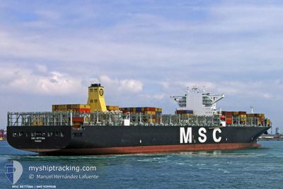
MSC BETTINA
Container Ship
Current Trip
CNTXG
| Time Travelled | 1 day |
|---|---|
| Remaining Time | --- |
| Distance Travelled | 670.96 nm |
| Remaining Distance | --- |
| AVG Speed | 16.4 Knop |
| MAX Speed | 20.1 Knop |
| AVG Wind | 6.3 knots |
| MAX Wind | 10.9 knots |
| MIN Temp | 11.3°C / 52.34°F |
| MAX Temp | 17.1°C / 62.78°F |
| Djupgående | 11 m |
| Position mottagen | 1 d sen |
Current Position
| Longitud | 118.79728° |
|---|---|
| Latitude | 38.78443° |
| Status | Under way using engine |
| Fart | 15.8 Knop |
| Kurs | 101.4° |
| Område | Yellow Sea |
| Station | T-AIS |
| Position mottagen | 1 d sen |
Info
Information
The current position of MSC BETTINA is in Yellow Sea with coordinates 38.78443° / 118.79728° as reported on 2024-05-07 08:28 by AIS to our vessel tracker app. The vessel's current speed is 15.8 Knop
The vessel MSC BETTINA (IMO: 9399038, MMSI: 352361000) is a Container Ship that was built in 2010 ( 14 År gammal ). It's sailing under the flag of [PA] Panama.
In this page you can find informations about the vessels current position, last detected port calls, and current voyage information. If the vessels is not in coverage by AIS you will find the latest position.
The current position of MSC BETTINA is detected by our AIS receivers and we are not responsible for the reliability of the data. The last position was recorded while the vessel was in Coverage by the Ais receivers of our vessel tracking app.
The current draught of MSC BETTINA as reported by AIS is 11 meters
Weather
| Temperature | 14.3°C / 57.74°F |
|---|---|
| Wind Speed | 8 knots |
| Direction | 299° WNW |
| Pressure | 1019.7 hPa |
| Humidity | 75.9 % |
| Cloud Coverage | --- |
Featured Company
Last Port Calls
Last Trips
| Origin | Departure | Destination | Arrival | Distance | |
|---|---|---|---|---|---|
| 2024-04-26 23:18 | 2024-05-05 22:16 | 2907.78 nm | |||
| 2024-04-20 04:34 | 2024-04-25 16:40 | 1623.18 nm | |||
| 2024-03-27 15:54 | 2024-03-29 00:20 | 396.90 nm | |||
| 2024-03-23 19:09 | 2024-03-25 04:26 | 402.49 nm | |||
| 2024-02-26 12:14 | 2024-03-22 08:01 | 8346.20 nm |
Events
| Tid | Event | Detaljer | Position / Dest | Information |
|---|---|---|---|---|
| 2024-05-07 08:37 | Status ändrad | Default Under way using engine |
38.77498 / 118.84357
CNTXG
|
Fart: 15.8 kn Kurs: 101.4° |
| 2024-05-07 08:28 | UTANFÖR täckningsområde |
38.78443 / 118.79728
Yellow Sea
|
Fart: 15.8 kn Kurs: 101.4° |
|
| 2024-05-07 08:10 | Byter havsområde | Chinese part of the Yellow Sea Malaysian part of the South China Sea |
38.79955 / 118.69913
Yellow Sea
|
Fart: 15.7 kn Kurs: 99.6° |
| 2024-05-07 08:10 | Status ändrad | Under way using engine Default |
38.79955 / 118.69913
CNTXG
|
Fart: 15.7 kn Kurs: 98° |
| 2024-05-07 08:08 | I täckningsområde |
38.79955 / 118.69913
Yellow Sea
|
Fart: 15.7 kn Kurs: 99.6° |
|
| 2024-05-07 05:14 | AVGÅTT HAMN |
|
38.95661 / 117.87648
CNTXG
|
Fart: 11.1 kn Kurs: 100° |
| 2024-05-05 14:16 | ANLÄNDER HAMN |
|
38.95830 / 117.86487
[CN] TIANJIN
|
Fart: 12.1 kn Kurs: 279° |