
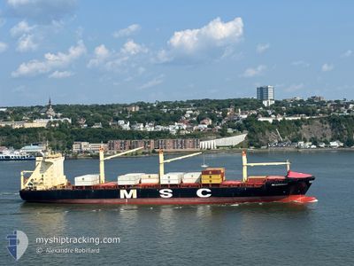
MSC ALDEBARAN III
Container Ship
Current Trip
| Time Travelled | 1 day |
|---|---|
| Remaining Time | --- |
| Distance Travelled | 437.11 nm |
| Remaining Distance | --- |
| AVG Speed | 12.8 Knop |
| MAX Speed | 20.2 Knop |
| AVG Wind | 23.6 knots |
| MAX Wind | 30 knots |
| MIN Temp | 6.7°C / 44.06°F |
| MAX Temp | 11.1°C / 51.98°F |
| Djupgående | 9.5 m |
| Position mottagen | 1 d sen |
Current Position
| Longitud | --- |
|---|---|
| Latitude | --- |
| Status | Under way using engine |
| Fart | 17.1 Knop |
| Kurs | 96° |
| Område | North Atlantic Ocean |
| Station | T-AIS |
| Position mottagen | 1 d sen |
Info
Information
The current position of MSC ALDEBARAN III is in North Atlantic Ocean with coordinates 40.38928° / -73.36351° as reported on 2025-03-17 00:45 by AIS to our vessel tracker app. The vessel's current speed is 17.1 Knop
The vessel MSC ALDEBARAN III (IMO: 9301990, MMSI: 636021529) is a Container Ship that was built in 2008 ( 17 År gammal ). It's sailing under the flag of [LR] Liberia.
In this page you can find informations about the vessels current position, last detected port calls, and current voyage information. If the vessels is not in coverage by AIS you will find the latest position.
The current position of MSC ALDEBARAN III is detected by our AIS receivers and we are not responsible for the reliability of the data. The last position was recorded while the vessel was in Coverage by the Ais receivers of our vessel tracking app.
The current draught of MSC ALDEBARAN III as reported by AIS is 9.5 meters
Weather
| Temperature | 6.4°C / 43.52°F |
|---|---|
| Wind Speed | 21 knots |
| Direction | 171° S |
| Pressure | 1012.8 hPa |
| Humidity | 97.8 % |
| Cloud Coverage | 97 % |
Featured Company
Last Port Calls
| Port | Arrival | Departure | Time In Port |
|---|---|---|---|
| 2025-03-15 13:30 | 2025-03-16 17:37 | 1 d | |
| 2025-03-08 14:28 | 2025-03-09 20:11 | 1 d | |
| 2025-03-03 09:32 | 2025-03-05 00:37 | 1 d | |
| 2025-02-28 14:08 | 2025-03-01 08:17 | 18 h | |
| 2025-02-20 19:47 | 2025-02-22 17:26 | 1 d | |
| 2025-02-05 17:23 | 2025-02-15 21:23 | 10 d | |
| 2025-01-30 02:11 | 2025-01-31 10:39 | 1 d | |
| 2025-01-25 10:37 | 2025-01-27 15:41 | 2 d | |
| 2025-01-05 04:14 | 2025-01-18 04:35 | 13 d |
Most Visited Ports (Last year)
| Port | Arrivals | |
|---|---|---|
| 15 | ||
| 7 | ||
| 6 | ||
| 6 | ||
| 6 | ||
| 5 |
Last Trips
| Origin | Departure | Destination | Arrival | Distance | |
|---|---|---|---|---|---|
| 2025-03-09 20:11 | 2025-03-15 13:30 | 1125.53 nm | |||
| 2025-03-05 00:37 | 2025-03-08 14:28 | 452.12 nm | |||
| 2025-03-01 08:17 | 2025-03-03 09:32 | 708.70 nm | |||
| 2025-02-22 17:26 | 2025-02-28 14:08 | 2190.76 nm | |||
| 2025-02-15 21:23 | 2025-02-20 19:47 | 1399.06 nm | |||
| 2025-01-31 10:39 | 2025-02-05 17:23 | 1433.62 nm | |||
| 2025-01-27 15:41 | 2025-01-30 02:11 | 787.41 nm | |||
| 2025-01-18 04:35 | 2025-01-25 10:37 | 1414.70 nm | |||
| 2024-12-30 19:01 | 2025-01-05 04:14 | 1112.42 nm |
Events
| Tid | Event | Detaljer | Position / Dest | Information |
|---|---|---|---|---|
| 2025-03-17 00:46 | Status ändrad | Default Under way using engine |
40.38878 / -73.35718
USNYC
|
Fart: 17.1 kn Kurs: 96° |
| 2025-03-17 00:45 | UTANFÖR täckningsområde |
40.38928 / -73.36351
North Atlantic Ocean
USNYC
|
Fart: 17.1 kn Kurs: 96° |
|
| 2025-03-16 21:37 | AVGÅTT HAMN |
|
40.57494 / -74.03385
USNYC
|
Fart: 18.9 kn Kurs: 163° |
| 2025-03-16 20:07 | STARTAR förflyttning |
40.68309 / -74.15064
[US] NEW YORK
|
Fart: 3.1 kn Kurs: 309° |
|
| 2025-03-16 19:55 | Status ändrad | Under way using engine Moored |
40.68556 / -74.15325
[US] NEW YORK
|
Fart: 0.1 kn Kurs: 307° |
| 2025-03-16 19:49 | Status ändrad | Moored Default |
40.68554 / -74.15319
[US] NEW YORK
|
Fart: Kurs: 307° |
| 2025-03-16 19:43 | Status ändrad | Default Moored |
40.68552 / -74.15317
[US] NEW YORK
|
Fart: Kurs: 307° |
| 2025-03-16 19:35 | ETA ändrat | 2025/03/20 06:00 2025/03/20 03:00 |
40.68552 / -74.15318
[US] NEW YORK
|
Fart: Kurs: 307° |
| 2025-03-16 19:28 | Djupgående ändrat | 9.5 9.1 |
40.68552 / -74.15317
[US] NEW YORK
|
Fart: Kurs: 307° |
| 2025-03-16 14:49 | Status ändrad | Moored Default |
40.68553 / -74.15320
[US] NEW YORK
|
Fart: Kurs: 307° |