

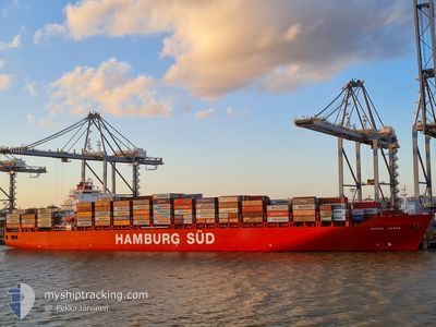
MONTE VERDE
Container Ship

Current Trip
| Time Travelled | 20 h, 39 mins |
|---|---|
| Remaining Time | 1 day |
| Distance Travelled | 347.21 nm |
| Remaining Distance | 683.81 nm |
| AVG Speed | 17.1 Knop |
| MAX Speed | 18.3 Knop |
| AVG Wind | 11.4 knots |
| MAX Wind | 14.2 knots |
| MIN Temp | 24.8°C / 76.64°F |
| MAX Temp | 26°C / 78.8°F |
| Djupgående | 9.5 m |
| Position mottagen | 58 m sen |
Current Position
| Longitud | --- |
|---|---|
| Latitude | --- |
| Status | Under way using engine |
| Fart | 17.1 Knop |
| Kurs | 217.1° |
| Område | South Atlantic Ocean |
| Station | T-AIS |
| Position mottagen | 58 m sen |
Information
The current position of MONTE VERDE is in South Atlantic Ocean with coordinates -29.20034° / -48.52594° as reported on 2025-03-29 17:30 by AIS to our vessel tracker app. The vessel's current speed is 17.1 Knop and is heading at the port of BUENOS AIRES. The estimated time of arrival as calculated by MyShipTracking vessel tracking app is 2025-03-31 07:33 LT
The vessel MONTE VERDE (IMO: 9283239, MMSI: 563051800) is a Container Ship that was built in 2005 ( 20 År gammal ). It's sailing under the flag of [SG] Singapore.
In this page you can find informations about the vessels current position, last detected port calls, and current voyage information. If the vessels is not in coverage by AIS you will find the latest position.
The current position of MONTE VERDE is detected by our AIS receivers and we are not responsible for the reliability of the data. The last position was recorded while the vessel was in Coverage by the Ais receivers of our vessel tracking app.
The current draught of MONTE VERDE as reported by AIS is 9.5 meters
Weather
| Temperature | 25.3°C / 77.54°F |
|---|---|
| Wind Speed | 10 knots |
| Direction | 208° SSW |
| Pressure | 1012.2 hPa |
| Humidity | 84.2 % |
| Cloud Coverage | 95 % |


Featured Company
Last Port Calls
| Port | Arrival | Departure | Time In Port |
|---|---|---|---|
| 2025-03-27 21:27 | 2025-03-28 18:50 | 21 h | |
| 2025-03-16 01:42 | 2025-03-16 22:29 | 20 h | |
| 2025-03-11 22:20 | 2025-03-12 18:07 | 19 h | |
| 2025-03-09 09:56 | 2025-03-09 23:40 | 13 h | |
| 2025-03-07 04:44 | 2025-03-08 05:50 | 1 d | |
| 2025-02-23 02:16 | 2025-02-23 18:30 | 16 h | |
| 2025-02-19 07:45 | 2025-02-20 02:44 | 18 h | |
| 2025-02-16 12:34 | 2025-02-17 16:09 | 1 d | |
| 2025-02-04 08:44 | 2025-02-04 17:03 | 8 h | |
| 2025-01-29 15:45 | 2025-01-30 09:07 | 17 h |
Most Visited Ports (Last year)
| Port | Arrivals | |
|---|---|---|
| 14 | ||
| 8 | ||
| 7 | ||
| 7 | ||
| 6 | ||
| 6 |
Last Trips
| Origin | Departure | Destination | Arrival | Distance | |
|---|---|---|---|---|---|
| 2025-03-16 22:29 | 2025-03-27 21:27 | 4777.33 nm | |||
| 2025-03-12 18:07 | 2025-03-16 01:42 | 585.72 nm | |||
| 2025-03-09 23:40 | 2025-03-11 22:20 | 634.30 nm | |||
| 2025-03-08 05:50 | 2025-03-09 09:56 | 249.05 nm | |||
| 2025-02-23 18:30 | 2025-03-07 04:44 | 4160.51 nm | |||
| 2025-02-20 02:44 | 2025-02-23 02:16 | 1118.57 nm | |||
| 2025-02-17 16:09 | 2025-02-19 07:45 | 193.30 nm | |||
| 2025-02-04 17:03 | 2025-02-16 12:34 | 4789.74 nm | |||
| 2025-01-30 09:07 | 2025-02-04 08:44 | 745.17 nm | |||
| 2025-01-26 08:45 | 2025-01-29 15:45 | 636.10 nm |
Events
| Tid | Event | Detaljer | Position / Dest | Information |
|---|---|---|---|---|
| 2025-03-29 17:37 | Status ändrad | Default Under way using engine |
-29.22617 / -48.54824
BRSSZ>ARBUE
|
Fart: 17.1 kn Kurs: 217.1° |
| 2025-03-29 17:24 | Status ändrad | Under way using engine Default |
-29.17484 / -48.50441
BRSSZ>ARBUE
|
Fart: 17.1 kn Kurs: 218° |
| 2025-03-29 16:53 | Status ändrad | Default Under way using engine |
-29.05513 / -48.40470
BRSSZ>ARBUE
|
Fart: 16 kn Kurs: 215.3° |
| 2025-03-29 16:46 | Status ändrad | Under way using engine Default |
-29.02984 / -48.38387
BRSSZ>ARBUE
|
Fart: 10.4 kn Kurs: 220° |
| 2025-03-29 16:38 | I täckningsområde |
-29.02984 / -48.38387
South Atlantic Ocean
BRSSZ>ARBUE
|
Fart: 15 kn Kurs: 214.4° |
|
| 2025-03-29 14:54 | Status ändrad | Default Under way using engine |
-28.60618 / -48.06027
BRSSZ>ARBUE
|
Fart: 16.3 kn Kurs: 200.2° |
| 2025-03-29 14:47 | UTANFÖR täckningsområde |
-28.57917 / -48.04757
South Atlantic Ocean
BRSSZ>ARBUE
|
Fart: 16.3 kn Kurs: 200.2° |
|
| 2025-03-29 08:55 | ETA ändrat | 2025/03/31 01:30 2025/03/30 23:30 |
-26.97979 / -47.42234
BRSSZ>ARBUE
|
Fart: 17.6 kn Kurs: 197.6° |
| 2025-03-29 08:54 | Status ändrad | Under way using engine Default |
-26.97596 / -47.42094
BRSSZ>ARBUE
|
Fart: 17.9 kn Kurs: 202° |
| 2025-03-29 08:54 | I täckningsområde |
-26.98306 / -47.42354
South Atlantic Ocean
BRSSZ>ARBUE
|
Fart: 17.5 kn Kurs: 198.7° |