
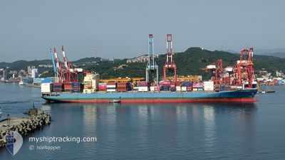
MOL EARNEST
Container Ship
Current Trip
| Time Travelled | 22 h, 30 mins |
|---|---|
| Remaining Time | 1 day |
| Distance Travelled | 362.86 nm |
| Remaining Distance | 573.01 nm |
| AVG Speed | 16 Knop |
| MAX Speed | 19 Knop |
| AVG Wind | 5.7 knots |
| MAX Wind | 12.7 knots |
| MIN Temp | 22.3°C / 72.14°F |
| MAX Temp | 26.4°C / 79.52°F |
| Djupgående | 11.1 m |
| Position mottagen | 6 h, 37 m sen |
Current Position
| Longitud | --- |
|---|---|
| Latitude | --- |
| Status | Under way using engine |
| Fart | 18.3 Knop |
| Kurs | 138.5° |
| Område | Gulf of Oman |
| Station | T-AIS |
| Position mottagen | 6 h, 37 m sen |
Information
The current position of MOL EARNEST is in Gulf of Oman with coordinates 24.68626° / 57.09491° as reported on 2025-03-28 20:25 by AIS to our vessel tracker app. The vessel's current speed is 18.3 Knop and is heading at the port of PORT QASIM. The estimated time of arrival as calculated by MyShipTracking vessel tracking app is 2025-03-30 05:52 LT
The vessel MOL EARNEST (IMO: 9333840, MMSI: 351496000) is a Container Ship that was built in 2007 ( 18 År gammal ). It's sailing under the flag of [PA] Panama.
In this page you can find informations about the vessels current position, last detected port calls, and current voyage information. If the vessels is not in coverage by AIS you will find the latest position.
The current position of MOL EARNEST is detected by our AIS receivers and we are not responsible for the reliability of the data. The last position was recorded while the vessel was in Coverage by the Ais receivers of our vessel tracking app.
The current draught of MOL EARNEST as reported by AIS is 11.1 meters
Weather
| Temperature | 24.1°C / 75.38°F |
|---|---|
| Wind Speed | 4 knots |
| Direction | 53° NE |
| Pressure | 1014.4 hPa |
| Humidity | 57.8 % |
| Cloud Coverage | --- |
Featured Company
Last Port Calls
| Port | Arrival | Departure | Time In Port |
|---|---|---|---|
| 2025-03-27 03:53 | 2025-03-28 04:33 | 1 d | |
| 2025-03-22 09:05 | 2025-03-22 13:41 | 4 h | |
| 2025-03-13 22:45 | 2025-03-15 09:46 | 1 d | |
| 2025-03-09 04:37 | 2025-03-11 00:06 | 1 d | |
| 2025-03-05 20:33 | 2025-03-07 02:35 | 1 d | |
| 2025-03-04 06:09 | 2025-03-05 00:41 | 18 h | |
| 2025-02-23 19:47 | 2025-02-25 18:37 | 1 d | |
| 2025-02-19 14:01 | 2025-02-20 04:37 | 14 h | |
| 2025-02-17 06:07 | 2025-02-18 06:01 | 23 h | |
| 2025-02-10 22:11 | 2025-02-12 20:53 | 1 d |
Most Visited Ports (Last year)
| Port | Arrivals | |
|---|---|---|
| 25 | ||
| 24 | ||
| 12 | ||
| 12 | ||
| 1 | ||
| 1 |
Last Trips
| Origin | Departure | Destination | Arrival | Distance | |
|---|---|---|---|---|---|
| 2025-03-22 19:11 | 2025-03-27 07:53 | 1269.53 nm | |||
| 2025-03-15 17:46 | 2025-03-22 14:35 | 2634.92 nm | |||
| 2025-03-11 07:06 | 2025-03-14 06:45 | 826.16 nm | |||
| 2025-03-07 10:35 | 2025-03-09 11:37 | 830.02 nm | |||
| 2025-03-05 08:41 | 2025-03-06 04:33 | 197.05 nm | |||
| 2025-02-26 00:07 | 2025-03-04 14:09 | 1423.26 nm | |||
| 2025-02-20 12:37 | 2025-02-24 01:17 | 1426.02 nm | |||
| 2025-02-18 14:01 | 2025-02-19 22:01 | 213.99 nm | |||
| 2025-02-13 03:53 | 2025-02-17 14:07 | 833.01 nm | |||
| 2025-02-07 15:38 | 2025-02-11 05:11 | 842.71 nm |
Events
| Tid | Event | Detaljer | Position / Dest | Information |
|---|---|---|---|---|
| 2025-03-28 20:27 | Status ändrad | Default Under way using engine |
24.67855 / 57.10234
PK BQM
|
Fart: 18.3 kn Kurs: 138.5° |
| 2025-03-28 20:25 | UTANFÖR täckningsområde |
24.68626 / 57.09491
Gulf of Oman
PK BQM
|
Fart: 18.3 kn Kurs: 138.5° |
|
| 2025-03-28 18:55 | Byter havsområde | Omani part of the Gulf of Oman United Arab Emirates part of the Gulf of Oman |
25.03142 / 56.82086
Gulf of Oman
PK BQM
|
Fart: 17.5 kn Kurs: 182.3° |
| 2025-03-28 18:55 | Status ändrad | Under way using engine Default |
25.03434 / 56.82100
PK BQM
|
Fart: 17.6 kn Kurs: 188° |
| 2025-03-28 18:51 | Status ändrad | Default Under way using engine |
25.05531 / 56.82406
PK BQM
|
Fart: 17.5 kn Kurs: 187.6° |
| 2025-03-28 18:43 | Status ändrad | Under way using engine Default |
25.09081 / 56.82961
PK BQM
|
Fart: 17.4 kn Kurs: 188° |
| 2025-03-28 18:26 | Status ändrad | Default Under way using engine |
25.17361 / 56.84008
PK BQM
|
Fart: 17.4 kn Kurs: 182.6° |
| 2025-03-28 17:05 | Byter havsområde | United Arab Emirates part of the Gulf of Oman Iranian part of the Gulf of Oman |
25.56801 / 56.86182
Gulf of Oman
PK BQM
|
Fart: 17.1 kn Kurs: 183.2° |
| 2025-03-28 15:58 | Byter havsområde | Iranian part of the Gulf of Oman Omani part of the Persian Gulf |
25.88534 / 56.87669
Gulf of Oman
PK BQM
|
Fart: 16.7 kn Kurs: 182.1° |
| 2025-03-28 15:57 | Status ändrad | Under way using engine Default |
25.88956 / 56.87686
PK BQM
|
Fart: 16.7 kn Kurs: 182° |