
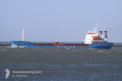
MODY M
Bulk Carrier
Current Trip
| Time Travelled | 4 days |
|---|---|
| Remaining Time | --- |
| Distance Travelled | 664.72 nm |
| Remaining Distance | --- |
| AVG Speed | 6 Knop |
| MAX Speed | 8.4 Knop |
| AVG Wind | 7.6 knots |
| MAX Wind | 17.9 knots |
| MIN Temp | 16.6°C / 61.88°F |
| MAX Temp | 20.2°C / 68.36°F |
| Djupgående | 7.5 m |
| Position mottagen | Nu |
Current Position
| Longitud | 23.72491° |
|---|---|
| Latitude | 36.80680° |
| Status | Under way using engine |
| Fart | 6.2 Knop |
| Kurs | 22.7° |
| Område | Aegean Sea |
| Station | T-AIS |
| Position mottagen | Nu |
Info
Information
The current position of MODY M is in Aegean Sea with coordinates 36.80680° / 23.72491° as reported on 2024-05-08 05:56 by AIS to our vessel tracker app. The vessel's current speed is 6.2 Knop and is heading at the port of DERINCE. The estimated time of arrival as calculated by MyShipTracking vessel tracking app is 2024-05-08 20:00 LT
The vessel MODY M (IMO: 7414183, MMSI: 677072000) is a Bulk Carrier that was built in 1976 ( 48 År gammal ). It's sailing under the flag of [TZ] Tanzania.
In this page you can find informations about the vessels current position, last detected port calls, and current voyage information. If the vessels is not in coverage by AIS you will find the latest position.
The current position of MODY M is detected by our AIS receivers and we are not responsible for the reliability of the data. The last position was recorded while the vessel was in Coverage by the Ais receivers of our vessel tracking app.
The current draught of MODY M as reported by AIS is 7.5 meters
Weather
| Temperature | 18.4°C / 65.12°F |
|---|---|
| Wind Speed | 4 knots |
| Direction | 186° S |
| Pressure | 1014.5 hPa |
| Humidity | 82.5 % |
| Cloud Coverage | 45 % |
Featured Company
Events
| Tid | Event | Detaljer | Position / Dest | Information |
|---|---|---|---|---|
| 2024-05-08 05:20 | Status ändrad | Under way using engine Default |
36.75275 / 23.69899
TR DRC
|
Fart: 5.7 kn Kurs: 33° |
| 2024-05-08 05:10 | Status ändrad | Default Under way using engine |
36.73730 / 23.69218
TR DRC
|
Fart: 5.7 kn Kurs: 35.1° |
| 2024-05-08 03:06 | Djupgående ändrat | 7.5 6.8 |
36.57337 / 23.54880
TR DRC
|
Fart: 5.8 kn Kurs: 32.1° |
| 2024-05-08 03:06 | Destination ändrad | TR DRC TN GAE |
36.57337 / 23.54880
TR DRC
|
Fart: 5.8 kn Kurs: 32.1° |
| 2024-05-08 03:06 | ETA ändrat | 2024/05/08 20:00 2024/04/15 09:00 |
36.57337 / 23.54880
TR DRC
|
Fart: 5.8 kn Kurs: 32.1° |
| 2024-05-08 02:26 | Status ändrad | Under way using engine Default |
36.51668 / 23.50603
TN GAE
|
Fart: 5.9 kn Kurs: 33° |
| 2024-05-08 02:13 | Status ändrad | Default Under way using engine |
36.49876 / 23.49223
TN GAE
|
Fart: 5.9 kn Kurs: 32.2° |
| 2024-05-08 01:58 | Status ändrad | Under way using engine Default |
36.47676 / 23.47504
TN GAE
|
Fart: 5.9 kn Kurs: 32° |
| 2024-05-08 01:47 | Status ändrad | Default Under way using engine |
36.46230 / 23.46355
TN GAE
|
Fart: 6 kn Kurs: 32.9° |
| 2024-05-08 01:47 | Upptäckt i hav | Greek part of the Aegean Sea |
36.46204 / 23.46334
Aegean Sea
|
Fart: 6 kn Kurs: 32.9° |