
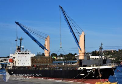
MITO
Bulk Carrier
Current Trip
| Time Travelled | 11 days |
|---|---|
| Remaining Time | --- |
| Distance Travelled | 2928.22 nm |
| Remaining Distance | --- |
| AVG Speed | 11.4 Knop |
| MAX Speed | 14.1 Knop |
| AVG Wind | 10.6 knots |
| MAX Wind | 20.8 knots |
| MIN Temp | 12.6°C / 54.68°F |
| MAX Temp | 26.2°C / 79.16°F |
| Djupgående | 7.7 m |
| Position mottagen | 21 h, 28 m sen |
Current Position
| Longitud | 151.01682° |
|---|---|
| Latitude | -23.37198° |
| Status | At anchor |
| Fart | |
| Kurs | 109° |
| Område | Coral Sea |
| Station | T-AIS |
| Position mottagen | 21 h, 28 m sen |
Info
Information
The current position of MITO is in Coral Sea with coordinates -23.37198° / 151.01682° as reported on 2024-05-27 23:16 by AIS to our vessel tracker app. The vessel's current speed is 0 Knop
The vessel MITO (IMO: 9587788, MMSI: 351646000) is a Bulk Carrier that was built in 2010 ( 14 År gammal ). It's sailing under the flag of [PA] Panama.
In this page you can find informations about the vessels current position, last detected port calls, and current voyage information. If the vessels is not in coverage by AIS you will find the latest position.
The current position of MITO is detected by our AIS receivers and we are not responsible for the reliability of the data. The last position was recorded while the vessel was in Coverage by the Ais receivers of our vessel tracking app.
The current draught of MITO as reported by AIS is 7.7 meters
Weather
| Temperature | 20.7°C / 69.26°F |
|---|---|
| Wind Speed | 16 knots |
| Direction | 120° ESE |
| Pressure | 1022.9 hPa |
| Humidity | 79.4 % |
| Cloud Coverage | 24 % |
Featured Company
Last Port Calls
| Port | Arrival | Departure | Time In Port |
|---|---|---|---|
| 2024-05-13 18:04 | 2024-05-17 14:21 | 3 d | |
| 2024-04-29 12:00 | 2024-05-01 06:24 | 1 d | |
| 2024-04-28 03:14 | 2024-04-29 02:03 | 22 h | |
| 2024-04-16 13:48 | 2024-04-18 05:37 | 1 d | |
| 2024-04-09 13:25 | 2024-04-10 18:00 | 1 d | |
| 2024-03-31 00:17 | 2024-04-01 12:41 | 1 d | |
| 2024-03-20 22:53 | 2024-03-23 06:44 | 2 d | |
| 2024-03-18 09:46 | 2024-03-20 10:32 | 2 d | |
| 2024-03-02 16:51 | 2024-03-04 10:16 | 1 d |
Last Trips
| Origin | Departure | Destination | Arrival | Distance | |
|---|---|---|---|---|---|
| 2024-05-01 06:24 | 2024-05-13 18:04 | 148.86 nm | |||
| 2024-04-29 02:03 | 2024-04-29 12:00 | 105.51 nm | |||
| 2024-04-18 05:37 | 2024-04-28 03:14 | 2743.27 nm | |||
| 2024-04-10 18:00 | 2024-04-16 13:48 | 1726.25 nm | |||
| 2024-04-01 12:41 | 2024-04-09 13:25 | 761.80 nm | |||
| 2024-03-23 06:44 | 2024-03-31 00:17 | 1909.65 nm | |||
| 2024-03-20 10:32 | 2024-03-20 22:53 | 137.75 nm | |||
| 2024-03-04 10:16 | 2024-03-18 09:46 | 3210.88 nm | |||
| 2024-02-24 11:25 | 2024-03-02 16:51 | 1564.12 nm |
Events
| Tid | Event | Detaljer | Position / Dest | Information |
|---|---|---|---|---|
| 2024-05-27 23:19 | Status ändrad | Default At anchor |
-23.37202 / 151.01682
AU PTL
|
Fart: Kurs: 109° |
| 2024-05-27 23:16 | Status ändrad | At anchor Default |
-23.37198 / 151.01682
AU PTL
|
Fart: Kurs: 108° |
| 2024-05-27 23:16 | UTANFÖR täckningsområde |
-23.37198 / 151.01682
Coral Sea
AU PTL
|
Fart: Kurs: 224° |
|
| 2024-05-27 23:07 | Status ändrad | Default At anchor |
-23.37197 / 151.01680
AU PTL
|
Fart: Kurs: 110° |
| 2024-05-27 22:49 | Status ändrad | At anchor Default |
-23.37188 / 151.01678
AU PTL
|
Fart: Kurs: 113° |
| 2024-05-27 22:43 | Status ändrad | Default At anchor |
-23.37182 / 151.01688
AU PTL
|
Fart: Kurs: 111° |
| 2024-05-27 22:40 | Status ändrad | At anchor Default |
-23.37183 / 151.01690
AU PTL
|
Fart: Kurs: 112° |
| 2024-05-27 22:40 | I täckningsområde |
-23.37183 / 151.01690
Coral Sea
AU PTL
|
Fart: Kurs: 327.9° |
|
| 2024-05-27 18:28 | STOPPAR förflyttning | 15.37 nm, North East of PORT ALMA |
-23.37153 / 151.01936
AU PTL
|
Fart: 0.1 kn Kurs: 202° |
| 2024-05-27 13:45 | UTANFÖR täckningsområde |
-23.70950 / 151.51960
Coral Sea
AU PTL
|
Fart: 10.5 kn Kurs: 335° |