

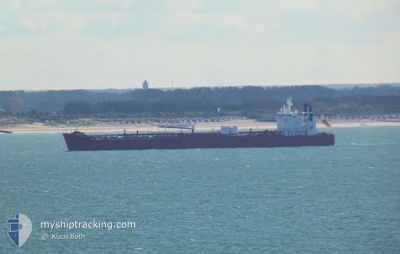
MERONAS
Tanker

Current Trip
| Time Travelled | 19 days |
|---|---|
| Remaining Time | --- |
| Distance Travelled | 4730.26 nm |
| Remaining Distance | --- |
| AVG Speed | 11 Knop |
| MAX Speed | 15.6 Knop |
| AVG Wind | 13.1 knots |
| MAX Wind | 39 knots |
| MIN Temp | 1.1°C / 33.98°F |
| MAX Temp | 16.7°C / 62.06°F |
| Djupgående | 8.2 m |
| Position mottagen | 2 m sen |
Current Position
| Longitud | --- |
|---|---|
| Latitude | --- |
| Status | Under way using engine |
| Fart | 2.5 Knop |
| Kurs | 208° |
| Område | Black Sea |
| Station | T-AIS |
| Position mottagen | 2 m sen |
Information
The current position of MERONAS is in Black Sea with coordinates 41.37199° / 28.87717° as reported on 2025-02-18 21:25 by AIS to our vessel tracker app. The vessel's current speed is 2.5 Knop and is heading at the port of TERNEUZEN. The estimated time of arrival as calculated by MyShipTracking vessel tracking app is 2025-02-19 20:30 LT
The vessel MERONAS (IMO: 9934905, MMSI: 241800000) is a Tanker It's sailing under the flag of [GR] Greece.
In this page you can find informations about the vessels current position, last detected port calls, and current voyage information. If the vessels is not in coverage by AIS you will find the latest position.
The current position of MERONAS is detected by our AIS receivers and we are not responsible for the reliability of the data. The last position was recorded while the vessel was in Coverage by the Ais receivers of our vessel tracking app.
The current draught of MERONAS as reported by AIS is 8.2 meters
Weather
| Temperature | 4.5°C / 40.1°F |
|---|---|
| Wind Speed | 12 knots |
| Direction | 67° ENE |
| Pressure | 1023.5 hPa |
| Humidity | 72.6 % |
| Cloud Coverage | 100 % |


Featured Company
Last Port Calls
| Port | Arrival | Departure | Time In Port |
|---|---|---|---|
| 2025-01-29 11:34 | 2025-01-30 13:51 | 1 d | |
| 2025-01-03 08:56 | 2025-01-05 18:47 | 2 d | |
| 2024-12-25 21:21 | 2024-12-27 09:28 | 1 d | |
| 2024-12-01 05:35 |
Most Visited Ports (Last year)
| Port | Arrivals | |
|---|---|---|
| 4 | ||
| 1 | ||
| 1 | ||
| 1 | ||
| 1 | ||
| 1 |
Last Trips
| Origin | Departure | Destination | Arrival | Distance | |
|---|---|---|---|---|---|
| 2025-01-05 14:47 | 2025-01-29 14:34 | 6210.95 nm | |||
| 2024-12-27 06:28 | 2025-01-03 04:56 | 1148.09 nm | |||
| 2024-12-01 08:35 | 2024-12-25 18:21 | 5627.42 nm |
Events
| Tid | Event | Detaljer | Position / Dest | Information |
|---|---|---|---|---|
| 2025-02-18 17:18 | STARTAR förflyttning | 13.76 nm, North West of RUMELI FENERI |
41.41754 / 28.93532
FOR ORDERS
|
Fart: 3.3 kn Kurs: 162° |
| 2025-02-18 15:05 | STOPPAR förflyttning | 14.15 nm, North West of RUMELI FENERI |
41.37177 / 28.86173
FOR ORDERS
|
Fart: 0.3 kn Kurs: 32° |
| 2025-02-18 07:35 | Destination ändrad | FOR ORDERS FOR ORDERSS |
41.42687 / 28.95519
FOR ORDERS
|
Fart: 3.1 kn Kurs: 315° |
| 2025-02-18 07:35 | ETA ändrat | 2025/02/19 20:30 2025/02/15 20:30 |
41.42687 / 28.95519
FOR ORDERS
|
Fart: 3.1 kn Kurs: 315° |
| 2025-02-18 06:10 | Destination ändrad | FOR ORDERSS IGA,TURKEY |
41.34446 / 28.82932
FOR ORDERSS
|
Fart: 7.5 kn Kurs: 70.1° |
| 2025-02-18 05:31 | STARTAR förflyttning | 15.51 nm, West of RUMELI FENERI |
41.31155 / 28.78719
IGA,TURKEY
|
Fart: 4 kn Kurs: 355° |
| 2025-02-18 05:24 | Djupgående ändrat | 8.2 12.4 |
41.30955 / 28.78864
IGA,TURKEY
|
Fart: Kurs: 4° |
| 2025-02-18 05:21 | Status ändrad | Under way using engine Moored |
41.30953 / 28.78865
IGA,TURKEY
|
Fart: Kurs: 4° |
| 2025-02-17 23:45 | Status ändrad | Moored Default |
41.30952 / 28.78864
IGA,TURKEY
|
Fart: Kurs: 4° |
| 2025-02-17 23:39 | Status ändrad | Default Moored |
41.30953 / 28.78864
IGA,TURKEY
|
Fart: Kurs: 3° |