
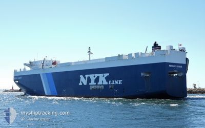
MERCURY LEADER
Vehicles Carrier
Current Trip
| Time Travelled | 11 days |
|---|---|
| Remaining Time | 1 day |
| Distance Travelled | 3681.24 nm |
| Remaining Distance | 611.27 nm |
| AVG Speed | 13.2 Knop |
| MAX Speed | 16.9 Knop |
| AVG Wind | 12.2 knots |
| MAX Wind | 20.6 knots |
| MIN Temp | 17.2°C / 62.96°F |
| MAX Temp | 29.8°C / 85.64°F |
| Djupgående | 6.6 m |
| Position mottagen | 4 h, 23 m sen |
Current Position
| Longitud | --- |
|---|---|
| Latitude | --- |
| Status | Under way using engine |
| Fart | 13.3 Knop |
| Kurs | 293° |
| Område | Java Sea |
| Station | T-AIS |
| Position mottagen | 4 h, 23 m sen |
Info
Information
The current position of MERCURY LEADER is in Java Sea with coordinates -4.81182° / 111.30475° as reported on 2024-11-25 07:28 by AIS to our vessel tracker app. The vessel's current speed is 13.3 Knop and is heading at the port of SINGAPORE. The estimated time of arrival as calculated by MyShipTracking vessel tracking app is 2024-11-27 13:03 LT
The vessel MERCURY LEADER (IMO: 9392353, MMSI: 431432000) is a Vehicles Carrier that was built in 2009 ( 15 År gammal ). It's sailing under the flag of [JP] Japan.
In this page you can find informations about the vessels current position, last detected port calls, and current voyage information. If the vessels is not in coverage by AIS you will find the latest position.
The current position of MERCURY LEADER is detected by our AIS receivers and we are not responsible for the reliability of the data. The last position was recorded while the vessel was in Coverage by the Ais receivers of our vessel tracking app.
The current draught of MERCURY LEADER as reported by AIS is 6.6 meters
Weather
| Temperature | 28°C / 82.4°F |
|---|---|
| Wind Speed | 1 knots |
| Direction | 23° NNE |
| Pressure | 1005.7 hPa |
| Humidity | 77.4 % |
| Cloud Coverage | 91 % |
Featured Company
Last Port Calls
| Port | Arrival | Departure | Time In Port |
|---|---|---|---|
| 2024-11-13 10:26 | 2024-11-13 23:18 | 12 h | |
| 2024-11-07 03:03 | 2024-11-11 20:19 | 4 d | |
| 2024-10-26 12:21 | 2024-10-26 17:50 | 5 h | |
| 2024-10-23 13:49 | 2024-10-25 20:32 | 2 d | |
| 2024-10-18 06:13 | 2024-10-18 12:09 | 5 h | |
| 2024-09-21 10:37 | 2024-09-22 05:34 | 18 h | |
| 2024-09-14 11:51 | 2024-09-14 23:05 | 11 h | |
| 2024-09-01 19:30 | 2024-09-03 22:16 | 2 d |
Last Trips
| Origin | Departure | Destination | Arrival | Distance | |
|---|---|---|---|---|---|
| 2024-11-11 20:19 | 2024-11-13 10:26 | 571.39 nm | |||
| 2024-10-26 17:50 | 2024-11-07 03:03 | 3992.25 nm | |||
| 2024-10-25 20:32 | 2024-10-26 12:21 | 217.23 nm | |||
| 2024-10-18 12:09 | 2024-10-23 13:49 | 820.83 nm | |||
| 2024-09-22 05:34 | 2024-10-18 06:13 | 7762.93 nm | |||
| 2024-09-14 23:05 | 2024-09-21 10:37 | 272.27 nm | |||
| 2024-09-03 22:16 | 2024-09-14 11:51 | 1093.76 nm | |||
| 2024-08-26 17:06 | 2024-09-01 19:30 | 1256.98 nm |
Events
| Tid | Event | Detaljer | Position / Dest | Information |
|---|---|---|---|---|
| 2024-11-25 07:38 | Status ändrad | Default Under way using engine |
-4.79837 / 111.27331
SG SIN
|
Fart: 13.3 kn Kurs: 293° |
| 2024-11-25 07:28 | UTANFÖR täckningsområde |
-4.81182 / 111.30475
Java Sea
SG SIN
|
Fart: 13.3 kn Kurs: 293° |
|
| 2024-11-25 06:32 | Status ändrad | Under way using engine Default |
-4.89158 / 111.49420
SG SIN
|
Fart: 13.9 kn Kurs: 292° |
| 2024-11-25 06:23 | Status ändrad | Default Under way using engine |
-4.90532 / 111.52660
SG SIN
|
Fart: 13.9 kn Kurs: 292° |
| 2024-11-25 05:00 | ETA ändrat | 2024/11/27 10:00 2024/11/26 21:00 |
-5.01500 / 111.86853
SG SIN
|
Fart: 13.2 kn Kurs: 291° |
| 2024-11-25 03:43 | Byter havsområde | Indonesian part of the Java Sea Australian part of the Coral Sea |
-5.10177 / 112.08862
Java Sea
SG SIN
|
Fart: 13 kn Kurs: 291° |
| 2024-11-25 03:42 | Status ändrad | Under way using engine Default |
-5.10307 / 112.09195
SG SIN
|
Fart: 13 kn Kurs: 286° |
| 2024-11-25 03:42 | I täckningsområde |
-5.10177 / 112.08862
Java Sea
SG SIN
|
Fart: 13 kn Kurs: 291° |
|
| 2024-11-17 04:03 | Status ändrad | Default Under way using engine |
-18.67858 / 146.90920
SG SIN
|
Fart: 11.8 kn Kurs: 313° |
| 2024-11-17 03:57 | UTANFÖR täckningsområde |
-18.69345 / 146.92588
Coral Sea
SG SIN
|
Fart: 11.8 kn Kurs: 313° |