
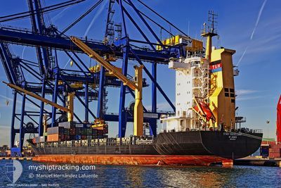
MED CERKEZKOY
General Cargo
Current Trip
EGALY
| Time Travelled | 10 h, 17 mins |
|---|---|
| Remaining Time | --- |
| Distance Travelled | 82.10 nm |
| Remaining Distance | --- |
| AVG Speed | 10.1 Knop |
| MAX Speed | 11.3 Knop |
| AVG Wind | 7.2 knots |
| MAX Wind | 9.9 knots |
| MIN Temp | 21.2°C / 70.16°F |
| MAX Temp | 23.1°C / 73.58°F |
| Djupgående | 9 m |
| Position mottagen | 2 d sen |
Current Position
| Longitud | --- |
|---|---|
| Latitude | --- |
| Status | Under way using engine |
| Fart | 10.3 Knop |
| Kurs | 145.6° |
| Område | Mediterranean Sea - Eastern Basin |
| Station | T-AIS |
| Position mottagen | 2 d sen |
Info
Information
The current position of MED CERKEZKOY is in Mediterranean Sea - Eastern Basin with coordinates 34.69436° / 26.95789° as reported on 2024-11-19 14:46 by AIS to our vessel tracker app. The vessel's current speed is 10.3 Knop
The vessel MED CERKEZKOY (IMO: 9147215, MMSI: 271044659) is a General Cargo that was built in 1998 ( 26 År gammal ). It's sailing under the flag of [TR] Turkey.
In this page you can find informations about the vessels current position, last detected port calls, and current voyage information. If the vessels is not in coverage by AIS you will find the latest position.
The current position of MED CERKEZKOY is detected by our AIS receivers and we are not responsible for the reliability of the data. The last position was recorded while the vessel was in Coverage by the Ais receivers of our vessel tracking app.
The current draught of MED CERKEZKOY as reported by AIS is 9 meters
Weather
| Temperature | 21.2°C / 70.16°F |
|---|---|
| Wind Speed | 9 knots |
| Direction | 167° SSE |
| Pressure | 1018.1 hPa |
| Humidity | 64.4 % |
| Cloud Coverage | 39 % |
Featured Company
Last Port Calls
| Port | Arrival | Departure | Time In Port |
|---|---|---|---|
| 2024-11-20 17:10 | 2024-11-21 14:40 | 21 h | |
| 2024-11-17 19:12 | 2024-11-18 12:28 | 17 h | |
| 2024-11-15 17:58 | 2024-11-16 15:07 | 21 h | |
| 2024-11-13 08:40 | 2024-11-13 21:01 | 12 h | |
| 2024-11-11 14:02 | 2024-11-13 08:07 | 1 d | |
| 2024-11-10 17:31 | 2024-11-11 01:48 | 8 h | |
| 2024-11-10 01:53 | 2024-11-10 11:05 | 9 h | |
| 2024-11-07 13:08 | 2024-11-08 16:31 | 1 d | |
| 2024-11-01 20:33 | 2024-11-02 18:10 | 21 h | |
| 2024-10-31 20:41 | 2024-11-01 05:00 | 8 h |
Last Trips
| Origin | Departure | Destination | Arrival | Distance | |
|---|---|---|---|---|---|
| 2024-11-18 14:28 | 2024-11-20 19:10 | 523.05 nm | |||
| 2024-11-16 17:07 | 2024-11-17 21:12 | 265.58 nm | |||
| 2024-11-14 00:01 | 2024-11-15 19:58 | 276.68 nm | |||
| 2024-11-13 11:07 | 2024-11-13 11:40 | 1.93 nm | |||
| 2024-11-11 04:48 | 2024-11-11 17:02 | 85.04 nm | |||
| 2024-11-10 14:05 | 2024-11-10 20:31 | 61.04 nm | |||
| 2024-11-08 19:31 | 2024-11-10 04:53 | 110.12 nm | |||
| 2024-11-02 20:10 | 2024-11-07 16:08 | 762.93 nm | |||
| 2024-11-01 07:00 | 2024-11-01 22:33 | 119.72 nm | |||
| 2024-10-31 01:51 | 2024-10-31 22:41 | 191.14 nm |
Events
| Tid | Event | Detaljer | Position / Dest | Information |
|---|---|---|---|---|
| 2024-11-21 14:40 | AVGÅTT HAMN |
|
31.16075 / 29.83449
EGALY
|
Fart: 6.8 kn Kurs: 253° |
| 2024-11-21 14:21 | STARTAR förflyttning |
31.19007 / 29.86943
[EG] ALEXANDRIA
|
Fart: 6.7 kn Kurs: 216° |
|
| 2024-11-20 18:04 | STOPPAR förflyttning |
31.19056 / 29.87259
[EG] ALEXANDRIA
|
Fart: Kurs: 128° |
|
| 2024-11-20 17:10 | ANLÄNDER HAMN |
|
31.17316 / 29.85531
[EG] ALEXANDRIA
|
Fart: 8.5 kn Kurs: 106° |
| 2024-11-19 14:46 | UTANFÖR täckningsområde |
34.69436 / 26.95789
Mediterranean Sea - Eastern Basin
EGALY
|
Fart: 10.3 kn Kurs: 145.6° |
|
| 2024-11-19 10:28 | Byter havsområde | Greek part of the Mediterranean Sea - Eastern Basin Greek part of the Aegean Sea |
35.30000 / 26.45144
Mediterranean Sea - Eastern Basin
EGALY
|
Fart: 10.1 kn Kurs: 144.3° |
| 2024-11-18 16:16 | Status ändrad | Under way using engine Default |
37.36390 / 23.86044
EGALY
|
Fart: 10.1 kn Kurs: 159° |
| 2024-11-18 16:11 | Status ändrad | Default Under way using engine |
37.37983 / 23.85283
EGALY
|
Fart: 10 kn Kurs: 158.5° |
| 2024-11-18 15:49 | Status ändrad | Under way using engine Default |
37.43460 / 23.82575
EGALY
|
Fart: 9.8 kn Kurs: 158° |
| 2024-11-18 15:46 | Status ändrad | Default Under way using engine |
37.44240 / 23.82182
EGALY
|
Fart: 9.8 kn Kurs: 157° |