

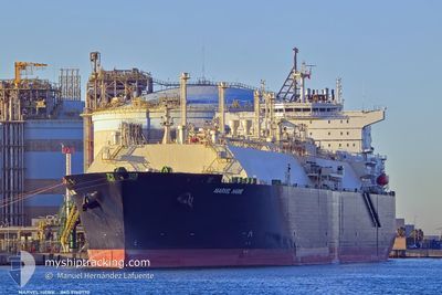
MARVEL HAWK
Tanker D

Current Trip
...
| Time Travelled | 22 days |
|---|---|
| Remaining Time | --- |
| Distance Travelled | 8129.87 nm |
| Remaining Distance | --- |
| AVG Speed | 15.5 Knop |
| MAX Speed | 21.5 Knop |
| AVG Wind | 12.4 knots |
| MAX Wind | 34.8 knots |
| MIN Temp | 12.9°C / 55.22°F |
| MAX Temp | 24.8°C / 76.64°F |
| Djupgående | 8.9 m |
| Position mottagen | 3 d sen |
Current Position
| Longitud | --- |
|---|---|
| Latitude | --- |
| Status | Under way using engine |
| Fart | 18 Knop |
| Kurs | 59° |
| Område | North Atlantic Ocean |
| Station | T-AIS |
| Position mottagen | 3 d sen |
Information
The current position of MARVEL HAWK is in North Atlantic Ocean with coordinates 25.89290° / -76.64818° as reported on 2025-03-05 16:09 by AIS to our vessel tracker app. The vessel's current speed is 18 Knop
The vessel MARVEL HAWK (IMO: 9760770, MMSI: 563063200) is a Tanker D It's sailing under the flag of [SG] Singapore.
In this page you can find informations about the vessels current position, last detected port calls, and current voyage information. If the vessels is not in coverage by AIS you will find the latest position.
The current position of MARVEL HAWK is detected by our AIS receivers and we are not responsible for the reliability of the data. The last position was recorded while the vessel was in Coverage by the Ais receivers of our vessel tracking app.
The current draught of MARVEL HAWK as reported by AIS is 8.9 meters
Weather
| Temperature | 17.5°C / 63.5°F |
|---|---|
| Wind Speed | 14 knots |
| Direction | 249° WSW |
| Pressure | 1012.9 hPa |
| Humidity | 72.2 % |
| Cloud Coverage | --- |


Featured Company
Last Trips
| Origin | Departure | Destination | Arrival | Distance |
|---|
Events
| Tid | Event | Detaljer | Position / Dest | Information |
|---|---|---|---|---|
| 2025-03-05 16:30 | Status ändrad | Default Under way using engine |
25.94826 / -76.54218
...
|
Fart: 18 kn Kurs: 59° |
| 2025-03-05 16:09 | UTANFÖR täckningsområde |
25.89290 / -76.64818
North Atlantic Ocean
...
|
Fart: 18 kn Kurs: 59° |
|
| 2025-03-05 14:52 | Status ändrad | Under way using engine Default |
25.69904 / -77.02925
...
|
Fart: 18.3 kn Kurs: 83° |
| 2025-03-05 14:48 | Status ändrad | Default Under way using engine |
25.69316 / -77.05624
...
|
Fart: 18 kn Kurs: 86° |
| 2025-03-05 14:44 | Status ändrad | Under way using engine Default |
25.69158 / -77.07869
...
|
Fart: 18.1 kn Kurs: 105° |
| 2025-03-05 14:27 | I täckningsområde |
25.69181 / -77.07081
North Atlantic Ocean
...
|
Fart: 18 kn Kurs: 86° |
|
| 2025-03-05 05:41 | Status ändrad | Default Under way using engine |
25.74236 / -79.57440
...
|
Fart: 21.5 kn Kurs: 6.7° |
| 2025-03-05 05:30 | UTANFÖR täckningsområde |
25.67736 / -79.58523
North Atlantic Ocean
...
|
Fart: 21.5 kn Kurs: 6.7° |
|
| 2025-03-05 04:56 | Byter havsområde | Bahamas part of the North Atlantic Ocean United States part of the Gulf of Mexico |
25.47602 / -79.61101
North Atlantic Ocean
...
|
Fart: 21.4 kn Kurs: 6.6° |
| 2025-03-05 04:53 | Status ändrad | Under way using engine Default |
25.46168 / -79.61311
...
|
Fart: 21.3 kn Kurs: 6° |