
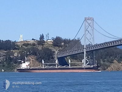
MARTIN ISLAND
General Cargo
Current Trip
| Time Travelled | 6 days |
|---|---|
| Remaining Time | --- |
| Distance Travelled | 89.40 nm |
| Remaining Distance | 5.16 nm |
| AVG Speed | 11.6 Knop |
| MAX Speed | 16.8 Knop |
| AVG Wind | 4.4 knots |
| MAX Wind | 19 knots |
| MIN Temp | 7.8°C / 46.04°F |
| MAX Temp | 17.6°C / 63.68°F |
| Djupgående | 6.3 m |
| Position mottagen | 3 m sen |
Current Position
| Longitud | --- |
|---|---|
| Latitude | --- |
| Status | At anchor |
| Fart | 0.1 Knop |
| Kurs | 173° |
| Område | North Pacific Ocean |
| Station | T-AIS |
| Position mottagen | 3 m sen |
Info
Information
The current position of MARTIN ISLAND is in North Pacific Ocean with coordinates 37.70162° / -122.31537° as reported on 2025-01-04 01:08 by AIS to our vessel tracker app. The vessel's current speed is 0.1 Knop and is heading at the port of SAN FRANCISCO. The estimated time of arrival as calculated by MyShipTracking vessel tracking app is 2024-12-29 01:00 LT
The vessel MARTIN ISLAND (IMO: 9681704, MMSI: 356660000) is a General Cargo that was built in 2014 ( 11 År gammal ). It's sailing under the flag of [PA] Panama.
In this page you can find informations about the vessels current position, last detected port calls, and current voyage information. If the vessels is not in coverage by AIS you will find the latest position.
The current position of MARTIN ISLAND is detected by our AIS receivers and we are not responsible for the reliability of the data. The last position was recorded while the vessel was in Coverage by the Ais receivers of our vessel tracking app.
The current draught of MARTIN ISLAND as reported by AIS is 6.3 meters
Weather
| Temperature | 11.4°C / 52.52°F |
|---|---|
| Wind Speed | 10 knots |
| Direction | 278° W |
| Pressure | 1018.7 hPa |
| Humidity | 84.8 % |
| Cloud Coverage | --- |
Featured Company
Events
| Tid | Event | Detaljer | Position / Dest | Information |
|---|---|---|---|---|
| 2025-01-03 20:08 | Status ändrad | At anchor Default |
37.69915 / -122.31423
US SFO
|
Fart: Kurs: 344° |
| 2025-01-03 20:05 | Status ändrad | Default At anchor |
37.69915 / -122.31428
US SFO
|
Fart: Kurs: 345° |
| 2025-01-03 18:26 | Status ändrad | At anchor Default |
37.69891 / -122.31512
US SFO
|
Fart: 0.1 kn Kurs: 7° |
| 2025-01-03 18:23 | Status ändrad | Default At anchor |
37.69891 / -122.31517
US SFO
|
Fart: Kurs: 6° |
| 2025-01-02 00:20 | Status ändrad | At anchor Default |
37.70138 / -122.31575
US SFO
|
Fart: Kurs: 152° |
| 2025-01-02 00:17 | Status ändrad | Default At anchor |
37.70135 / -122.31571
US SFO
|
Fart: Kurs: 152° |
| 2025-01-01 12:20 | Status ändrad | At anchor Default |
37.70130 / -122.31541
US SFO
|
Fart: 0.1 kn Kurs: 168° |
| 2025-01-01 12:17 | Status ändrad | Default At anchor |
37.70128 / -122.31548
US SFO
|
Fart: 0.1 kn Kurs: 157° |
| 2025-01-01 06:08 | Status ändrad | At anchor Default |
37.69830 / -122.31385
US SFO
|
Fart: 0.1 kn Kurs: 330° |
| 2025-01-01 06:05 | Status ändrad | Default At anchor |
37.69832 / -122.31380
US SFO
|
Fart: 0.1 kn Kurs: 330° |