
MARS
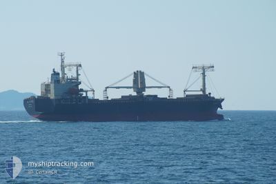
Ro-Ro Cargo
Current Trip
| Time Travelled | 18 days |
|---|---|
| Remaining Time | --- |
| Distance Travelled | 4532.56 nm |
| Remaining Distance | --- |
| AVG Speed | 12.1 Knop |
| MAX Speed | 15.1 Knop |
| AVG Wind | 17 knots |
| MAX Wind | 38 knots |
| MIN Temp | -5.8°C / 21.56°F |
| MAX Temp | 28.7°C / 83.66°F |
| Djupgående | 9.1 m |
| Position mottagen | 7 d sen |
Current Position
| Longitud | --- |
|---|---|
| Latitude | --- |
| Status | Under way using engine |
| Fart | 13.3 Knop |
| Kurs | 280.4° |
| Område | Singapore Strait |
| Station | T-AIS |
| Position mottagen | 7 d sen |
Info
Information
The current position of MARS is in Singapore Strait with coordinates 1.21300° / 103.50671° as reported on 2024-12-19 23:50 by AIS to our vessel tracker app. The vessel's current speed is 13.3 Knop and is heading at the port of PARADIP. The estimated time of arrival as calculated by MyShipTracking vessel tracking app is 2024-12-25 14:00 LT
The vessel MARS (IMO: 9370551, MMSI: 372116000) is a Ro-Ro Cargo that was built in 2006 ( 18 År gammal ). It's sailing under the flag of [PA] Panama.
In this page you can find informations about the vessels current position, last detected port calls, and current voyage information. If the vessels is not in coverage by AIS you will find the latest position.
The current position of MARS is detected by our AIS receivers and we are not responsible for the reliability of the data. The last position was recorded while the vessel was in Coverage by the Ais receivers of our vessel tracking app.
The current draught of MARS as reported by AIS is 9.1 meters
Weather
| Temperature | --- |
|---|---|
| Wind Speed | --- |
| Direction | --- |
| Pressure | --- |
| Humidity | --- |
| Cloud Coverage | --- |
Featured Company
Events
| Tid | Event | Detaljer | Position / Dest | Information |
|---|---|---|---|---|
| 2024-12-25 05:03 | STOPPAR förflyttning | 7.46 nm, East of PARADIP |
20.21991 / 86.79638
IN PRT
|
Fart: 0.3 kn Kurs: 41° |
| 2024-12-19 23:57 | Status ändrad | Default Under way using engine |
1.21900 / 103.48385
IN PRT
|
Fart: 13.3 kn Kurs: 280.4° |
| 2024-12-19 23:50 | UTANFÖR täckningsområde |
1.21300 / 103.50671
Singapore Strait
IN PRT
|
Fart: 13.3 kn Kurs: 280.4° |
|
| 2024-12-19 23:42 | Status ändrad | Under way using engine Default |
1.20703 / 103.53842
IN PRT
|
Fart: 13.4 kn Kurs: 284° |
| 2024-12-19 23:41 | Status ändrad | Default Under way using engine |
1.20610 / 103.54205
IN PRT
|
Fart: 13.6 kn Kurs: 282.9° |
| 2024-12-19 23:29 | Byter havsområde | Malaysian part of the Singapore Strait Indonesian part of the Singapore Strait |
1.19744 / 103.58612
Singapore Strait
IN PRT
|
Fart: 13.9 kn Kurs: 280.9° |
| 2024-12-19 22:53 | Byter havsområde | Indonesian part of the Singapore Strait Singaporean part of the Singapore Strait |
1.14944 / 103.71279
Singapore Strait
IN PRT
|
Fart: 13.4 kn Kurs: 293.5° |
| 2024-12-19 21:29 | Byter havsområde | Singaporean part of the Singapore Strait Indonesian part of the Singapore Strait |
1.25987 / 104.00526
Singapore Strait
IN PRT
|
Fart: 13.1 kn Kurs: 264.5° |
| 2024-12-19 21:07 | Byter havsområde | Indonesian part of the Singapore Strait Malaysian part of the Singapore Strait |
1.26914 / 104.08537
Singapore Strait
IN PRT
|
Fart: 13.1 kn Kurs: 258.7° |
| 2024-12-19 21:04 | Djupgående ändrat | 9.1 5.1 |
1.27197 / 104.09901
IN PRT
|
Fart: 13 kn Kurs: 257.9° |