
MARIN
Not available
Current Trip
| Trip Time | 1 h, 43 mins |
|---|---|
| Trip Distance | 15.54 nm |
| AVG Speed | 8.9 Knop |
| MAX Speed | 13.9 Knop |
| Djupgående | 3 m |
| AVG Wind | 10.1 knots |
| MAX Wind | 11 knots |
| MIN Temp | 28.3°C / 82.94°F |
| MAX Temp | 28.3°C / 82.94°F |
| Position mottagen | 1 m sen |
Current Position
| Longitud | -63.09613° |
|---|---|
| Latitude | 18.03986° |
| Status | Under way sailing |
| Fart | 0.1 Knop |
| Kurs | 46° |
| Område | Caribbean Sea |
| Station | T-AIS |
| Position mottagen | 1 m sen |
Info
Information
The current position of MARIN is in Caribbean Sea with coordinates 18.03986° / -63.09613° as reported on 2024-06-17 15:26 by AIS to our vessel tracker app. The vessel's current speed is 0.1 Knop and is currently inside the port of ST MAARTEN.
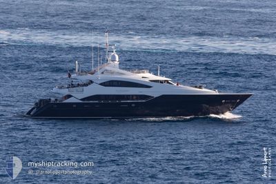
The vessel MARIN (MMSI: 378380000) is a Not available It's sailing under the flag of [VG] British Virgin Is.
In this page you can find informations about the vessels current position, last detected port calls, and current voyage information. If the vessels is not in coverage by AIS you will find the latest position.
The current position of MARIN is detected by our AIS receivers and we are not responsible for the reliability of the data. The last position was recorded while the vessel was in Coverage by the Ais receivers of our vessel tracking app.
The current draught of MARIN as reported by AIS is 3 meters
Weather
| Temperature | 28.3°C / 82.94°F |
|---|---|
| Wind Speed | 7 knots |
| Direction | 126° SE |
| Pressure | 1014 hPa |
| Humidity | 75.3 % |
| Cloud Coverage | 17 % |
Featured Company
Last Port Calls
| Port | Arrival | Departure | Time In Port |
|---|---|---|---|
| 2024-06-16 15:36 | |||
| 2024-06-11 12:50 | 2024-06-16 13:53 | 5 d | |
| 2024-04-07 13:48 | 2024-06-10 20:07 | ||
| 2024-04-06 21:18 | 2024-04-07 12:40 | 15 h | |
| 2024-04-05 19:33 |
Most Visited Ports (Last year)
| Port | Arrivals | |
|---|---|---|
| 7 | ||
| 5 | ||
| 3 | ||
| 2 | ||
| 1 |
Last Trips
| Origin | Departure | Destination | Arrival | Distance | |
|---|---|---|---|---|---|
| 2024-06-16 09:53 | 2024-06-16 11:36 | 15.54 nm | |||
| 2024-06-10 16:07 | 2024-06-11 08:50 | 24.85 nm | |||
| 2024-04-07 08:40 | 2024-04-07 09:48 | 14.45 nm | |||
| 2024-04-05 15:33 | 2024-04-06 17:18 | 3.58 nm |
Events
| Tid | Event | Detaljer | Position / Dest | Information |
|---|---|---|---|---|
| 2024-06-16 15:37 | STOPPAR förflyttning |
18.04027 / -63.09537
[SX] ST MAARTEN
|
Fart: 0.1 kn Kurs: 338° |
|
| 2024-06-16 15:36 | ANLÄNDER HAMN |
|
18.04012 / -63.09524
[SX] ST MAARTEN
|
Fart: 2 kn Kurs: 313° |
| 2024-06-16 14:38 | Byter havsområde | Sint-Maarten part of the Caribbean Sea Saint-Martin part of the Caribbean Sea |
17.97199 / -63.01483
Caribbean Sea
|
Fart: 9.6 kn Kurs: 297.1° |
| 2024-06-16 14:38 | Status ändrad | Under way sailing Default |
17.97199 / -63.01483
ST.MAARTEN
|
Fart: 10.8 kn Kurs: 301° |
| 2024-06-16 14:37 | Destination ändrad | ST.MAARTEN ST.BARTH |
17.96812 / -63.00761
ST.MAARTEN
|
Fart: 10.8 kn Kurs: 301° |
| 2024-06-16 14:27 | I täckningsområde |
17.97199 / -63.01483
Caribbean Sea
|
Fart: 9.6 kn Kurs: 297.1° |
|
| 2024-06-16 13:53 | AVGÅTT HAMN |
|
17.91167 / -62.88833
ST.BARTH
|
Fart: 10.4 kn Kurs: 290° |
| 2024-06-16 13:43 | STARTAR förflyttning |
17.90321 / -62.85899
[BL] GUSTAVIA
|
Fart: 10.4 kn Kurs: 290° |
|
| 2024-06-15 13:18 | Status ändrad | Default At anchor |
17.89833 / -62.85166
[BL] GUSTAVIA
|
Fart: 0.2 kn Kurs: 16° |
| 2024-06-15 13:13 | UTANFÖR täckningsområde |
17.89883 / -62.85229
Caribbean Sea
[BL] GUSTAVIA
|
Fart: 0.2 kn Kurs: 125.8° |