

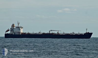
MARIA GLORY
Oil/Chemical Tanker

Current Trip
| Time Travelled | 14 days |
|---|---|
| Remaining Time | --- |
| Distance Travelled | 1285.24 nm |
| Remaining Distance | --- |
| AVG Speed | 10.6 Knop |
| MAX Speed | 15.8 Knop |
| AVG Wind | 6.4 knots |
| MAX Wind | 16.5 knots |
| MIN Temp | 20.2°C / 68.36°F |
| MAX Temp | 27.8°C / 82.04°F |
| Djupgående | 9 m |
| Position mottagen | 2 d sen |
Current Position
| Longitud | --- |
|---|---|
| Latitude | --- |
| Status | Under way using engine |
| Fart | 13.7 Knop |
| Kurs | 95.3° |
| Område | Gulf of Oman |
| Station | T-AIS |
| Position mottagen | 2 d sen |
Information
The current position of MARIA GLORY is in Gulf of Oman with coordinates 25.03829° / 57.20325° as reported on 2025-02-20 13:39 by AIS to our vessel tracker app. The vessel's current speed is 13.7 Knop
The vessel MARIA GLORY (IMO: 9314909, MMSI: 538003855) is a Oil/Chemical Tanker that was built in 2006 ( 19 År gammal ). It's sailing under the flag of [MH] Marshall Is.
In this page you can find informations about the vessels current position, last detected port calls, and current voyage information. If the vessels is not in coverage by AIS you will find the latest position.
The current position of MARIA GLORY is detected by our AIS receivers and we are not responsible for the reliability of the data. The last position was recorded while the vessel was in Coverage by the Ais receivers of our vessel tracking app.
The current draught of MARIA GLORY as reported by AIS is 9 meters
Weather
| Temperature | 22.9°C / 73.22°F |
|---|---|
| Wind Speed | 6 knots |
| Direction | 273° W |
| Pressure | 1017.2 hPa |
| Humidity | 65.2 % |
| Cloud Coverage | --- |


Featured Company
Last Port Calls
| Port | Arrival | Departure | Time In Port |
|---|---|---|---|
| 2025-01-15 16:30 | 2025-02-07 21:34 | 23 d | |
| 2025-01-09 16:45 | 2025-01-13 12:05 | 3 d | |
| 2025-01-03 19:04 | 2025-01-05 12:29 | 1 d | |
| 2024-12-21 13:56 | 2024-12-23 00:01 | 1 d | |
| 2024-12-04 21:48 | 2024-12-06 06:35 | 1 d | |
| 2024-12-01 04:28 | 2024-12-03 05:56 | 2 d |
Last Trips
| Origin | Departure | Destination | Arrival | Distance | |
|---|---|---|---|---|---|
| 2025-01-13 16:05 | 2025-01-15 20:30 | 510.88 nm | |||
| 2025-01-05 16:29 | 2025-01-09 20:45 | 233.20 nm | |||
| 2024-12-23 05:31 | 2025-01-03 23:04 | 3046.23 nm | |||
| 2024-12-06 12:05 | 2024-12-21 19:26 | 317.11 nm | |||
| 2024-12-03 11:56 | 2024-12-05 03:18 | 363.13 nm | |||
| 2024-11-17 20:46 | 2024-12-01 10:28 | 2578.92 nm |
Events
| Tid | Event | Detaljer | Position / Dest | Information |
|---|---|---|---|---|
| 2025-02-22 05:21 | STOPPAR förflyttning | 7.86 nm, South West of SALEHAABAD ISLAND |
24.73586 / 66.84731
PK KHI
|
Fart: 0.2 kn Kurs: 139° |
| 2025-02-20 13:41 | Status ändrad | Default Under way using engine |
25.03725 / 57.21236
PK KHI
|
Fart: 13.7 kn Kurs: 95.3° |
| 2025-02-20 13:39 | UTANFÖR täckningsområde |
25.03829 / 57.20325
Gulf of Oman
PK KHI
|
Fart: 13.7 kn Kurs: 95.3° |
|
| 2025-02-20 13:25 | Status ändrad | Under way using engine Default |
25.04407 / 57.14368
PK KHI
|
Fart: 13.6 kn Kurs: 97° |
| 2025-02-20 13:04 | Status ändrad | Default Under way using engine |
25.05350 / 57.05988
PK KHI
|
Fart: 13.4 kn Kurs: 97.9° |
| 2025-02-20 12:33 | Upptäckt i hav | Omani part of the Gulf of Oman |
25.07034 / 56.93084
Gulf of Oman
PK KHI
|
Fart: 13.8 kn Kurs: 98.1° |
| 2025-02-20 12:28 | Status ändrad | Under way using engine Default |
25.07335 / 56.90845
PK KHI
|
Fart: 13.9 kn Kurs: 99° |
| 2025-02-20 12:21 | Status ändrad | Default Under way using engine |
25.07710 / 56.88102
PK KHI
|
Fart: 13.9 kn Kurs: 99.2° |
| 2025-02-20 10:47 | Status ändrad | Under way using engine Moored |
25.11989 / 56.47320
PK KHI
|
Fart: 14.1 kn Kurs: 89.6° |
| 2025-02-20 09:46 | STARTAR förflyttning | 3.62 nm, North of FUJAIRAH |
25.20951 / 56.36901
PK KHI
|
Fart: 3.5 kn Kurs: 15° |