
SIDER PANORAMA
General Cargo
Current Trip
| Time Travelled | 17 days |
|---|---|
| Remaining Time | 3 days |
| Distance Travelled | 4062.11 nm |
| Remaining Distance | 976.63 nm |
| AVG Speed | 10 Knop |
| MAX Speed | 12 Knop |
| AVG Wind | 17.2 knots |
| MAX Wind | 29 knots |
| MIN Temp | 18.8°C / 65.84°F |
| MAX Temp | 30.6°C / 87.08°F |
| Djupgående | 8.5 m |
| Position mottagen | 3 d sen |
Current Position
| Longitud | 57.43510° |
|---|---|
| Latitude | -20.15499° |
| Status | At anchor |
| Fart | 0.2 Knop |
| Kurs | 134° |
| Område | Singapore Strait |
| Station | T-AIS |
| Position mottagen | 3 d sen |
Info
Information
The current position of SIDER PANORAMA is in Singapore Strait with coordinates -20.15499° / 57.43510° as reported on 2024-06-06 04:57 by AIS to our vessel tracker app. The vessel's current speed is 0.2 Knop and is heading at the port of PORT LOUIS. The estimated time of arrival as calculated by MyShipTracking vessel tracking app is 2024-06-14 05:08 LT
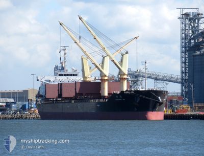
The vessel SIDER PANORAMA (IMO: 9495583, MMSI: 373139000) is a General Cargo that was built in 2012 ( 12 År gammal ). It's sailing under the flag of [PA] Panama.
In this page you can find informations about the vessels current position, last detected port calls, and current voyage information. If the vessels is not in coverage by AIS you will find the latest position.
The current position of SIDER PANORAMA is detected by our AIS receivers and we are not responsible for the reliability of the data. The last position was recorded while the vessel was in Coverage by the Ais receivers of our vessel tracking app.
The current draught of SIDER PANORAMA as reported by AIS is 8.5 meters
Weather
| Temperature | 19°C / 66.2°F |
|---|---|
| Wind Speed | 20 knots |
| Direction | 131° SE |
| Pressure | 1029.5 hPa |
| Humidity | 70.3 % |
| Cloud Coverage | 13 % |
Featured Company
Last Port Calls
| Port | Arrival | Departure | Time In Port |
|---|---|---|---|
| 2024-05-21 16:33 | 2024-05-24 03:21 | 2 d | |
| 2024-05-02 20:45 | 2024-05-04 21:59 | 2 d | |
| 2024-04-28 08:04 | 2024-05-02 12:12 | 4 d | |
| 2024-04-04 05:57 | 2024-04-10 17:13 | 6 d |
Last Trips
| Origin | Departure | Destination | Arrival | Distance | |
|---|---|---|---|---|---|
| 2024-05-04 21:59 | 2024-05-21 16:33 | 2479.59 nm | |||
| 2024-05-02 12:12 | 2024-05-02 20:45 | 98.57 nm | |||
| 2024-04-10 17:13 | 2024-04-28 08:04 | 3595.59 nm |
Events
| Tid | Event | Detaljer | Position / Dest | Information |
|---|---|---|---|---|
| 2024-06-06 05:06 | Status ändrad | Default At anchor |
-20.15503 / 57.43516
MU PLU
|
Fart: 0.2 kn Kurs: 134° |
| 2024-06-06 04:57 | UTANFÖR täckningsområde |
-20.15499 / 57.43510
Singapore Strait
|
Fart: 0.2 kn Kurs: 176.1° |
|
| 2024-06-05 17:09 | Status ändrad | At anchor Default |
-20.15459 / 57.43598
MU PLU
|
Fart: Kurs: -1° |
| 2024-06-05 16:58 | Status ändrad | Default At anchor |
-20.15333 / 57.43500
MU PLU
|
Fart: 0.1 kn Kurs: 145° |
| 2024-06-05 14:21 | Status ändrad | At anchor Default |
-20.15661 / 57.43502
MU PLU
|
Fart: 0.1 kn Kurs: 82° |
| 2024-06-05 14:18 | Status ändrad | Default At anchor |
-20.15661 / 57.43507
MU PLU
|
Fart: 0.1 kn Kurs: 83° |
| 2024-06-05 12:54 | Status ändrad | At anchor Under way using engine |
-20.15549 / 57.43582
MU PLU
|
Fart: 0.7 kn Kurs: 123° |
| 2024-06-05 12:52 | Djupgående ändrat | 8.5 5.9 |
-20.15544 / 57.43617
MU PLU
|
Fart: 0.4 kn Kurs: 113° |
| 2024-06-05 12:52 | Destination ändrad | MU PLU IN PRT |
-20.15544 / 57.43617
MU PLU
|
Fart: 0.5 kn Kurs: 115° |
| 2024-06-05 12:52 | ETA ändrat | 2024/06/05 12:00 2024/05/21 17:00 |
-20.15544 / 57.43617
MU PLU
|
Fart: 0.5 kn Kurs: 115° |