
MANISA EMY
General Cargo
Current Trip
| Time Travelled | 6 days |
|---|---|
| Remaining Time | --- |
| Distance Travelled | 1640.94 nm |
| Remaining Distance | --- |
| AVG Speed | 10.2 Knop |
| MAX Speed | 10.2 Knop |
| AVG Wind | 13.3 knots |
| MAX Wind | 34.9 knots |
| MIN Temp | 13.8°C / 56.84°F |
| MAX Temp | 22.3°C / 72.14°F |
| Djupgående | 5.8 m |
| Position mottagen | 8 h, 30 m sen |
Current Position
| Longitud | 35.85222° |
|---|---|
| Latitude | 36.50075° |
| Status | Under way using engine |
| Fart | 10.5 Knop |
| Kurs | 51° |
| Område | Mediterranean Sea - Eastern Basin |
| Station | T-AIS |
| Position mottagen | 8 h, 30 m sen |
Info
Information
The current position of MANISA EMY is in Mediterranean Sea - Eastern Basin with coordinates 36.50075° / 35.85222° as reported on 2024-05-04 04:14 by AIS to our vessel tracker app. The vessel's current speed is 10.5 Knop
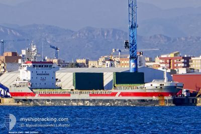
The vessel MANISA EMY (IMO: 9421063, MMSI: 244790314) is a General Cargo that was built in 2008 ( 16 År gammal ). It's sailing under the flag of [NL] Netherlands.
In this page you can find informations about the vessels current position, last detected port calls, and current voyage information. If the vessels is not in coverage by AIS you will find the latest position.
The current position of MANISA EMY is detected by our AIS receivers and we are not responsible for the reliability of the data. The last position was recorded while the vessel was in Coverage by the Ais receivers of our vessel tracking app.
The current draught of MANISA EMY as reported by AIS is 5.8 meters
Weather
| Temperature | 21.2°C / 70.16°F |
|---|---|
| Wind Speed | 22 knots |
| Direction | 198° SSW |
| Pressure | 1005.2 hPa |
| Humidity | 72.8 % |
| Cloud Coverage | 98 % |
Featured Company
Last Port Calls
| Port | Arrival | Departure | Time In Port |
|---|---|---|---|
| 2024-04-24 10:34 | 2024-04-27 14:40 | 3 d | |
| 2024-04-20 13:32 | 2024-04-24 09:48 | 3 d | |
| 2024-04-16 11:00 | 2024-04-19 18:18 | 3 d | |
| 2024-04-10 10:34 | 2024-04-11 14:56 | 1 d | |
| 2024-04-09 13:05 | 2024-04-09 22:24 | 9 h | |
| 2024-04-06 21:30 | 2024-04-08 12:27 | 1 d | |
| 2024-04-03 15:06 | 2024-04-05 10:08 | 1 d | |
| 2024-03-25 09:27 | 2024-03-26 12:57 | 1 d | |
| 2024-03-06 21:19 | 2024-03-10 22:34 | 4 d |
Last Trips
| Origin | Departure | Destination | Arrival | Distance | |
|---|---|---|---|---|---|
| 2024-04-24 11:48 | 2024-04-24 12:34 | 3.20 nm | |||
| 2024-04-19 20:18 | 2024-04-20 15:32 | 204.87 nm | |||
| 2024-04-11 17:56 | 2024-04-16 13:00 | 1063.79 nm | |||
| 2024-04-10 01:24 | 2024-04-10 13:34 | 1.61 nm | |||
| 2024-04-08 15:27 | 2024-04-09 16:05 | 287.57 nm | |||
| 2024-04-05 13:08 | 2024-04-07 00:30 | 347.91 nm | |||
| 2024-03-26 13:57 | 2024-04-03 18:06 | 1598.64 nm | |||
| 2024-03-10 23:34 | 2024-03-25 10:27 | 2435.63 nm | |||
| 2024-02-25 13:04 | 2024-03-06 22:19 | 2001.95 nm |
Events
| Tid | Event | Detaljer | Position / Dest | Information |
|---|---|---|---|---|
| 2024-05-04 04:14 | UTANFÖR täckningsområde |
36.50075 / 35.85222
Mediterranean Sea - Eastern Basin
ISDEMIR
|
Fart: 10.5 kn Kurs: 51° |
|
| 2024-05-04 01:34 | I täckningsområde |
36.29711 / 35.36867
Mediterranean Sea - Eastern Basin
ISDEMIR
|
Fart: 10.5 kn Kurs: 71° |
|
| 2024-05-03 18:28 | UTANFÖR täckningsområde |
35.89065 / 33.89617
Mediterranean Sea - Eastern Basin
ISDEMIR
|
Fart: 10.5 kn Kurs: 78° |
|
| 2024-05-03 15:47 | Byter havsområde | Turkish part of the Mediterranean Sea - Eastern Basin Greek part of the Mediterranean Sea - Eastern Basin |
35.98214 / 33.49237
Mediterranean Sea - Eastern Basin
ISDEMIR
|
Fart: 10.5 kn Kurs: 80.3° |
| 2024-05-03 15:45 | Status ändrad | Under way using engine Default |
35.98105 / 33.48478
ISDEMIR
|
Fart: 10 kn Kurs: 82° |
| 2024-05-03 15:45 | I täckningsområde |
35.98214 / 33.49237
Mediterranean Sea - Eastern Basin
ISDEMIR
|
Fart: 10.5 kn Kurs: 80.3° |
|
| 2024-05-02 22:21 | Status ändrad | Default Under way using engine |
35.84318 / 29.81491
ISDEMIR
|
Fart: 10 kn Kurs: 89.3° |
| 2024-05-02 22:11 | UTANFÖR täckningsområde |
35.84307 / 29.78078
Mediterranean Sea - Eastern Basin
ISDEMIR
|
Fart: 10 kn Kurs: 89.3° |
|
| 2024-05-02 21:13 | Status ändrad | Under way using engine Default |
35.83769 / 29.57545
ISDEMIR
|
Fart: 10 kn Kurs: 88° |
| 2024-05-02 21:00 | I täckningsområde |
35.83769 / 29.57545
Mediterranean Sea - Eastern Basin
ISDEMIR
|
Fart: 10.3 kn Kurs: 86.9° |