
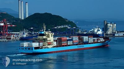
MAERSK JABAL
Container Ship
Current Trip
| Time Travelled | 5 days |
|---|---|
| Remaining Time | --- |
| Distance Travelled | 1413.94 nm |
| Remaining Distance | --- |
| AVG Speed | 11.1 Knop |
| MAX Speed | 18.2 Knop |
| AVG Wind | 14 knots |
| MAX Wind | 32 knots |
| MIN Temp | 14.2°C / 57.56°F |
| MAX Temp | 22.1°C / 71.78°F |
| Djupgående | 8.5 m |
| Position mottagen | 1 h, 19 m sen |
Current Position
| Longitud | --- |
|---|---|
| Latitude | --- |
| Status | Under way using engine |
| Fart | 7.7 Knop |
| Kurs | 120.8° |
| Område | Alboran Sea |
| Station | T-AIS |
| Position mottagen | 1 h, 19 m sen |
Info
Information
The current position of MAERSK JABAL is in Alboran Sea with coordinates 35.72816° / -4.81916° as reported on 2024-12-27 21:11 by AIS to our vessel tracker app. The vessel's current speed is 7.7 Knop and is heading at the port of TANGER MED. The estimated time of arrival as calculated by MyShipTracking vessel tracking app is 2024-12-28 18:30 LT
The vessel MAERSK JABAL (IMO: 9343077, MMSI: 565936000) is a Container Ship that was built in 2008 ( 16 År gammal ). It's sailing under the flag of [SG] Singapore.
In this page you can find informations about the vessels current position, last detected port calls, and current voyage information. If the vessels is not in coverage by AIS you will find the latest position.
The current position of MAERSK JABAL is detected by our AIS receivers and we are not responsible for the reliability of the data. The last position was recorded while the vessel was in Coverage by the Ais receivers of our vessel tracking app.
The current draught of MAERSK JABAL as reported by AIS is 8.5 meters
Weather
| Temperature | 15.7°C / 60.26°F |
|---|---|
| Wind Speed | 22 knots |
| Direction | 97° E |
| Pressure | 1027.5 hPa |
| Humidity | 64 % |
| Cloud Coverage | 2 % |
Featured Company
Last Port Calls
| Port | Arrival | Departure | Time In Port |
|---|---|---|---|
| 2024-12-20 11:34 | 2024-12-22 10:50 | 1 d | |
| 2024-12-07 17:29 | 2024-12-09 09:49 | 1 d | |
| 2024-11-28 05:53 | 2024-11-28 12:50 | 6 h | |
| 2024-10-31 04:01 | 2024-10-31 15:25 | 11 h | |
| 2024-10-18 19:49 | 2024-10-20 19:30 | 1 d | |
| 2024-10-16 09:22 | 2024-10-17 17:58 | 1 d | |
| 2024-10-06 05:41 | 2024-10-06 20:54 | 15 h | |
| 2024-10-01 08:07 |
Last Trips
| Origin | Departure | Destination | Arrival | Distance | |
|---|---|---|---|---|---|
| 2024-12-09 10:49 | 2024-12-20 11:34 | 2255.60 nm | |||
| 2024-11-28 13:50 | 2024-12-07 18:29 | 3171.86 nm | |||
| 2024-10-31 16:25 | 2024-11-28 06:53 | 6237.06 nm | |||
| 2024-10-20 19:30 | 2024-10-31 05:01 | 2183.77 nm | |||
| 2024-10-17 17:58 | 2024-10-18 19:49 | 184.85 nm | |||
| 2024-10-06 21:54 | 2024-10-16 09:22 | 2164.14 nm | |||
| 2024-10-01 08:07 | 2024-10-06 06:41 | 2053.99 nm |
Events
| Tid | Event | Detaljer | Position / Dest | Information |
|---|---|---|---|---|
| 2024-12-27 21:18 | Status ändrad | Default Under way using engine |
35.71996 / -4.80308
MRNLU>MAPTM
|
Fart: 7.7 kn Kurs: 120.8° |
| 2024-12-27 21:11 | UTANFÖR täckningsområde |
35.72816 / -4.81916
Alboran Sea
MRNLU>MAPTM
|
Fart: 7.7 kn Kurs: 120.8° |
|
| 2024-12-27 20:55 | Status ändrad | Under way using engine Default |
35.74459 / -4.85481
MRNLU>MAPTM
|
Fart: 7.7 kn Kurs: 119° |
| 2024-12-27 20:54 | Status ändrad | Default Under way using engine |
35.74610 / -4.85837
MRNLU>MAPTM
|
Fart: 7.9 kn Kurs: 117.4° |
| 2024-12-27 19:56 | Byter havsområde | Moroccan part of the Alboran Sea Spanish part of the Alboran Sea |
35.79568 / -4.99223
Alboran Sea
MRNLU>MAPTM
|
Fart: 5.7 kn Kurs: 146.5° |
| 2024-12-27 19:56 | Status ändrad | Under way using engine Default |
35.79568 / -4.99223
MRNLU>MAPTM
|
Fart: 5.9 kn Kurs: 206° |
| 2024-12-27 19:51 | Status ändrad | Default Under way using engine |
35.80286 / -4.99144
MRNLU>MAPTM
|
Fart: 5.5 kn Kurs: 187.7° |
| 2024-12-27 19:38 | Byter havsområde | Spanish part of the Alboran Sea Moroccan part of the Alboran Sea |
35.79640 / -4.97656
Alboran Sea
MRNLU>MAPTM
|
Fart: 7.3 kn Kurs: 342.7° |
| 2024-12-27 18:58 | Status ändrad | Under way using engine Default |
35.77455 / -4.96341
MRNLU>MAPTM
|
Fart: 3.1 kn Kurs: 8° |
| 2024-12-27 18:48 | Status ändrad | Default Under way using engine |
35.76963 / -4.96049
MRNLU>MAPTM
|
Fart: 1.1 kn Kurs: 4° |