
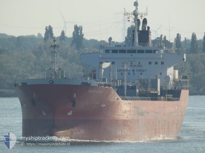
M/T GLEN COVE
Tanker
Current Trip
| Time Travelled | 3 days |
|---|---|
| Remaining Time | 9 h, 59 mins |
| Distance Travelled | 315.67 nm |
| Remaining Distance | 85.47 nm |
| AVG Speed | 7.7 Knop |
| MAX Speed | 12.3 Knop |
| AVG Wind | 12.2 knots |
| MAX Wind | 27 knots |
| MIN Temp | 9.8°C / 49.64°F |
| MAX Temp | 21.4°C / 70.52°F |
| Djupgående | 7 m |
| Position mottagen | Nu |
Current Position
| Longitud | 2.84912° |
|---|---|
| Latitude | 52.47377° |
| Status | Under way using engine |
| Fart | 9.1 Knop |
| Kurs | 188° |
| Område | North Sea |
| Station | T-AIS |
| Position mottagen | Nu |
Info
Information
The current position of M/T GLEN COVE is in North Sea with coordinates 52.47377° / 2.84912° as reported on 2024-05-05 05:32 by AIS to our vessel tracker app. The vessel's current speed is 9.1 Knop and is heading at the port of TERNEUZEN. The estimated time of arrival as calculated by MyShipTracking vessel tracking app is 2024-05-05 15:32 LT
The vessel M/T GLEN COVE (IMO: 9414228, MMSI: 538009346) is a Tanker It's sailing under the flag of [MH] Marshall Is.
In this page you can find informations about the vessels current position, last detected port calls, and current voyage information. If the vessels is not in coverage by AIS you will find the latest position.
The current position of M/T GLEN COVE is detected by our AIS receivers and we are not responsible for the reliability of the data. The last position was recorded while the vessel was in Coverage by the Ais receivers of our vessel tracking app.
The current draught of M/T GLEN COVE as reported by AIS is 7 meters
Weather
| Temperature | 10.4°C / 50.72°F |
|---|---|
| Wind Speed | 6 knots |
| Direction | 246° WSW |
| Pressure | 1008.8 hPa |
| Humidity | 85.6 % |
| Cloud Coverage | 37 % |
Featured Company
Last Trips
Events
| Tid | Event | Detaljer | Position / Dest | Information |
|---|---|---|---|---|
| 2024-05-05 05:08 | Status ändrad | Under way using engine Default |
52.53437 / 2.86355
GHENT
|
Fart: 8.8 kn Kurs: 197° |
| 2024-05-05 04:49 | Status ändrad | Default Under way using engine |
52.58014 / 2.87370
GHENT
|
Fart: 8.6 kn Kurs: 179° |
| 2024-05-05 04:17 | Status ändrad | Under way using engine Default |
52.64708 / 2.88242
GHENT
|
Fart: 0.7 kn Kurs: 316° |
| 2024-05-05 04:04 | Status ändrad | Default Under way using engine |
52.64700 / 2.88263
GHENT
|
Fart: 0.6 kn Kurs: 310° |
| 2024-05-05 03:52 | Status ändrad | Under way using engine Default |
52.64823 / 2.87951
GHENT
|
Fart: 0.6 kn Kurs: 285° |
| 2024-05-05 03:48 | Status ändrad | Default Under way using engine |
52.64848 / 2.87858
GHENT
|
Fart: 0.6 kn Kurs: 268° |
| 2024-05-05 03:30 | Status ändrad | Under way using engine Default |
52.64874 / 2.87310
GHENT
|
Fart: 0.6 kn Kurs: 243° |
| 2024-05-05 03:28 | Status ändrad | Default Under way using engine |
52.64869 / 2.87260
GHENT
|
Fart: 0.5 kn Kurs: 243° |
| 2024-05-05 02:51 | Byter havsområde | United Kingdom part of the North Sea Dutch part of the North Sea |
52.64511 / 2.86432
North Sea
GHENT
|
Fart: 0.6 kn Kurs: 30° |
| 2024-05-05 02:51 | Status ändrad | Under way using engine Default |
52.64511 / 2.86432
GHENT
|
Fart: 0.7 kn Kurs: 246° |