
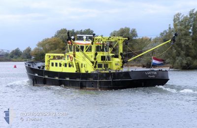
LUCTOR
Research/Survey Vessel
Current Trip
| Time Travelled | 1 h, 28 mins |
|---|---|
| Remaining Time | --- |
| Distance Travelled | 9.10 nm |
| Remaining Distance | --- |
| AVG Speed | 6.4 Knop |
| MAX Speed | 7.7 Knop |
| AVG Wind | 11 knots |
| MAX Wind | 13.5 knots |
| MIN Temp | 3.7°C / 38.66°F |
| MAX Temp | 3.9°C / 39.02°F |
| Djupgående | 1.5 m |
| Position mottagen | 1 m sen |
Current Position
| Longitud | --- |
|---|---|
| Latitude | --- |
| Status | Engaged in Fishing |
| Fart | 7.6 Knop |
| Kurs | 168.3° |
| Område | North Sea |
| Station | T-AIS |
| Position mottagen | 1 m sen |
Info
Information
The current position of LUCTOR is in North Sea with coordinates 51.57326° / 3.96114° as reported on 2026-01-06 13:40 by AIS to our vessel tracker app. The vessel's current speed is 7.6 Knop
The vessel LUCTOR (IMO: 8510697, MMSI: 244486000) is a Research/Survey Vessel that was built in 1985 ( 41 År gammal ). It's sailing under the flag of [NL] Netherlands.
In this page you can find informations about the vessels current position, last detected port calls, and current voyage information. If the vessels is not in coverage by AIS you will find the latest position.
The current position of LUCTOR is detected by our AIS receivers and we are not responsible for the reliability of the data. The last position was recorded while the vessel was in Coverage by the Ais receivers of our vessel tracking app.
The current draught of LUCTOR as reported by AIS is 1.5 meters
Weather
| Temperature | 3.9°C / 39.02°F |
|---|---|
| Wind Speed | 10 knots |
| Direction | 265° W |
| Pressure | 1015.8 hPa |
| Humidity | 65.3 % |
| Cloud Coverage | 6 % |
Featured Company
Last Port Calls
| Port | Arrival | Departure | Time In Port |
|---|---|---|---|
| 2026-01-06 11:44 | 2026-01-06 13:14 | 1 h | |
| 2026-01-05 15:12 | 2026-01-06 08:00 | 16 h | |
| 2025-12-19 13:51 | 2026-01-05 08:33 | 16 d | |
| 2025-12-18 15:37 | 2025-12-19 10:13 | 18 h | |
| 2025-12-17 14:26 | 2025-12-18 07:42 | 17 h | |
| 2025-12-16 15:50 | 2025-12-17 08:04 | 16 h | |
| 2025-12-16 11:46 | 2025-12-16 14:13 | 2 h | |
| 2025-12-15 15:53 | 2025-12-16 07:59 | 16 h | |
| 2025-12-12 14:04 | 2025-12-15 07:46 | 2 d | |
| 2025-12-11 14:50 | 2025-12-12 08:25 | 17 h |
Most Visited Ports (Last year)
| Port | Arrivals | |
|---|---|---|
| 107 | ||
| 27 | ||
| 16 | ||
| 12 | ||
| 9 | ||
| 8 |
Last Trips
| Origin | Departure | Destination | Arrival | Distance | |
|---|---|---|---|---|---|
| 2026-01-06 08:00 | 2026-01-06 11:44 | 24.33 nm | |||
| 2026-01-05 08:33 | 2026-01-05 15:12 | 38.63 nm | |||
| 2025-12-19 10:13 | 2025-12-19 13:51 | 10.63 nm | |||
| 2025-12-18 07:42 | 2025-12-18 15:37 | 36.64 nm | |||
| 2025-12-17 08:04 | 2025-12-17 14:26 | 24.73 nm | |||
| 2025-12-16 14:13 | 2025-12-16 15:50 | 8.77 nm | |||
| 2025-12-16 07:59 | 2025-12-16 11:46 | 15.74 nm | |||
| 2025-12-15 07:46 | 2025-12-15 15:53 | 26.13 nm | |||
| 2025-12-12 08:25 | 2025-12-12 14:04 | 11.19 nm | |||
| 2025-12-11 13:24 | 2025-12-11 14:50 | 10.99 nm |
Events
| Tid | Event | Detaljer | Position / Dest | Information |
|---|---|---|---|---|
| 2026-01-06 13:23 | Status ändrad | Engaged in Fishing Default |
51.60362 / 3.97779
YERSEKE
|
Fart: 6.2 kn Kurs: 275° |
| 2026-01-06 13:21 | Status ändrad | Default Engaged in Fishing |
51.60392 / 3.98331
YERSEKE
|
Fart: 6.2 kn Kurs: 270.6° |
| 2026-01-06 13:10 | Status ändrad | Engaged in Fishing Default |
51.60369 / 4.01194
YERSEKE
|
Fart: 6 kn Kurs: 242° |
| 2026-01-06 12:26 | Status ändrad | Default Engaged in Fishing |
51.64843 / 4.09930
YERSEKE
|
Fart: 5.5 kn Kurs: 211.6° |
| 2026-01-06 12:20 | Status ändrad | Engaged in Fishing Default |
51.65605 / 4.10631
YERSEKE
|
Fart: 5 kn Kurs: 124° |
| 2026-01-06 12:20 | I täckningsområde |
51.65342 / 4.10363
North Sea
|
Fart: 5.5 kn Kurs: 211.6° |
|
| 2026-01-06 12:14 | STARTAR förflyttning | 0.61 nm, South East of BRUINISSE |
51.66337 / 4.10395
YERSEKE
|
Fart: 5 kn Kurs: 124° |
| 2026-01-06 12:14 | AVGÅTT HAMN |
|
51.66337 / 4.10395
YERSEKE
|
Fart: 4.6 kn Kurs: 113° |
| 2026-01-06 10:49 | STOPPAR förflyttning |
51.66519 / 4.09833
[NL] BRUINISSE
|
Fart: Kurs: 315° |
|
| 2026-01-06 10:11 | UTANFÖR täckningsområde |
51.64761 / 4.16827
North Sea
[NL] BRUINISSE
|
Fart: 2.3 kn Kurs: 305.1° |