
LINDE-G
Not available
Current Trip
NAWVB DRYDOCK
| Time Travelled | 9 days |
|---|---|
| Remaining Time | --- |
| Distance Travelled | 1640.25 nm |
| Remaining Distance | --- |
| AVG Speed | 8 Knop |
| MAX Speed | 20.5 Knop |
| AVG Wind | 15 knots |
| MAX Wind | 20 knots |
| MIN Temp | 24.4°C / 75.92°F |
| MAX Temp | 27°C / 80.6°F |
| Djupgående | 3.1 m |
| Position mottagen | 2 d sen |
Current Position
| Longitud | --- |
|---|---|
| Latitude | --- |
| Status | Under way using engine |
| Fart | 3.5 Knop |
| Kurs | 43° |
| Område | North Atlantic Ocean |
| Station | T-AIS |
| Position mottagen | 2 d sen |
Info
Information
The current position of LINDE-G is in North Atlantic Ocean with coordinates 7.64389° / -54.61964° as reported on 2025-02-26 22:21 by AIS to our vessel tracker app. The vessel's current speed is 3.5 Knop
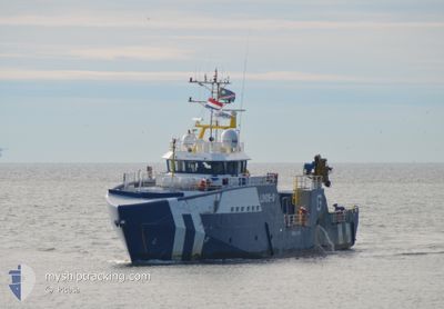
The vessel LINDE-G (IMO: 9731298, MMSI: 538008216) is a Not available It's sailing under the flag of [MH] Marshall Is.
In this page you can find informations about the vessels current position, last detected port calls, and current voyage information. If the vessels is not in coverage by AIS you will find the latest position.
The current position of LINDE-G is detected by our AIS receivers and we are not responsible for the reliability of the data. The last position was recorded while the vessel was in Coverage by the Ais receivers of our vessel tracking app.
The current draught of LINDE-G as reported by AIS is 3.1 meters
Weather
| Temperature | 26.2°C / 79.16°F |
|---|---|
| Wind Speed | 15 knots |
| Direction | 55° NE |
| Pressure | 1010.6 hPa |
| Humidity | 73.7 % |
| Cloud Coverage | 85 % |
Featured Company
Last Port Calls
| Port | Arrival | Departure | Time In Port |
|---|---|---|---|
| 2025-02-18 23:37 | 2025-02-19 22:55 | 23 h | |
| 2025-01-21 13:11 | 2025-01-22 12:40 | 23 h |
Most Visited Ports (Last year)
| Port | Arrivals | |
|---|---|---|
| 8 | ||
| 1 | ||
| 1 | ||
| 1 | ||
| 1 | ||
| 1 |
Last Trips
| Origin | Departure | Destination | Arrival | Distance | |
|---|---|---|---|---|---|
| 2025-01-22 09:40 | 2025-02-18 20:37 | 3500.64 nm | |||
| 2024-12-26 13:03 | 2025-01-21 10:11 | 3081.85 nm |
Events
| Tid | Event | Detaljer | Position / Dest | Information |
|---|---|---|---|---|
| 2025-02-26 22:24 | Status ändrad | Default Under way using engine |
7.64685 / -54.61911
NAWVB DRYDOCK
|
Fart: 3.5 kn Kurs: 43° |
| 2025-02-26 22:21 | Status ändrad | Under way using engine Default |
7.64389 / -54.61964
NAWVB DRYDOCK
|
Fart: 3.7 kn Kurs: 44° |
| 2025-02-26 22:21 | UTANFÖR täckningsområde |
7.64389 / -54.61964
North Atlantic Ocean
|
Fart: 3.5 kn Kurs: 15.2° |
|
| 2025-02-26 22:05 | Status ändrad | Default Under way using engine |
7.62738 / -54.62362
NAWVB DRYDOCK
|
Fart: 1.4 kn Kurs: 49° |
| 2025-02-26 21:59 | Status ändrad | Under way using engine Default |
7.62276 / -54.62179
NAWVB DRYDOCK
|
Fart: 7 kn Kurs: 14° |
| 2025-02-26 21:50 | Status ändrad | Default Under way using engine |
7.60999 / -54.62439
NAWVB DRYDOCK
|
Fart: 6.1 kn Kurs: 21.4° |
| 2025-02-26 21:36 | Status ändrad | Under way using engine Default |
7.58796 / -54.63026
NAWVB DRYDOCK
|
Fart: 4.3 kn Kurs: 48° |
| 2025-02-26 21:34 | Status ändrad | Default Under way using engine |
7.58395 / -54.63086
NAWVB DRYDOCK
|
Fart: 3.9 kn Kurs: 70° |
| 2025-02-26 19:33 | Status ändrad | Under way using engine Default |
7.50929 / -54.69462
NAWVB DRYDOCK
|
Fart: 4.7 kn Kurs: 66° |
| 2025-02-26 19:27 | I täckningsområde |
7.50929 / -54.69462
North Atlantic Ocean
|
Fart: 4.4 kn Kurs: 55.2° |