

LENA
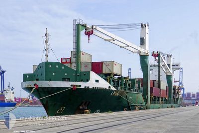
Container Ship

Current Trip
| Time Travelled | 1 day |
|---|---|
| Remaining Time | 8 h, 46 mins |
| Distance Travelled | 675.47 nm |
| Remaining Distance | 390.82 nm |
| AVG Speed | 13 Knop |
| MAX Speed | 16 Knop |
| AVG Wind | 14.2 knots |
| MAX Wind | 18 knots |
| MIN Temp | 22.7°C / 72.86°F |
| MAX Temp | 28.6°C / 83.48°F |
| Djupgående | 8.2 m |
| Position mottagen | 1 d sen |
Current Position
| Longitud | --- |
|---|---|
| Latitude | --- |
| Status | Under way using engine |
| Fart | 13.4 Knop |
| Kurs | 206.3° |
| Område | North Atlantic Ocean |
| Station | T-AIS |
| Position mottagen | 1 d sen |
Information
The current position of LENA is in North Atlantic Ocean with coordinates 24.80229° / -80.18714° as reported on 2025-03-04 01:26 by AIS to our vessel tracker app. The vessel's current speed is 13.4 Knop and is heading at the port of PUERTO SANTO TOMAS. The estimated time of arrival as calculated by MyShipTracking vessel tracking app is 2025-03-06 04:52 LT
The vessel LENA (IMO: 9347750, MMSI: 210740000) is a Container Ship that was built in 2006 ( 19 År gammal ). It's sailing under the flag of [CY] Cyprus.
In this page you can find informations about the vessels current position, last detected port calls, and current voyage information. If the vessels is not in coverage by AIS you will find the latest position.
The current position of LENA is detected by our AIS receivers and we are not responsible for the reliability of the data. The last position was recorded while the vessel was in Coverage by the Ais receivers of our vessel tracking app.
The current draught of LENA as reported by AIS is 8.2 meters
Weather
| Temperature | 27.1°C / 80.78°F |
|---|---|
| Wind Speed | 8 knots |
| Direction | 114° ESE |
| Pressure | 1011 hPa |
| Humidity | 77.4 % |
| Cloud Coverage | 5 % |


Featured Company
Last Port Calls
| Port | Arrival | Departure | Time In Port |
|---|---|---|---|
| 2025-03-02 14:12 | 2025-03-03 20:14 | 1 d | |
| 2025-02-26 12:39 | 2025-02-28 03:13 | 1 d | |
| 2025-02-23 09:26 | 2025-02-24 02:48 | 17 h | |
| 2025-02-19 12:35 | 2025-02-20 15:51 | 1 d | |
| 2025-02-16 13:32 | 2025-02-17 03:47 | 14 h | |
| 2025-02-12 11:55 | 2025-02-14 03:56 | 1 d | |
| 2025-02-11 06:50 | 2025-02-12 06:39 | 23 h | |
| 2025-02-07 19:13 | 2025-02-08 16:12 | 20 h | |
| 2025-02-03 21:15 | 2025-02-05 06:31 | 1 d | |
| 2025-01-30 23:22 | 2025-02-01 05:45 | 1 d |
Most Visited Ports (Last year)
| Port | Arrivals | |
|---|---|---|
| 26 | ||
| 20 | ||
| 12 | ||
| 11 | ||
| 5 | ||
| 4 |
Last Trips
| Origin | Departure | Destination | Arrival | Distance | |
|---|---|---|---|---|---|
| 2025-02-27 21:13 | 2025-03-02 09:12 | 856.19 nm | |||
| 2025-02-23 21:48 | 2025-02-26 06:39 | 851.11 nm | |||
| 2025-02-20 09:51 | 2025-02-23 04:26 | 859.18 nm | |||
| 2025-02-16 22:47 | 2025-02-19 06:35 | 850.25 nm | |||
| 2025-02-13 21:56 | 2025-02-16 08:32 | 804.43 nm | |||
| 2025-02-12 00:39 | 2025-02-12 05:55 | 65.20 nm | |||
| 2025-02-08 11:12 | 2025-02-11 00:50 | 853.12 nm | |||
| 2025-02-05 00:31 | 2025-02-07 14:13 | 857.98 nm | |||
| 2025-02-01 00:45 | 2025-02-03 15:15 | 852.67 nm | |||
| 2025-01-28 04:35 | 2025-01-30 18:22 | 855.52 nm |
Events
| Tid | Event | Detaljer | Position / Dest | Information |
|---|---|---|---|---|
| 2025-03-04 13:17 | STARTAR förflyttning | 19.48 nm, North of ALAMEDA DEL SIBONEY |
23.41466 / -82.55823
GTSTC
|
Fart: 13 kn Kurs: 250° |
| 2025-03-04 12:44 | STOPPAR förflyttning | 19.41 nm, North of ALAMEDA DEL SIBONEY |
23.41692 / -82.53580
GTSTC
|
Fart: 0.3 kn Kurs: 154° |
| 2025-03-04 01:52 | Status ändrad | Default Under way using engine |
24.71985 / -80.23918
GTSTC
|
Fart: 13.4 kn Kurs: 206.3° |
| 2025-03-04 01:26 | UTANFÖR täckningsområde |
24.80229 / -80.18714
North Atlantic Ocean
GTSTC
|
Fart: 13.4 kn Kurs: 206.3° |
|
| 2025-03-04 00:57 | I täckningsområde |
24.89768 / -80.13195
North Atlantic Ocean
GTSTC
|
Fart: 13 kn Kurs: 209.6° |
|
| 2025-03-04 00:56 | Status ändrad | Under way using engine Default |
24.89978 / -80.13063
GTSTC
|
Fart: 13.1 kn Kurs: 212° |
| 2025-03-03 22:49 | Status ändrad | Default Under way using engine |
25.32094 / -79.96544
GTSTC
|
Fart: 12.4 kn Kurs: 172.1° |
| 2025-03-03 22:34 | UTANFÖR täckningsområde |
25.37417 / -79.96864
North Atlantic Ocean
GTSTC
|
Fart: 12.4 kn Kurs: 172.1° |
|
| 2025-03-03 21:07 | ETA ändrat | 2025/03/06 05:00 2025/03/06 04:00 |
25.66893 / -80.01501
GTSTC
|
Fart: 11.9 kn Kurs: 171.7° |
| 2025-03-03 20:32 | STARTAR förflyttning | 4.91 nm, East of MIAMI |
25.76094 / -80.07680
GTSTC
|
Fart: 8.3 kn Kurs: 121.8° |