
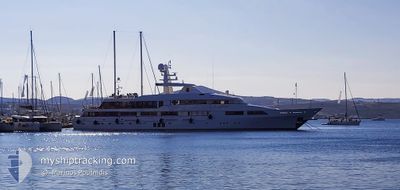
LE PHARAON
Yacht
Current Trip
| Trip Time | 2 days |
|---|---|
| Trip Distance | 76.15 nm |
| AVG Speed | 9.3 Knop |
| MAX Speed | 13.5 Knop |
| Djupgående | 3.5 m |
| AVG Wind | 8.6 knots |
| MAX Wind | 21 knots |
| MIN Temp | 22.8°C / 73.04°F |
| MAX Temp | 25.2°C / 77.36°F |
| Position mottagen | 4 m sen |
Current Position
| Longitud | 24.44682° |
|---|---|
| Latitude | 36.72365° |
| Status | At anchor |
| Fart | |
| Kurs | 180° |
| Område | Aegean Sea |
| Station | T-AIS |
| Position mottagen | 4 m sen |
Info
Information
The current position of LE PHARAON is in Aegean Sea with coordinates 36.72365° / 24.44682° as reported on 2024-07-06 22:35 by AIS to our vessel tracker app. The vessel's current speed is 0 Knop and is currently inside the port of MILOS.
The vessel LE PHARAON (IMO: 1002469, MMSI: 335150000) is a Yacht that was built in 1989 ( 35 År gammal ). It's sailing under the flag of [00] Unknown.
In this page you can find informations about the vessels current position, last detected port calls, and current voyage information. If the vessels is not in coverage by AIS you will find the latest position.
The current position of LE PHARAON is detected by our AIS receivers and we are not responsible for the reliability of the data. The last position was recorded while the vessel was in Coverage by the Ais receivers of our vessel tracking app.
The current draught of LE PHARAON as reported by AIS is 3.5 meters
Weather
| Temperature | 25.4°C / 77.72°F |
|---|---|
| Wind Speed | 20 knots |
| Direction | 355° N |
| Pressure | 1010.2 hPa |
| Humidity | 66.2 % |
| Cloud Coverage | --- |
Featured Company
Last Port Calls
| Port | Arrival | Departure | Time In Port |
|---|---|---|---|
| 2024-07-06 16:54 | |||
| 2024-07-02 15:04 | 2024-07-04 04:05 | 1 d | |
| 2024-06-26 03:08 | 2024-06-26 05:24 | 2 h | |
| 2024-05-18 13:41 | 2024-06-24 15:30 | ||
| 2024-05-18 06:29 |
Most Visited Ports (Last year)
| Port | Arrivals | |
|---|---|---|
| 3 | ||
| 2 | ||
| 2 | ||
| 2 | ||
| 2 |
Last Trips
| Origin | Departure | Destination | Arrival | Distance | |
|---|---|---|---|---|---|
| 2024-07-04 07:05 | 2024-07-06 19:54 | 76.15 nm | |||
| 2024-06-26 07:24 | 2024-07-02 18:04 | 352.25 nm | |||
| 2024-06-24 17:30 | 2024-06-26 05:08 | 430.09 nm | |||
| 2024-05-18 08:29 | 2024-05-18 15:41 | 17.68 nm |
Events
| Tid | Event | Detaljer | Position / Dest | Information |
|---|---|---|---|---|
| 2024-07-06 18:00 | Status ändrad | At anchor Under way using engine |
36.72363 / 24.44680
[GR] MILOS
|
Fart: Kurs: 178° |
| 2024-07-06 16:59 | STOPPAR förflyttning |
36.72241 / 24.44663
[GR] MILOS
|
Fart: 0.3 kn Kurs: 280° |
|
| 2024-07-06 16:54 | ANLÄNDER HAMN |
|
36.71883 / 24.44532
[GR] MILOS
|
Fart: 9.1 kn Kurs: 55.9° |
| 2024-07-06 15:37 | Status ändrad | Under way using engine At anchor |
36.76673 / 24.57784
SIFNOS,GR
|
Fart: 13.2 kn Kurs: 255.9° |
| 2024-07-06 15:30 | STARTAR förflyttning | 0.79 nm, South of POLYAIGOS |
36.77250 / 24.60497
SIFNOS,GR
|
Fart: 7 kn Kurs: 259.6° |
| 2024-07-06 14:14 | I täckningsområde |
36.77371 / 24.60774
Aegean Sea
|
Fart: Kurs: 254.7° |
|
| 2024-07-06 12:38 | UTANFÖR täckningsområde |
36.77372 / 24.60775
Aegean Sea
|
Fart: 0.1 kn Kurs: 285.7° |
|
| 2024-07-06 12:32 | I täckningsområde |
36.77372 / 24.60775
Aegean Sea
|
Fart: Kurs: 288.7° |
|
| 2024-07-06 08:20 | UTANFÖR täckningsområde |
36.77369 / 24.60777
Aegean Sea
|
Fart: Kurs: 316.3° |
|
| 2024-07-06 06:56 | I täckningsområde |
36.77369 / 24.60770
Aegean Sea
|
Fart: Kurs: 339.4° |