
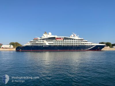
LE BELLOT
Passenger
Current Trip
| Time Travelled | 12 h, 3 mins |
|---|---|
| Remaining Time | 4 h, 44 mins |
| Distance Travelled | 115.56 nm |
| Remaining Distance | 40.61 nm |
| AVG Speed | 9.8 Knop |
| MAX Speed | 13.2 Knop |
| AVG Wind | 15.4 knots |
| MAX Wind | 17.8 knots |
| MIN Temp | 6.1°C / 42.98°F |
| MAX Temp | 12.5°C / 54.5°F |
| Djupgående | 4.7 m |
| Position mottagen | Nu |
Current Position
| Longitud | 16.49275° |
|---|---|
| Latitude | 56.06012° |
| Status | Under way using engine |
| Fart | 8.3 Knop |
| Kurs | 248° |
| Område | Baltic Sea |
| Station | T-AIS |
| Position mottagen | Nu |
Info
Information
The current position of LE BELLOT is in Baltic Sea with coordinates 56.06012° / 16.49275° as reported on 2024-05-01 04:07 by AIS to our vessel tracker app. The vessel's current speed is 8.3 Knop and is heading at the port of KARLSKRONA. The estimated time of arrival as calculated by MyShipTracking vessel tracking app is 2024-05-01 08:51 LT
The vessel LE BELLOT (IMO: 9852418, MMSI: 578001500) is a Passenger It's sailing under the flag of [WF] Wallis Futuna Is.
In this page you can find informations about the vessels current position, last detected port calls, and current voyage information. If the vessels is not in coverage by AIS you will find the latest position.
The current position of LE BELLOT is detected by our AIS receivers and we are not responsible for the reliability of the data. The last position was recorded while the vessel was in Coverage by the Ais receivers of our vessel tracking app.
The current draught of LE BELLOT as reported by AIS is 4.7 meters
Weather
| Temperature | 6.3°C / 43.34°F |
|---|---|
| Wind Speed | 14 knots |
| Direction | 61° ENE |
| Pressure | 1020.1 hPa |
| Humidity | 96.5 % |
| Cloud Coverage | 35 % |
Featured Company
Last Port Calls
| Port | Arrival | Departure | Time In Port |
|---|---|---|---|
| 2024-04-30 09:04 | 2024-04-30 16:04 | 6 h | |
| 2024-04-29 05:54 | 2024-04-29 17:38 | 11 h | |
| 2024-04-28 04:28 | 2024-04-28 11:39 | 7 h | |
| 2024-04-27 03:56 | 2024-04-27 17:52 | 13 h | |
| 2024-04-25 07:48 | 2024-04-25 17:56 | 10 h | |
| 2024-04-24 06:32 | 2024-04-24 11:12 | 4 h | |
| 2024-04-23 08:32 | 2024-04-23 15:58 | 7 h | |
| 2024-04-22 04:49 | 2024-04-22 18:42 | 13 h | |
| 2024-04-20 05:25 | 2024-04-20 16:36 | 11 h | |
| 2024-04-18 05:53 | 2024-04-18 16:16 | 10 h |
Most Visited Ports (Last year)
| Port | Arrivals | |
|---|---|---|
| 12 | ||
| 10 | ||
| 9 | ||
| 9 | ||
| 8 | ||
| 8 |
Last Trips
| Origin | Departure | Destination | Arrival | Distance | |
|---|---|---|---|---|---|
| 2024-04-29 19:38 | 2024-04-30 11:04 | 146.19 nm | |||
| 2024-04-28 14:39 | 2024-04-29 07:54 | 225.06 nm | |||
| 2024-04-27 20:52 | 2024-04-28 07:28 | 59.08 nm | |||
| 2024-04-25 20:56 | 2024-04-27 06:56 | 317.21 nm | |||
| 2024-04-24 13:12 | 2024-04-25 10:48 | 232.03 nm | |||
| 2024-04-23 18:58 | 2024-04-24 08:32 | 194.38 nm | |||
| 2024-04-22 20:42 | 2024-04-23 11:32 | 167.74 nm | |||
| 2024-04-20 18:36 | 2024-04-22 06:49 | 347.77 nm | |||
| 2024-04-18 18:16 | 2024-04-20 07:25 | 504.68 nm | |||
| 2024-04-15 18:42 | 2024-04-18 07:53 | 703.29 nm |
Events
| Tid | Event | Detaljer | Position / Dest | Information |
|---|---|---|---|---|
| 2024-05-01 03:05 | Destination ändrad | SE KAA SE VBY |
56.13398 / 16.71121
SE KAA
|
Fart: 8.4 kn Kurs: 235.5° |
| 2024-05-01 03:05 | ETA ändrat | 2024/05/01 09:00 2024/04/30 08:45 |
56.13398 / 16.71121
SE KAA
|
Fart: 8.4 kn Kurs: 235.5° |
| 2024-05-01 02:59 | Status ändrad | Under way using engine Default |
56.14265 / 16.73102
SE VBY
|
Fart: 8.3 kn Kurs: 209° |
| 2024-05-01 02:52 | I täckningsområde |
56.13912 / 16.72443
Baltic Sea
|
Fart: 8.4 kn Kurs: 230.2° |
|
| 2024-05-01 01:00 | Status ändrad | Default Under way using engine |
56.38871 / 16.90683
SE VBY
|
Fart: 7.9 kn Kurs: 201.4° |
| 2024-05-01 00:53 | UTANFÖR täckningsområde |
56.40459 / 16.91792
Baltic Sea
|
Fart: 7.9 kn Kurs: 201.4° |
|
| 2024-05-01 00:17 | Status ändrad | Under way using engine Default |
56.47773 / 16.96937
SE VBY
|
Fart: 7.7 kn Kurs: 202° |
| 2024-04-30 23:56 | Status ändrad | Default Under way using engine |
56.51864 / 16.99813
SE VBY
|
Fart: 7.9 kn Kurs: 200.9° |
| 2024-04-30 23:38 | Status ändrad | Under way using engine Default |
56.55771 / 17.02512
SE VBY
|
Fart: 8 kn Kurs: 201° |
| 2024-04-30 23:24 | Status ändrad | Default Under way using engine |
56.58574 / 17.04464
SE VBY
|
Fart: 8.1 kn Kurs: 201.5° |