
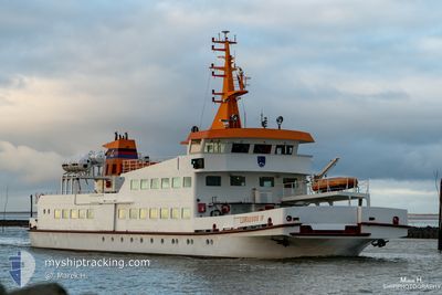
LANGEOOG IV
Passengers Ship
Current Trip
| Time Travelled | 12 mins |
|---|---|
| Remaining Time | --- |
| Distance Travelled | 1.47 nm |
| Remaining Distance | --- |
| AVG Speed | --- |
| MAX Speed | --- |
| AVG Wind | 17 knots |
| MAX Wind | 17 knots |
| MIN Temp | 16.2°C / 61.16°F |
| MAX Temp | 16.3°C / 61.34°F |
| Djupgående | 1.2 m |
| Position mottagen | 1 m sen |
Current Position
| Longitud | 7.52834° |
|---|---|
| Latitude | 53.70286° |
| Status | Under way using engine |
| Fart | 7.3 Knop |
| Kurs | 109° |
| Område | North Sea |
| Station | T-AIS |
| Position mottagen | 1 m sen |
Info
Information
The current position of LANGEOOG IV is in North Sea with coordinates 53.70286° / 7.52834° as reported on 2024-05-16 09:56 by AIS to our vessel tracker app. The vessel's current speed is 7.3 Knop
The vessel LANGEOOG IV (IMO: 7822469, MMSI: 211270830) is a Passengers Ship that was built in 1979 ( 45 År gammal ). It's sailing under the flag of [DE] Germany.
In this page you can find informations about the vessels current position, last detected port calls, and current voyage information. If the vessels is not in coverage by AIS you will find the latest position.
The current position of LANGEOOG IV is detected by our AIS receivers and we are not responsible for the reliability of the data. The last position was recorded while the vessel was in Coverage by the Ais receivers of our vessel tracking app.
The current draught of LANGEOOG IV as reported by AIS is 1.2 meters
Weather
| Temperature | 15.9°C / 60.62°F |
|---|---|
| Wind Speed | 17 knots |
| Direction | 92° E |
| Pressure | 1007.5 hPa |
| Humidity | 77.9 % |
| Cloud Coverage | 5 % |
Featured Company
Last Port Calls
| Port | Arrival | Departure | Time In Port |
|---|---|---|---|
| 2024-05-16 08:07 | 2024-05-16 09:45 | 1 h | |
| 2024-05-16 06:02 | 2024-05-16 07:43 | 1 h | |
| 2024-05-16 05:13 | 2024-05-16 05:34 | 21 m | |
| 2024-05-15 16:02 | 2024-05-16 04:51 | 12 h | |
| 2024-05-15 14:30 | 2024-05-15 15:36 | 1 h | |
| 2024-05-15 13:04 | 2024-05-15 14:09 | 1 h | |
| 2024-05-15 10:14 | 2024-05-15 12:39 | 2 h | |
| 2024-05-15 08:27 | 2024-05-15 09:40 | 1 h | |
| 2024-05-14 16:02 | 2024-05-15 07:41 | 15 h | |
| 2024-05-14 14:53 | 2024-05-14 15:42 | 48 m |
Most Visited Ports (Last year)
| Port | Arrivals | |
|---|---|---|
| 1088 | ||
| 1066 | ||
| 1 |
Last Trips
| Origin | Departure | Destination | Arrival | Distance | |
|---|---|---|---|---|---|
| 2024-05-16 09:43 | 2024-05-16 10:07 | 3.62 nm | |||
| 2024-05-16 07:34 | 2024-05-16 08:02 | 3.77 nm | |||
| 2024-05-16 06:51 | 2024-05-16 07:13 | 3.67 nm | |||
| 2024-05-15 17:36 | 2024-05-15 18:02 | 3.76 nm | |||
| 2024-05-15 16:09 | 2024-05-15 16:30 | 3.37 nm | |||
| 2024-05-15 14:39 | 2024-05-15 15:04 | 3.71 nm | |||
| 2024-05-15 11:40 | 2024-05-15 12:14 | 3.60 nm | |||
| 2024-05-15 09:41 | 2024-05-15 10:27 | 3.82 nm | |||
| 2024-05-14 17:42 | 2024-05-14 18:02 | 3.53 nm | |||
| 2024-05-14 16:28 | 2024-05-14 16:53 | 3.72 nm |
Events
| Tid | Event | Detaljer | Position / Dest | Information |
|---|---|---|---|---|
| 2024-05-16 09:45 | AVGÅTT HAMN |
|
53.72177 / 7.50293
BENSERSIEL-LANGEOOG
|
Fart: 7.2 kn Kurs: 157° |
| 2024-05-16 09:43 | STARTAR förflyttning |
53.72442 / 7.49900
[DE] LANGEOOG
|
Fart: 4.4 kn Kurs: 114° |
|
| 2024-05-16 08:11 | STOPPAR förflyttning |
53.72549 / 7.49633
[DE] LANGEOOG
|
Fart: 0.3 kn Kurs: 299° |
|
| 2024-05-16 08:07 | ANLÄNDER HAMN |
|
53.72341 / 7.50227
[DE] LANGEOOG
|
Fart: 8.3 kn Kurs: 326.3° |
| 2024-05-16 07:43 | STARTAR förflyttning | 0.35 nm, North West of BENSERSIEL |
53.68315 / 7.56588
BENSERSIEL-LANGEOOG
|
Fart: 5 kn Kurs: 319° |
| 2024-05-16 07:43 | AVGÅTT HAMN |
|
53.68315 / 7.56588
BENSERSIEL-LANGEOOG
|
Fart: 1.5 kn Kurs: 349° |
| 2024-05-16 07:38 | Status ändrad | Under way using engine Default |
53.67801 / 7.57331
[DE] BENSERSIEL
|
Fart: Kurs: -1° |
| 2024-05-16 07:29 | Status ändrad | Default Under way using engine |
53.67667 / 7.57333
[DE] BENSERSIEL
|
Fart: Kurs: 91° |
| 2024-05-16 06:04 | STOPPAR förflyttning |
53.67800 / 7.57354
[DE] BENSERSIEL
|
Fart: 0.1 kn Kurs: 91° |
|
| 2024-05-16 06:03 | Status ändrad | Under way using engine Default |
53.67842 / 7.57212
[DE] BENSERSIEL
|
Fart: 6.8 kn Kurs: 137° |